Dom v Tamarju - Slemenova špica (via Grlo)
Starting point: Dom v Tamarju (1108 m)
Starting point Lat/Lon: 46.476°N 13.7241°E 
Path name: via Grlo
Time of walking: 2 h 10 min
Difficulty: difficult marked way
Difficulty of skiing: more demanding
Altitude difference: 803 m
Altitude difference (by path): 803 m
Map: Kranjska Gora 1:30.000
Access to starting point:
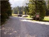
From Kranjska Gora, we drive towards the border crossing Rateče, but only to the spot where (in the village Rateče) the road to Planica and the Tamar valley branches off to the left. The road, which moderately ascends, soon brings us to a large parking lot at the ski jumps in Planica. From here we continue on a macadam road in the direction of the Dom v Tamarju, which we then follow to the parking lot located near the mountain hut.
The road into the Tamar valley is now closed. This extends the path by approximately 1 hour.
Path description:
From the parking lot, we descend on the road two minutes back towards Planica to the signs for Slemenova špica. We head onto the path, which already after a few steps brings us out of the forest onto expansive scree fields. The path ahead gently ascends slightly towards the left to the end of the mighty gully, which we see in front of us. The path then brings us right into the gully, through which the path continues. Ahead we ascend through the gully upwards and in doing so look for passages, which after every heavy rain are elsewhere. The path through the gully is otherwise marked, but many trail blazes are upside down and where there is a trail blaze, the passage is often almost impossible. The entire approximately 45 minutes long passage through the gully is also exposed to falling stones. The ascent through the gully is difficult but nowhere exposed. From the gully we exit onto the saddle Grlo, where a barely noticeable unmarked path from the valley of Mala Pišnica joins.
We continue right in the direction of Slemenova špica and Vršič. The path ahead crosses a shorter strip of forest and brings us a little higher onto scree fields, which the path in a gentle ascent crosses to the steep slopes. Here the path ascends steeply, aided by some pegs and a steel cable. Further, we ascend the moderately overgrown slope quite steeply upwards to the spot where we join the path from Vršič.
Here we continue right on the path, which only occasionally ascends more steeply and soon brings us to the lakes on Sleme, from which there is a nice view of Jalovec. Further, we continue slightly to the right past the summit register box to the top of Slemenova špica, which we reach in a few minutes of further walking.
On the way: Grlo (1457m)
Pictures:
 1
1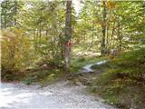 2
2 3
3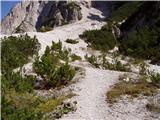 4
4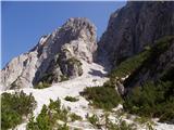 5
5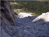 6
6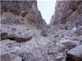 7
7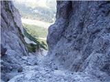 8
8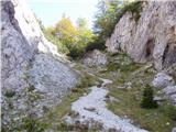 9
9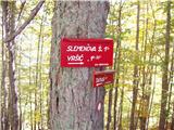 10
10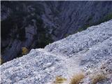 11
11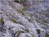 12
12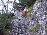 13
13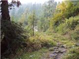 14
14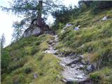 15
15 16
16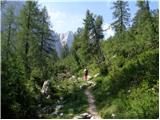 17
17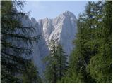 18
18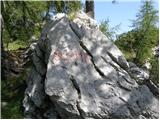 19
19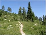 20
20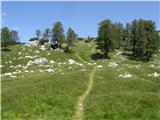 21
21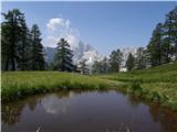 22
22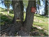 23
23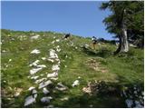 24
24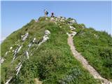 25
25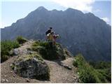 26
26