Dravograd (na Meži) - Kremžarjev vrh
Starting point: Dravograd (na Meži) (363 m)
| Latitude/Longitude: | 46,58530°N 15,02640°E |
| |
Walking time: 5 h 10 min
Difficulty: easy marked way
Elevation gain: 801 m
Elevation difference along the route: 1090 m
Map: Koroška 1:50.000
Recommended equipment (summer):
Recommended equipment (winter): ice axe, crampons
Views: 3.880
 | 2 people like this post |
Access to starting point:
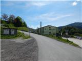
A) From Slovenj Gradec or Ravne na Koroškem we drive to Dravograd, and then before crossing the Drava River we continue right (we turn right at the first right turnoff). Next follows crossing the railway track, and then we are already at the beginning of the described path at the Agricultural and Forestry Cooperative Koroška (Kmetijsko-gozdarska zadruga Koroška). At the starting point, there are no arranged parking places for hikers.
B) From Maribor we drive to Dravograd, where we continue left towards Slovenj Gradec and Ravne na Koroškem. After the bridge over the Drava River we take the second street left. Next follows crossing the railway track, and then we are already at the beginning of the described path at the Agricultural and Forestry Cooperative Koroška (Kmetijsko-gozdarska zadruga Koroška). At the starting point, there are no arranged parking places for hikers.
Route description:
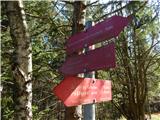
On the other side of the railway track we go right, and then before the Agricultural and Forestry Cooperative Koroška left onto an ascending asphalt road. We continue along the asphalt road to the nearby right hairpin turn, from where we continue straight in the direction of the marked path (near the intersection there are a few parking options). Next follows an ascent on the macadam road to the nearby house, behind which the road changes into a cart track, along which we continue the ascent through the forest. We ascend for a few minutes along the cart track, then we arrive at the area affected by the windstorm. Here we go from the cart track right onto a nicely maintained path, which ascends over the slope with nice views, and the slope is slowly becoming overgrown. The excellently repaired path makes a few hairpin turns, then it ascends diagonally to the vantage point Skala, where there is a logbook box and from where a beautiful view opens towards Dravograd.
We continue along the marked path, which a little higher brings us to a cart track, where the path splits. We head left towards Šisernik (also possible right towards Vinkler), and the cart track a little further turns sharply right. Next follows a shorter diagonal ascent, then the cart track ends. Next follows a shorter steep ascent, then we reach another cart track, which we follow right (on this section a beaten path leads somewhat away from the old marked path).
Next follows a shorter traverse to the right, then we join the path past Vinkler.
We continue left, where first a nice view opens up, then the path ascends along the cart track, where at junctions we continue straight. Higher up the path levels out, and the cart track with occasional views brings us to the junction at the Ošlovnik farm.
We continue right in the direction of Šisernikova pot and begin to descend diagonally along the road. During the descent the path leads past a few more houses at the Kržečnik farm, then through the forest we reach Cvitrško sedlo, where we exit the forest and where there are several successive junctions. We walk along the road to the marker, from the marker we head onto an initially poorly traceable path towards Golarjev vrh, where we ascend along the edge of the hay meadow or indistinct ridge. Here, looking back, a nice view opens up on Mežnarjev vrh and the church of St. Daniel, and the path a little higher enters the forest and brings us to a macadam road.
We follow the road right (straight to Golarjev vrh) along which in a few minutes we arrive at the Kljuk homestead, where a nice view opens towards Peca, and the path behind the farm turns slightly left into the forest, where it continues on a gentle cart track in traverse. In the forest we follow the markers, and when we exit the forest we quickly descend to the road, which we follow left. Along the road, which we reach at the Gnamuš farm, we quickly arrive at the chapel located on the saddle between Golarjev vrh and Potoški vrh. We continue along the road, which descends diagonally for quite some time, and from it occasionally a view opens towards the church of St. Anne on Anski vrh. Somewhat further from the Lubas homestead the signs for Šisernikova pot direct us left onto a cart track that continues through the forest. After crossing a spring the path ascends to a smaller saddle, where on the right we notice a marker.
Here we continue straight down along the marked path (right Anski vrh), along which we descend to the next macadam road, along which we continue the descent to the junction at the larger chapel.
Here we cross the asphalt road (left Trbonje and ecological farm Škorjanc, right Mislinjska dolina) and continue past the NOB monument into the forest. We ascend along the road to the Škratek farm, which we bypass on the right side, where the path leads across pastures and is harder to follow. On the other side of the pasture the path enters the forest and continues along the cart track. At the smaller junction we continue right (straight hunting observatory) and ascend to the next hay meadow, from which a nice view opens again on the surrounding hills. The path quickly returns to the forest, and we reach the macadam road, where on the left we notice the NOB monument and marker.
We continue slightly right, and the road brings us to the junction at the next chapel, where we go left. We walk a few more minutes along the road, then the markers direct us slightly left onto a cart track, along which we continue to the saddle below Jesenkov vrh, where there is a cross and a chapel.
We continue straight (left farm Osirnik) and continue walking along the road. Soon a nice view opens to the right towards Uršlja gora and Peca, and when the path returns to the forest we go slightly right onto the parallel marked path, which after a short ascent returns to the road (if we continue along the road, at the nearby junction we continue right). We follow the road right, along which we walk to the nearby hunting lodge LD Gradišče.
We bypass the hunting lodge on the left side and continue along the gentle forest path, along which after crossing Durnski vrh we return to the macadam road. We walk a few minutes along the road, then the markers direct us onto a cart track that begins to ascend quite steeply through the forest. Somewhat further we cross another macadam road, and higher we arrive at a marked junction, where we join the more visited path from Slovenj Gradec.
We continue in the direction of Koča pod Kremžarjevim vrhom, which we reach in a few minutes of moderate ascent.
From the hut we continue in the direction of Kremžarjev vrh, where we first walk along the road, then at the section from where a nice view opens towards Golica / Koralpe we go slightly right (left Vuzenica) into the forest, where we quickly arrive at an interesting chapel.
At the chapel the path splits, and we continue straight (slightly right Kope, right Šmartno) and continue walking along the indistinct ridge. We follow this path all the way to the nearby Kremžarjev vrh, where there is a logbook box.
Dravograd - Skala 0:25, Skala - Cvitrško sedlo 1:00, Cvitrško sedlo - lovski dom LD Gradišče 2:45, lovski dom LD Gradišče - Koča pod Kremžarjevim vrhom 0:50, Koča pod Kremžarjevim vrhom - Kremžarjev vrh 0:10.
Description and pictures refer to the condition in 2019 (May).

Along the route: Skala (nad Dravogradom) (525m), Cvitrško sedlo (677m), Lovski dom LD Gradišče (880m), Koča pod Kremžarjevim vrhom (1102m)
The trip can be extended to the following destinations: Kremžarjev vrh
Photos:
 1
1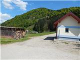 2
2 3
3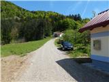 4
4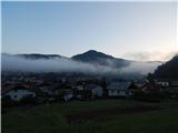 5
5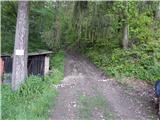 6
6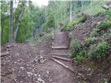 7
7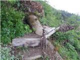 8
8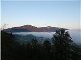 9
9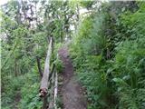 10
10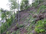 11
11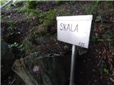 12
12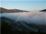 13
13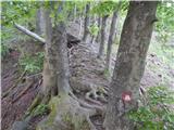 14
14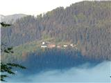 15
15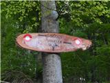 16
16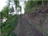 17
17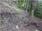 18
18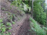 19
19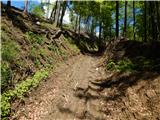 20
20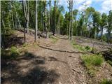 21
21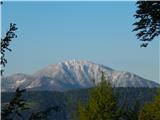 22
22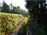 23
23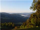 24
24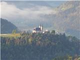 25
25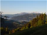 26
26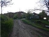 27
27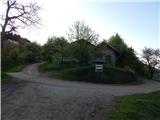 28
28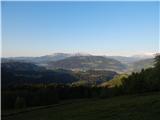 29
29 30
30 31
31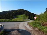 32
32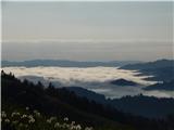 33
33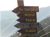 34
34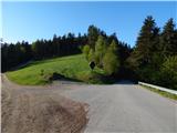 35
35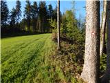 36
36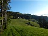 37
37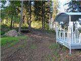 38
38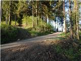 39
39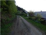 40
40 41
41 42
42 43
43 44
44 45
45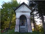 46
46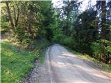 47
47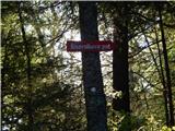 48
48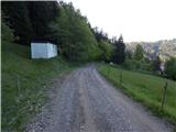 49
49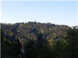 50
50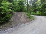 51
51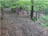 52
52 53
53 54
54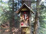 55
55 56
56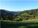 57
57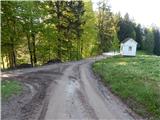 58
58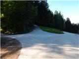 59
59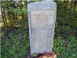 60
60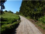 61
61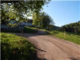 62
62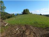 63
63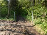 64
64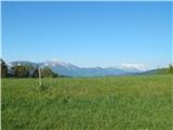 65
65 66
66 67
67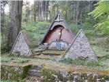 68
68 69
69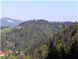 70
70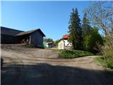 71
71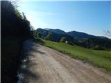 72
72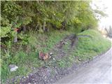 73
73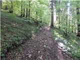 74
74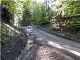 75
75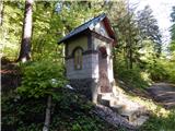 76
76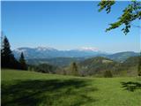 77
77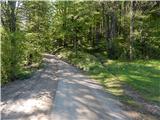 78
78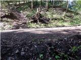 79
79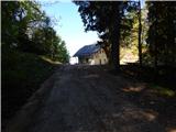 80
80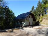 81
81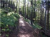 82
82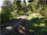 83
83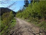 84
84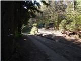 85
85 86
86 87
87 88
8889
90
91
92
93
94
95
 96
96 97
97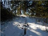 98
98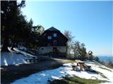 99
99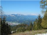 100
100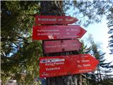 101
101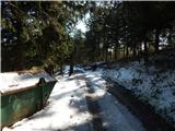 102
102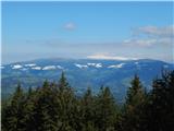 103
103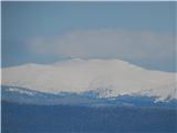 104
104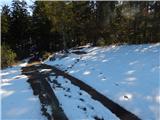 105
105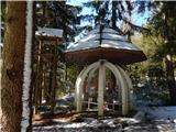 106
106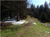 107
107 108
108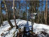 109
109
Discussion about the trip Dravograd (na Meži) - Kremžarjev vrh
To post a comment you must log in:
If you do not yet have a username, you must first
register.