Fram - Mariborska koča (Jugova pot)
Starting point: Fram (336 m)
Route name: Jugova pot
Walking time: 3 h
Difficulty: easy marked way
Elevation gain: 750 m
Elevation difference along the route: 770 m
Map: Pohorje 1:50 000
Recommended equipment (summer):
Recommended equipment (winter):
Views: 4.485
 | 1 person like this post |
Access to starting point:
a) From LJ on the highway towards MB, exit Rače-Fram. Past the gas station for trucks and over the roundabout, at the next one turn left onto the road that goes over the overpass towards Fram. At the next major traffic light intersection, we drive straight, and after approximately 1.5 km, we notice parking spots on the right side of the road where we can park the vehicle.
b) From MB on the highway towards LJ, exit Rače-Fram. Over the overpass, past the gas station for trucks, through the roundabout, and at the next one, we turn left. Then follow the above description.
Route description:
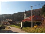
From the parking lot, we go right towards the bridge over stream Framski potok. We go in the direction of Oljarna Fram on the street that passes by the building. We soon come to a crossroad, where there is another bridge over the stream. We turn left over the bridge and then immediately right onto the road that goes in the direction of the village Ranče.
We walk straight along the road through the valley beside the stream, which leads us past a fish farm by the forest. After approximately 1.5 km, the path at a turn veers right upwards onto a forest cart track. On the cart track, we pass by a solitary farm to a gate, where we again turn right upwards onto a footpath. Higher up, we step out of the forest; the path goes along the field on the right side upwards to a residential house, where we step onto an asphalt road in the village Ranče, and a trail blaze directs us to the left. The road on which we continue slightly ascends past a few more houses, and on the plain, a beautiful view opens up. When we reach the next house, we take the left path at the crossroad, which turns into the forest. The path continues on a forest logging trail, and after a few minutes of further walking, we arrive at a crossroad where we join the path coming from the direction of Slivnica pri Mariboru.
We continue along the road over Plahutnikov vrh (687 m) to the Plahutnik farm. A signpost directs us uphill along the slope toward the lung disease hospital. We pass through the hospital’s yard, crossing the Hoče-Belvi road. By the traffic sign, we turn right into the forest. After a few minutes of ascending, we step back onto the Hoče-Belvi road. We walk along the road for approximately 500 m, then turn left again at the trail blaze. The footpath ascends through a meadow, crosses the road again, and transitions onto a macadam road. This leads us to saddle Petkovo sedlo (881 m). We go straight past the "Na prepihu" bar to the next crossroad. We continue straight by the bushes upwards to the forest’s edge, where a large trail blaze is visible from afar. The path ascends through the forest again and then crosses the road once more. We reach the forest’s edge by a religious symbol, where we can already see the mountain hut Mariborska koča. After a short stretch through the forest, we step onto the road, and in the middle of the apartment settlement, we head to the left. Within the next 5 minutes, we arrive at the mountain hut Mariborska koča (1068 m).

Photos:
 1
1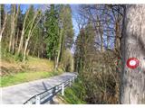 2
2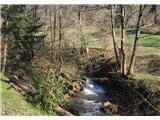 3
3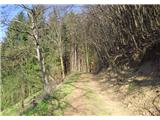 4
4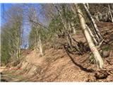 5
5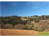 6
6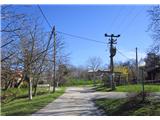 7
7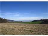 8
8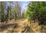 9
9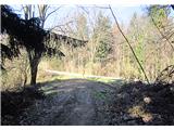 10
10 11
11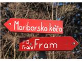 12
12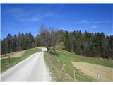 13
13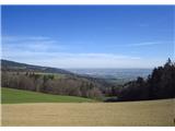 14
14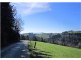 15
15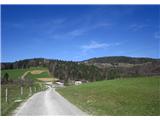 16
16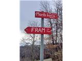 17
17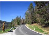 18
18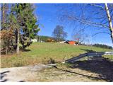 19
19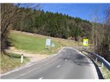 20
20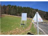 21
21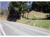 22
22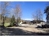 23
23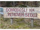 24
24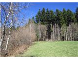 25
25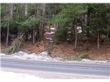 26
26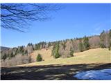 27
27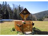 28
28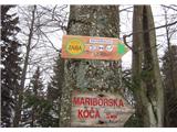 29
29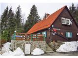 30
30
Discussion about the trip Fram - Mariborska koča (Jugova pot)
To post a comment you must log in:
If you do not yet have a username, you must first
register.