Frbežari - Rudnik (po smučišču)
Starting point: Frbežari (840 m)
Starting point Lat/Lon: 45.57087°N 14.61971°E 
Path name: po smučišču
Time of walking: 45 min
Difficulty: easy marked way
Difficulty of skiing: no data
Altitude difference: 212 m
Altitude difference (by path): 212 m
Map:
Access to starting point:
From the Ljubljana - Koper motorway, take the Unec exit and continue following the road towards Cerknica. Continue driving through Cerknica, Martinjak and Grahovo to the village of Bloška polica, where at the intersection continue right towards the villages of Lož and Babno Polje. Drive through Lož, Stari trg and Igo vas to the MP Babno Polje border crossing, where we cross into Croatia. Continue the drive through Prezid all the way to the place Tršče, where the sign for Planinski dom Frbežari in the center of the village directs us right. Drive along the narrower road past the mentioned hut to the intersection, where we continue right and soon park on the gravel parking lot on the right side of the road
Path description:
From the starting point, head past the holiday house Brvnara on the left side. A little behind it, a barely noticeable path branches off to Rudnik. Continue along the barely visible trail to the foot of the ski slope, where the path turns left and becomes well traceable. The path widens into a gully and ascends steeply. After it, the path levels out, but soon a fairly steep ascent begins along the edge of the ski slope. After the steep ascent, the path levels and enters a small valley. Soon we arrive at an unmarked junction, the marked path goes straight ahead, and even if we go right, we will reach Rudnik. After 5 minutes of walking through the forest, the paths merge. The path leads us across a small clearing and over a short steep ascent to soon reach the summit of Rudnik. The stamp is located on a stone by the bench, the summit signboard a little further on the tree.
Description and photos refer to the condition in July 2025.
Pictures:
 1
1 2
2 3
3 4
4 5
5 6
6 7
7 8
8 9
9 10
10 11
11 12
12 13
13 14
14 15
15 16
16 17
17 18
18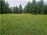 19
19