Gozd Martuljek - Kurji vrh
Starting point: Gozd Martuljek (750 m)
| Latitude/Longitude: | 46,48210°N 13,83780°E |
| |
Walking time: 3 h
Difficulty: partly demanding unmarked way
Elevation gain: 1012 m
Elevation difference along the route: 1012 m
Map: Kranjska Gora 1:30.000
Recommended equipment (summer):
Recommended equipment (winter): ice axe, crampons
Views: 32.473
 | 3 people like this post |
Access to starting point:
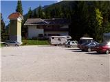
From Mojstrana we drive towards Kranjska Gora or vice versa, but only to the village Gozd Martuljek, where we park on a parking lot near the bridge over the river Sava Dolinka (parking lot is located after the bridge, or before, if we come from Kranjska Gora).
Route description:
From the parking lot, we continue by the main road towards Kranjska Gora, but only to a spot where a cycling road branches off to the left (by the beginning of the cycling path there are also signposts, which point us on the mentioned road). We follow the cycling road to the first crossroad, where we continue straight on a macadam road (cycling road turns right), which quickly brings us to the next crossroad.
We continue right and follow the road closed to traffic to the TNP sign. Further, the path splits into two parts. We continue straight upwards on a steep cart track which is ascending on the right side of the Martuljška soteska gorge. The cart track, which is mostly ascending through the forest, after 15 minutes brings us to a nice vantage point, where a view opens up towards the valley. The path then goes again into the forest and continues to ascend. A little further from the left joins the path from the waterfall, and a little further, the path towards the bivouac pod Špikom branches off to the right.
We head onto this path, which at first ascends gently on a cart track. The wide path on which we are ascending then leads us past the rock with the caption "pod Špik". Only 5 minutes after this rock we leave the marked path which leads to the bivouac pod Špikom. At the spot where we notice a few smaller cairns, an unmarked cart track branches off to the right, which slightly descends and thereby crosses a small spring. The cart track, which then starts to ascend, soon has two successive junctions. In both cases we continue straight and follow it a little higher to the next junction, where we continue left upwards (on a tree we notice an unofficial marking and an arrow to the left). Further we ascend on an unmarked and wide path, which higher brings us to the next orientational loop. At the spot where the path approaches a wide cart track we again notice unofficial markings, which direct us left upwards onto a steep forest path (orientation further on is substantially easier). After 15 minutes the steepness eases a little and the path brings us out of the forest to the edge of a torrent gully, along which we then ascend. A little higher the footpath turns right and takes us back into the forest, where after a short descent we come to a pleasant spring, which we cross just a few meters below its source. The path then again starts to ascend steeply, and the forest is soon replaced by dwarf pines. The increasingly scenic path then brings us higher between two boulders, where there is a smaller junction (on the right boulder the marking PP, path Planica - Pokljuka).
We continue right on the lower path (left Rušica and Rigljica, it is also possible to Kurji vrh but the path is in the upper part quite overgrown with dwarf pines), which crosses the slopes of Kurji vrh. The path, which ascends moderately, crosses several steep grassy slopes which in wet are dangerous for slipping, in dry however the ascent does not present greater danger. When the path goes from the western to the northern slopes we come to a junction, where we continue on the left upper path, which starts to ascend steeply along the edge of shorter cliffs. We follow this steep path, on which the steepness in the last part eases a little, to Kurji vrh.
The logbook box is on the forepeak, as the summit is overgrown with dwarf pines and therefore difficult to access.

The trip can be extended to the following destinations: Rigljica (2 h)
Photos:
 1
1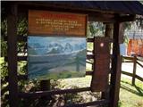 2
2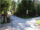 3
3 4
4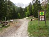 5
5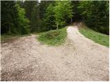 6
6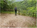 7
7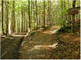 8
8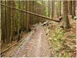 9
9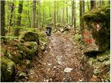 10
10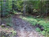 11
11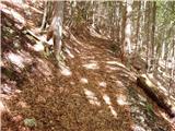 12
12 13
13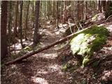 14
14 15
15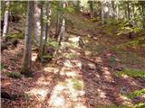 16
16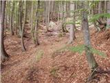 17
17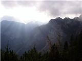 18
18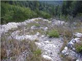 19
19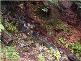 20
20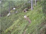 21
21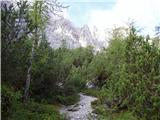 22
22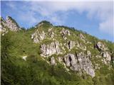 23
23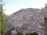 24
24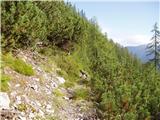 25
25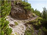 26
26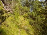 27
27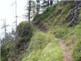 28
28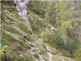 29
29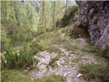 30
30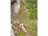 31
31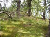 32
32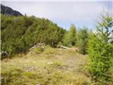 33
33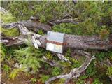 34
34
Discussion about the trip Gozd Martuljek - Kurji vrh
|
| Tadej10. 09. 2008 |
I was on Kurji vrh yesterday and as a curiosity I can say that the summit logbook is from 2003. There are barely over 350 entries in the book, which means (even if we don't count those who don't sign), that the summit is very rarely visited.
Otherwise, the path (except for orientation) is not difficult.
|
|
|
|
| Hribuc14. 09. 2008 |
Hello, I'm interested whether the path described here passes by the hunting hut, or if the path past the hunting hut branches off lower down? Thanks for the answer.
|
|
|
|
| Tadej14. 09. 2008 |
I left the marked path towards the bivouac under Špik at the location of picture 11 (i.e., at the place where the Kranjska Gora 1:30,000 map shows the start of the path to the hunting hut). I then followed the cart track to the place where I noticed a cairn and a red arrow on a tree that directed me left upwards.
I don't know exactly where the hunting hut is located, as I didn't notice it along the path.
|
|
|
|
| Hribuc14. 09. 2008 |
Then this path certainly goes past there. The hunting hut should be to the left above the path and visible from the path.
Let me also thank you for the path description and photos, Kurji vrh is a wish for this autumn, but I was a bit doubtful due to orientation. Since the descriptions in Siddharth's guides were made, quite a few new tracks have appeared around here and orientation based on those descriptions has become more difficult. Regards.
|
|
|
|
| grega_p21. 05. 2010 |
I was up there yesterday and had a completely solitary 3-hour trip. I took the route described in PV May10 (Andrej Trošt), as it seems orientationally easier than the one described above:
- a little further from the viewpoint or between photo 7 and 8, a unmarked cart track branches right, leading to a forest road, which we cross. Continue steeply uphill on the logging trail, which narrows somewhat and has several side paths joining it. Just after crossing the dry stream bed, you'll see a sign for Kurji Vrh on the left - head onto the path, then join the route described above. The ascent further (junction at the boulder) is indeed better than described here - to the right (To the foot of Kurji vrh).
If descending to the north side and left towards Kranjska Gora - the path (better trail) across the gully is damaged - I misjudged and unintentionally slipped...
Also: near the spring I encountered a pile (probably dung) - watch your step.
Good luck!
|
|
|
|
| JusAvgustin3. 11. 2010 |
because it doesn't stop raining and everywhere there's a muddy condition I decided to go from the hut... the goal was again Kurji vrh specifically from GM. For such weather a completely decent goal, since everywhere else it's one big s***** ! Up to about 1500m a.s.l. no snow, from there onwards you can encounter the worst possible rotten snow on the path, which of course makes uphill walking difficult. Especially the traverses and descent are dangerous. Fog on the summit, fog on the path. In short a foggy day which I spent outside. It was still worth airing out the brain a bit. Descent was through the gorge to the starting point.
|
|
|
|
| JusAvgustin21. 03. 2011 |
today after work for the soul to Kurji vrh, mainly for reconnaissance...  no one, as always, solitude, all around Martuljek, the path is now trodden, but we went up from the other side namely through the scree that falls from the notch between KV and Rigljica... It's cleared, conditions are super for picking! If I had two more hours I would jump to Rigljica, which is made "to zero"!!!!!!!!!!!! no one, as always, solitude, all around Martuljek, the path is now trodden, but we went up from the other side namely through the scree that falls from the notch between KV and Rigljica... It's cleared, conditions are super for picking! If I had two more hours I would jump to Rigljica, which is made "to zero"!!!!!!!!!!!!
Juš & Iztok
oh, first time I almost made a full circle! that's success
Starting point-KV 1:50
KV-Starting point good half hour
|
|
|
|
| JusAvgustin14. 05. 2011 |
just a small hint: you can continue along the logging trail also in the direction of Črnega vrha (sign on the tree)(predgrebenski vrh to Kurji vrh.), when the path brings us to a clearing and plateau then we leave it, cairn leads us left into the forest and from there onwards follow  orange blazes on trees (such a pigsty!) to Kurji vrh it's worth it just for the view! orange blazes on trees (such a pigsty!) to Kurji vrh it's worth it just for the view!
|
|
|
|
| Zasavčan10. 06. 2011 |
I'd go to Kurji vrh on Sunday. I'm interested in which path is the easiest (regarding orientation)
|
|
|
|
| JusAvgustin10. 06. 2011 |
From GM it's steeper, from KG it's better marked
Best!
|
|
|
|
| Zasavčan29. 10. 2011 |
I have already been from Martuljek, now I'm wondering where in KG the path branches off towards Kurji vrh. Tomorrow there will be nice weather and I think it will be just the right walk.
|
|
|
|
| JusAvgustin20. 05. 2013 |
The path along Rogarjev graben (from the settlement Ivana Krivica in KG) is a special adventure. The PP path just circles KV, doesn’t go to the summit, then heads into the Rušice ledges and continues towards the bivouac under Špik.
The “markings” case isn’t isolated either... I’d really like to meet “bojan” who painted Škrbinjek
|
|
|
|
| irska8. 09. 2013 |
Actually, we went a bit our own way at the beginning (and towards the end), but yesterday's day was so nice that exploring didn't bother us . From the PP log, we went up around the "right" side, down via "tahitri" the other one . Great trip ... but down there there are really a lot of excavated tracks and working machines ...
|
|
|
|
| ločanka31. 05. 2016 |
I also like this variant of the trail description mentioned by grega p, especially the upper circular variant namely at the boulder PP right, return via the notch between KV and Rigljica. Unforgettable excursion!
|
|
|
|
| margu5019. 05. 2017 |
I'm wondering, has anyone been to Kurji vrh in the last days, is there possibly still some snow on the path. Please for information, if anyone knows anything. Thanks and best regards
|
|
|
|
| aditaker4. 07. 2018 |
Hello!
Can someone please write to me if there is a stamp at Kurji vrh because I need it for a hiking booklet?
Regards, Rok
|
|
|
|
| Stane75. 07. 2018 |
This winter it wasn't there.
|
|
|
|
| GregorD30. 06. 2019 |
At an altitude of approx. 1350 m there is a lot of fallen trees across the path.
|
|
|
|
| Rozzina10. 10. 2021 23:03:39 |
Hello! Today I tried to ascend the marked path to Kurji vrh - as Gregor D already wrote, on the path at 1350m there is a lot of fallen trees, so much that the path is completely impassable. The avalanche piled trees completely across the path, so the path can no longer be found.
|
|
|
|
| ločanka11. 10. 2021 10:57:49 |
Since when is this path marked?
|
|
|
|
| Majdag11. 10. 2021 14:29:44 |
It's not marked, chicken paths to Kurji vrh..
|
|
|
|
| Rozzina11. 10. 2021 17:28:52 |
I may have expressed myself poorly - we followed the little men.
Anyway, the key message of the post holds: the path to Kurji vrh described in the above description is dangerous and at least for us it was impassable and lost.
|
|
|
To post a comment you must log in:
If you do not yet have a username, you must first
register.