Gozd Martuljek - Rutarski Vršič
Starting point: Gozd Martuljek (750 m)
| Latitude/Longitude: | 46,48210°N 13,83780°E |
| |
Walking time: 3 h
Difficulty: difficult marked way, easy unmarked way
Elevation gain: 949 m
Elevation difference along the route: 975 m
Map: Kranjska Gora 1:30.000
Recommended equipment (summer): helmet
Recommended equipment (winter): helmet, self belay set, ice axe, crampons
Views: 20.254
 | 3 people like this post |
Access to starting point:
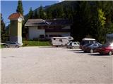
From Mojstrana we drive towards Kranjska Gora or vice versa, but only to the village Gozd-Martuljek, where we park on a parking lot near the bridge over the river Sava Dolinka (parking lot is located after the bridge, or before, if we come from Kranjska Gora).
Route description:
From the parking lot, we continue by the main road towards Kranjska Gora, but only to a spot where the cycling road branches off to the left (by the beginning of the cycling path there are also signposts, which point us to the mentioned road). We follow the cycling road to the first crossroad, where we continue straight on a macadam road (cycling road turns right), which quickly brings us to the next crossroad.
We continue right and follow the traffic-closed road to the TNP sign. Further, the path splits into two parts. We continue straight upwards on a steep cart track which ascends on the right side of the Martuljška soteska gorge. The cart track, which mostly ascends through the forest, brings us after 15 minutes to a nice vantage point, where a view opens up into the valley. The path then goes back into the forest and continues to ascend. A little further, the path from the waterfall joins from the left, and a little further right, the path to the bivouac pod Špikom branches off. We continue in the direction of the Ingotova koča cottage. The path ahead brings us to a crossing, where we continue straight, the path to the left leads to the Ingotova koča cottage, which is two minutes' walk away.
The path ahead ascends gently at first but only for a short time. The path then crosses a small spring and steeply ascends on the other side. The steepness starts to decrease and the path brings us to a crossing, where we continue slightly right in the direction of the bivouac Za Akom (left Zgornji slap waterfall 10 minutes). The path ahead steeply ascends for some time more, then brings us to a more demanding part. First, with the help of a steel cable we cross a steep grassy slope, then still with the help of fixed safety gear we traverse an exposed ledge (watch your head, slightly overhanging rock above us). The still secured path (fixed safety gear here mainly due to wet terrain) then starts to ascend more steeply and after a few minutes of further walking brings us to the most difficult part. With the help of artificial footholds and a steel cable we cross a smooth and wet rocky slab, then also cross a shorter very steep wall, which is well secured (due to the wet slope great caution is needed). The steepness of the slopes then eases and the still wet path after a short ascent brings us to the edge of mighty scree fields. At the spot where the mark directs us left downwards onto the mentioned scree fields we continue right on the path, which steeply ascends after just a few steps. This steep path, dangerous for slipping when wet, brings us in less than five minutes to the bivouac Za Akom (if the last part of the path is too steep for us, we can continue over the scree and ascend to the bivouac from the other less steep side. Both paths in the last part are unmarked).
From the bivouac we return to the beginning or end of the scree fields, here we continue along the left scree field (viewed from bottom to top) beside which on a larger rock we notice PP signs (path Planica - Pokljuka). Further we ascend another 10 steps or so along the edge of the scree fields, then on the left side we will notice a smaller cairn, which directs us onto a narrow path along which we continue the ascent (path ahead unmarked). The path, which for some time continues along the edge of the torrent bed, first still offers some views of the northern walls of the Martuljek mountains (most prominent is the mighty wall of Široka peč), then the path turns slightly left and gradually starts to ascend more steeply through dense forest. Further we ascend along an occasionally barely visible path (aided by individual small cairns), which turns increasingly to the left. The path higher up widens (we join a hunting path) and after approximately one hour of walking from the extensive scree fields brings us to a smaller saddle, where we continue left (straight down the valley of Beli potok stream, right viewpoint on the walls of Martuljek mountains - 20 minutes). The path ahead moderately ascends along the ridge of Rutarski Vršič and after 5 minutes of further walking brings us to the summit (summit logbook is located entirely on the northern part of the summit).

Photos:
 1
1 2
2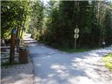 3
3 4
4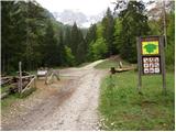 5
5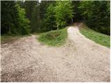 6
6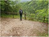 7
7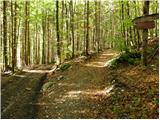 8
8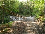 9
9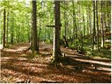 10
10 11
11 12
12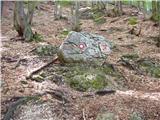 13
13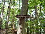 14
14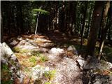 15
15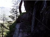 16
16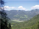 17
17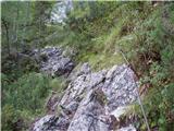 18
18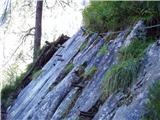 19
19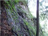 20
20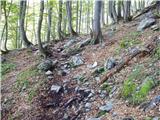 21
21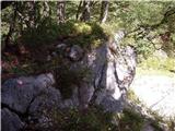 22
22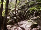 23
23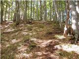 24
24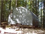 25
25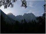 26
26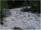 27
27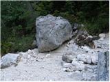 28
28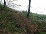 29
29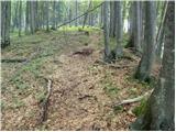 30
30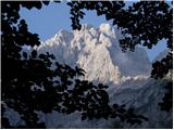 31
31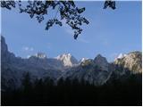 32
32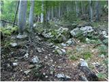 33
33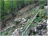 34
34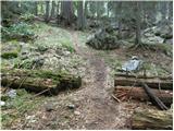 35
35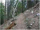 36
36 37
37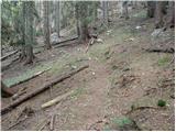 38
38 39
39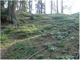 40
40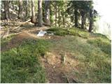 41
41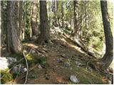 42
42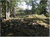 43
43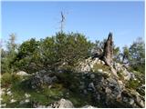 44
44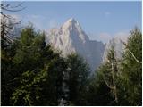 45
45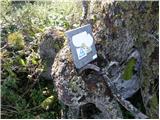 46
46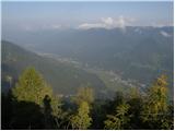 47
47
Discussion about the trip Gozd Martuljek - Rutarski Vršič
|
| ljubitelj gora2. 06. 2013 |
Picture 23, you can also get up here to the bivouac, but it's a bit steeper, otherwise you step onto the path, scree field, when the view opens to the Martuljek mountains, another minute's walk on this right scree field, on the right side cairns and faintly visible trail. Ascent to Rutarski Vršič, cairns are now rare, possible that someone will place them, the path sometimes gets lost a bit, but it's still barely traceable.
|
|
|
|
| navdušena15. 09. 2017 |
Thanks for the description. But who knows what condition the fixed protections are in now? And of course: is there a stamp in the box (or next to it)??
|
|
|
|
| franca15. 09. 2017 |
I walked there mid-June. Protections up to Za Aka are in order, the "path" further towards Vršič is harder to follow than in previous years (downed and overgrown), until you reach the well-trodden hunting path, where cairns also appear.
|
|
|
|
| Batistuta16. 08. 2020 |
I walked this path today downhill. The path is not drawn on the PZ map, so I noticed it by chance at Rutarski Vršič (I came up from the other side), at the point between the two summits. The path is normally followable, in the last part there are more and more cairns. There are also cairns for entering the streambed and for exiting. I didn't go to the bivouac, it's not necessary at all, cross the streambed lower. After crossing the streambed the 'climbing' section starts, which is well protected and not technically demanding.
The last part of this path description is very poor and misleading: ''...leads to a small saddle, where we continue left (straight down Beli potok valley, right scenic point...).
There is no path straight from the saddle, if we choose the left path we reach one of the two Rutarski Vršič summits, if we continue on that path further we descend to Beli potok valley. From the saddle if we choose the right path, we reach the other Rutarski Vršič summit, which is nicer as it has a view of Široka peč and Kukova špica. From there on there is no path.
Rutarski Vršič thus has two summits, I don't know which is higher. I didn't find a summit register on either, although I checked several times. Obviously the marmot ate it??? 
|
|
|
|
| lynx17. 08. 2020 |
The descent path from the saddle is not particularly nice or well-trodden. It is really better to go elsewhere.
|
|
|
|
| mjk18. 08. 2021 14:09:11 |
The logbook was still there last year
|
|
|
|
| ljubitelj gora4. 10. 2021 09:49:48 |
Walked 3.10.2021, quite a bit of fallen trees from picture no.33 onwards, returned via pathless forest
|
|
|
To post a comment you must log in:
If you do not yet have a username, you must first
register.