Gozd Martuljek - The Upper Martuljek waterfall (along the river and via hut)
Starting point: Gozd Martuljek (750 m)
Starting point Lat/Lon: 46.4821°N 13.8378°E 
Path name: along the river and via hut
Time of walking: 1 h 45 min
Difficulty: difficult marked way
Difficulty of skiing: very demanding
Altitude difference: 400 m
Altitude difference (by path): 500 m
Map: Kranjska Gora 1:30.000
Access to starting point:
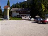
From Mojstrana we drive towards Kranjska Gora or vice versa, but only to the village Gozd Martuljek, where we park on a parking lot near the bridge over the river Sava Dolinka (parking lot is located after the bridge, or before, if we come from Kranjska Gora).
Path description:
From the parking lot, we continue by the main road towards Kranjska Gora, but only to a spot, where cycling road branches off to the left (by the beginning of the cycling path there are also signposts, which point us on the mentioned road). We follow the cycling road to the first crossroad, where we continue straight on a macadam road (cycling road turns right), which quickly brings us to the next crossroad.
We continue right and we follow for traffic closed road to TNP sign. Further, the path splits into two parts. We go on the left path, which brings us to a small bridge, which crosses a river. Immediately after the small bridge, we turn right into a gorge of Martuljek waterfalls. The path ahead is exposed to falling stones so it is best to put on a helmet. The path ahead is at first ascending gently by the river upwards and then with the help of stairs starts ascending steeper. After that, the path crosses a bigger bridge over a river and on the other side ascends on stairs below the wall. Only few steps ahead, the path brings us to another bridge, from which there is a nice view towards the waterfall Spodnji Martuljkov slap. After the bridge, the path turns left and it ascends below the steep slopes near the waterfall. Further, we continue right on a wet ground almost horizontal. The path ahead ascends steeper and after a shorter ascent brings us on a cart track, where we continue left. Already after few steps, the path brings us to a crossing, where the path towards the bivouac Bivak pod Špikom branches off to the right.
We continue on the left bottom path, which after few minutes brings us to the next crossing. We go left over a bridge (straight waterfall Zgornji Martuljkov slap) and in few minutes we come to the cottage Ingotova koča on the mountain pasture Jesenje.
At the cottage, we go right on a poorly visible footpath, that is gently ascending on the mountain pasture. After five minutes of walking from the cottage we come to a bigger chapel, which is situated on the edge of the forest. At the chapel, we go right to river, where with the help of a smaller bridge we cross a river. On the other side, we look for a footpath which in few steps it brings us on the path which runs towards the waterfall Zgornji Martuljkov slap. We go left and we follow the path which is becoming steeper and steeper. After that, the path crosses a well and on the other side steeply ascends. Steepness starts decreasing and the path brings us to a crossing, where we continue left (straight bivouac Za Akom). Further, in a gentle ascent, we cross steep slopes, which are in wet slightly dangerous for slipping. Crossing soon brings us to a gorge, where there is waterfall. The path at first with the help of fixed safety gear descends to water, which with some smaller problems we cross. The path ahead in few steps ascends to point from which we can see the waterfall. Here we end the ascent or we ascend on a secured but quite wet path below the waterfall. Ascent to the waterfall is difficult and exposed to falling stones.
Pictures:
 1
1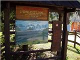 2
2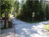 3
3 4
4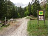 5
5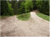 6
6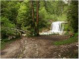 7
7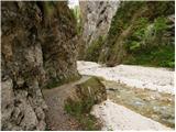 8
8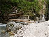 9
9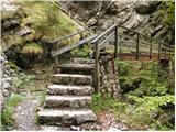 10
10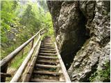 11
11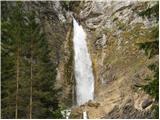 12
12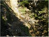 13
13 14
14 15
15 16
16 17
17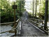 18
18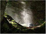 19
19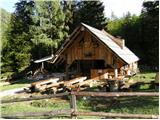 20
20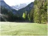 21
21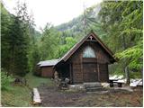 22
22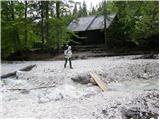 23
23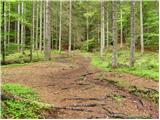 24
24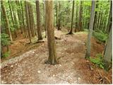 25
25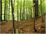 26
26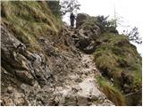 27
27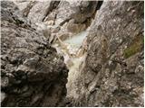 28
28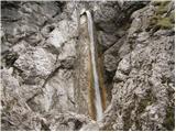 29
29 30
30 31
31