Gradišče - Koča pod Kremžarjevim vrhom
Starting point: Gradišče (460 m)
| Latitude/Longitude: | 46,51510°N 15,09740°E |
| |
Walking time: 1 h 45 min
Difficulty: easy marked way
Elevation gain: 642 m
Elevation difference along the route: 642 m
Map: Pohorje 1:50.000
Recommended equipment (summer):
Recommended equipment (winter): crampons
Views: 12.720
 | 1 person like this post |
Access to starting point:
We drive to Slovenj Gradec (from Velenje, Dravograd or Ravne na Koroškem to here), then from the roundabout at the Hofer store we take the exit Legen and Kope. This is followed by driving through the Legensko naselje settlement, then we leave the road towards Kope and continue straight on a side road in the direction of Gradišče. Further, we drive through the valley of the Reka stream and soon turn left towards the Gradiščar homestead. Next follows some diagonal ascent, passing a few houses, and when the road turns sharply right, we continue straight and park on the marked parking lot, which is located at the crossroads and sign.
Route description:
From the parking lot we continue on the asphalt road that continues towards the east (at the crossroads where we have parked, we can also start along the Stations of the Cross or on an unmarked footpath that branches off from the road right at the crossroads - all paths join after a few minutes), after approximately one minute of walking we join the marked path from Slovenj Gradec. For a short time we still continue on the road, then the blazes direct us slightly left onto a footpath that ascends through the forest. Quickly the previously mentioned unmarked path joins us from the left, a little higher at the crossing of the macadam road also the path along the Stations of the Cross.
Follows an ascent across a panoramic grassy slope, then after crossing a poor road we enter the forest again. We quickly leave the forest and arrive at a second meadow, along the edge of which we continue to a smaller hamlet where we step onto the road. Here, along the road that we follow for a few meters, we notice a cross and then turn left onto a wide cart track that we leave after a few meters. The signs direct us right uphill onto a path that through the forest brings us to the next hamlet. Here we again step onto the road that we follow to the left. After a few minutes of walking on the road we come to a crossroads, where we continue straight on the lower road that brings us to the next hamlet. Just a few meters before the house the marked path turns left and continues on a cart track. We follow this path to the next hamlet, after which we walk a few meters on the road. The blazes here again direct us onto a footpath that a little higher crosses the road again. The path then for a short time ascends somewhat more steeply and brings us to a junction where the path from Dravograd joins us. Here we continue right and after a short ascent across a partly unvegetated slope we arrive at the Koča pod Kremžarjevim vrhom.

Photos:
 1
1 2
2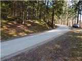 3
3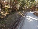 4
4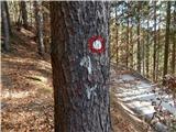 5
5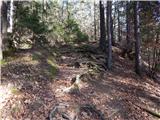 6
6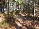 7
7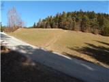 8
8 9
9 10
10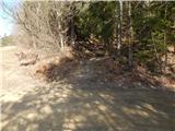 11
11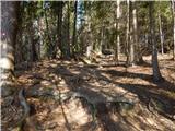 12
12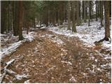 13
13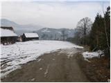 14
14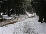 15
15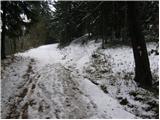 16
16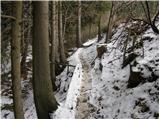 17
17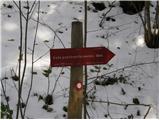 18
18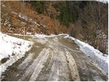 19
19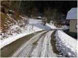 20
20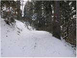 21
21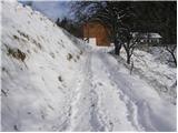 22
22 23
23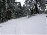 24
24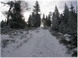 25
25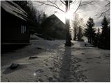 26
26
Discussion about the trip Gradišče - Koča pod Kremžarjevim vrhom
|
| Gost8. 12. 2007 |
Pleasant hike even in the snow. For Slovenj Gradec residents, this is a nice half-day hike, somewhat longer than Šmarna gora for Ljubljana residents. Since the peak is also well-visited in winter, the path is often trodden a few hours after snowfall.
I recommend visiting this corner of Slovenia, it's worth it. Uroš
|
|
|
To post a comment you must log in:
If you do not yet have a username, you must first
register.