Gschnitz - Kalkwand (zahodni pristop iz Gschnitza preko Pinnisjocha)
Starting point: Gschnitz (1242 m)
Starting point Lat/Lon: 47.04252°N 11.34538°E 
Path name: zahodni pristop iz Gschnitza preko Pinnisjocha
Time of walking: 3 h 45 min
Difficulty: difficult marked way
Difficulty of skiing: more demanding
Altitude difference: 1322 m
Altitude difference (by path): 1322 m
Map: Stubaier Alpen Hochstubai, 31/1 1:25.000; Outdooractive Stubai Wanderkarte
Access to starting point:
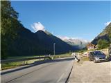
From Ljubljana, we drive on the highway past Salzburg in the direction towards München. At the multilevel junction Dreieck Inntal we go on the road A93 in the direction of Innsbruck/Kufstein/Brenner. When we return to Austria we continue to the junction with the exit Innsbruck-Mitte. Here we don't turn towards Innsbruck, but we continue on the highway A13 in the direction towards the mountain pass Brenner. We continue on the highway all the way to the settlement Matrei am Brenner, where we go to the exit 19-Matrei. We continue driving on the road B182 to the settlement Steinach am Brenner, where at the roundabout in the middle of the town we take the first exit and in a gentle ascent, we continue driving past Trins through scenic valley Gschnitztal to the eponymous elongated village, where we will behind the church soon notice a relatively small free parking lot, intended for visitors of Innsbrucker Hütte.
Alternatively we can drive through northern Italy: in this case from the main Slovenia on the highway A2 we drive to one of the border crossings with Austria and we continue towards Lienz. Here we continue on the road 100 and past the passage Prato alla Drava we drive into Italy. In Italy we follow the road SS49 all the way to the juncture with highway A22 in the direction towards the mountain pass Brenner. After the mountain pass, we continue in the direction towards Innsbruck, but only to the exit on the road B182 near the Brennersee. On this road we continue to Steinach am Brenner, thence following the instructions described above.
Path description:
From the parking lot, we go on a clearly visible and marked, at first fenced path in the direction of Innsbrucker Hütte, which soon starts moderately ascending by the edge of cultivated land. Above the village, a narrower path continues through a thinner forest, which occasionally offers nice views towards scenic valley Gschnitztal. For some time we are moderately ascending on the path which is carved into steep slopes of the mountain range of Habicht group. A little higher with increasingly beautiful views on the south part of Stubai Alps, where there are especially exposed Pflerscher and Gschitzer Tribulaun, we pass on open terrain of high mountain grasslands. In parts a little precipitous path high above the valley, below the mountain walls of peaks Habicht group slowly crosses towards the west. In doing so we cross few gullies, where some caution is needed. In the last part of the path towards the mountain hut, the footpath again a little steeper ascends to the grassy edge, after which we step into high mountain terrain between the mountain walls of Habicht and Kalkwand, where we the first time notice Innsbrucker Hütte. Below the western edge of the wall of Kalkwand massif with the help of some fixed safety gear we descend a little to a diagonal path between the mentioned mountains, where we gradually join the paths from inn Feuerstein and from the valley Stubaital.
From Gschnitz to the saddle Pinnisjoch near the Innsbrucker Hütte there is around 2h 30min - 3h. The path isn't very demanding, but it is quite steep and in parts a little precipitous, and in the winter it is very exposed to avalanches. The approach from the inn Feurstein is slightly shorter and easier, but a little less panoramic.
From the saddle, we continue towards the east on a quite gentle footpath below the western wall of Kalkwand, which among other things has also a learning ferrata and a smaller climbing area. We soon get to a shorter secured part, where with the help of a steel cable we ascend over a steep section (less demanding). After this we through steep scree ascend to the saddle between the eastern and western wall of Kalkwand, where a breathtaking view opens up on deeply below us situated valley Gschnitztal, which we will be from now on visible all the way to the top.
We continue on a narrow and in parts quite precipitous footpath which is winding below the upper massif of Kalkwand high above Gschnitztal. We soon find ourselves in front of a rocky jump, over which we are lead by reliable fixed safety gear, and behind it, we ascend on a narrow path to the crossing below Kalkwand.
To the right, the path continues towards Ilmspitze (following this path, a little later it also possible to access to the summit of Kalkwand), and our path turns left directly towards the summit. Few minutes we follow a well-marked path to poles on the secondary peak, and from there we are in only few steps at the cross on the highest point of Kalkwand, which offers a breathtaking view on more famous neighbors, Habicht and Ilmspitze.
The ascent on Kalkwand is a nice, although in parts slightly exposed and neglected tour, which we can make during a multi-day hike on Habicht or by the way by the path on Ilmspitze. Because of in parts good rock, in the western part of the massif there are settled some climbing routes and shorter, attractive learning ferrata, which reaches the difficulty C/D-D.
On the way: Innsbrucker Hütte (2369m)
Pictures:
 1
1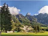 2
2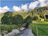 3
3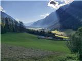 4
4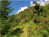 5
5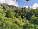 6
6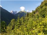 7
7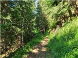 8
8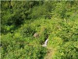 9
9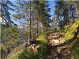 10
10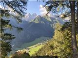 11
11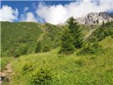 12
12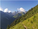 13
13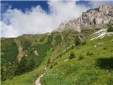 14
14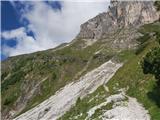 15
15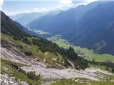 16
16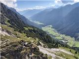 17
17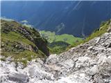 18
18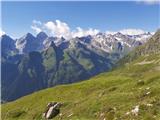 19
19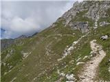 20
20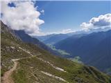 21
21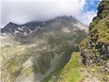 22
22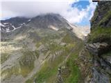 23
23 24
24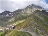 25
25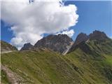 26
26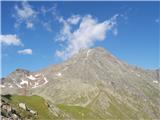 27
27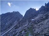 28
28 29
29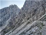 30
30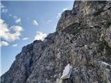 31
31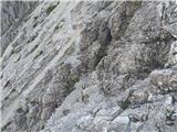 32
32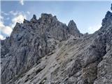 33
33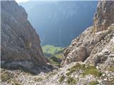 34
34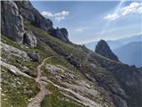 35
35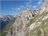 36
36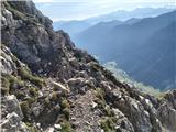 37
37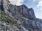 38
38 39
39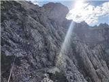 40
40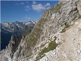 41
41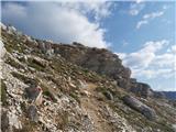 42
42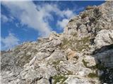 43
43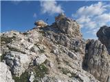 44
44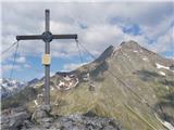 45
45