Hrastovlje - Sveti Štefan (Zanigrad)
Starting point: Hrastovlje (165 m)
| Latitude/Longitude: | 45,50950°N 13,90060°E |
| |
Walking time: 40 min
Difficulty: easy marked way
Elevation gain: 81 m
Elevation difference along the route: 145 m
Map: Slovenska Istra - Čičarija, Brkini in Kras 1:50.000
Recommended equipment (summer):
Recommended equipment (winter):
Views: 8.860
 | 1 person like this post |
Access to starting point:
From the Ljubljana–Koper highway take the Črni Kal exit. From Črni Kal continue driving on the old road towards the sea, but follow it only to the next somewhat larger intersection, where turn left towards the Sočerga border crossing. Further, drive towards the mentioned border crossing, but follow the road only for a few km, as signs for the village Hrastovlje then direct us left onto a local road. After a few km of further driving arrive in Hrastovlje, where at the intersection by a smaller chapel continue left and then park on the arranged parking lot below the church of the Holy Trinity in Hrastovlje, which is world-famous for the Mrtvaški ples frescoes.
Route description:
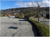
From the parking lot, we continue on a narrower asphalt road which ascends towards the nearby church of the Holy Trinity. Right before we come to the church, the road splits into two parts. We continue on the lower left marked road (on the right road in a few steps we get to the already mentioned church, which is known for the Mrtvaški ples frescoes), which starts descending through the village. Through the village we carefully follow the blazes, so that at no crossroads we stray onto the wrong path. After a few-minute descent the road flattens, and we continue the path on a macadam road, from which beautiful views open up on the Kraški rob. The road quickly brings us to a smaller intersection below the power lines, where we continue straight, or slightly left on the marked road. For some time we continue along the bottom of the valley, then the poorer road crosses a stream and behind it turns slightly to the right and starts moderately ascending. A little higher the poorer road splits into two parts, and we continue slightly left and the path on a wider cart track, on which in a few minutes of additional walking we arrive at the underpass under the railway track.
On the other side of the railway track there is an unmarked junction, and we continue sharply right (straight Podpeč and Zjat) and for some time continue parallel with the railway track. We continue on the marked path, from which a view opens up towards the church of St. Štefan in Zanigrad, Hrastovlje and the surrounding hills. The path ahead steeply ascends for a short time, then passes into a belt of bushes, through which it ascends along a partly panoramic ridge. After a few minutes we pay attention, as the blazes direct us sharply to the right on a quite overgrown footpath, on which in one minute of additional walking we arrive at the church of St. Štefan in Zanigrad.

Along the route: Sveta Trojica (177m)
Photos:
 1
1 2
2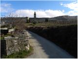 3
3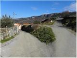 4
4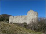 5
5 6
6 7
7 8
8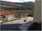 9
9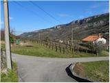 10
10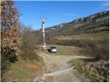 11
11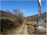 12
12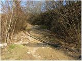 13
13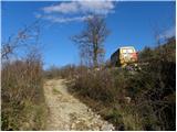 14
14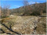 15
15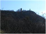 16
16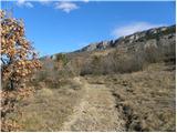 17
17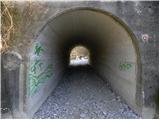 18
18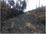 19
19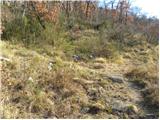 20
20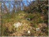 21
21 22
22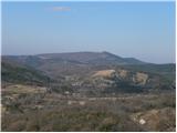 23
23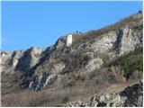 24
24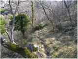 25
25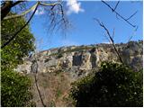 26
26 27
27 28
28 29
29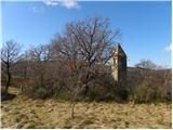 30
30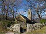 31
31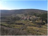 32
32
Discussion about the trip Hrastovlje - Sveti Štefan (Zanigrad)
|
| Kigeot18. 11. 2014 |
Let me add that the church is closed, so you can't see the remains of the frescoes. On December 26th they have a traditional blessing of horses.
|
|
|
|
| Macesna18. 11. 2014 |
Hm, regarding the frescoes in the Hrastovlje church, which are indeed exceptionally beautiful: the church is indeed locked, but not long ago, when I was there last, people from the village came to unlock it and turn on the lights, and they also explained briefly. If I remember correctly, there was a note on the church doors about which house to ring at, otherwise everyone in the village knows for sure.
It's worth the effort, because the interior is really something special!
|
|
|
|
| Kigeot27. 12. 2014 |
Macesna, misunderstanding - I meant the church of St. Stefan in Zanigrad, there should also be remnants of frescoes.
In Hrastovlje you can really enter the church of Holy Trinity, in principle open every day a few hours morning and afternoon; closed only on Tuesdays.
|
|
|
To post a comment you must log in:
If you do not yet have a username, you must first
register.