Hruševo - Vrhe above Dobrova
Starting point: Hruševo (319 m)
| Latitude/Longitude: | 46,07270°N 14,39990°E |
| |
Walking time: 1 h
Difficulty: easy unmarked way
Elevation gain: 284 m
Elevation difference along the route: 284 m
Map: Ljubljana - okolica 1:50.000
Recommended equipment (summer):
Recommended equipment (winter):
Views: 4.446
 | 4 people like this post |
Access to starting point:
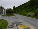
From the highway Ljubljana - Koper, we go to the exit Brezovica, and then we continue driving in the direction of Dobrova (to Dobrova we can also come from the direction of Šentvid, namely through Podutik and through the mountain pass Preval) and Polhov Gradec. When the valley of Gradaščica narrows, we arrive at a crossroad, where signs for Hruševo direct us to the left. Immediately after we have left the main road, we are at the inn Kramarjev hram, where our path begins. Because parking by the inn is allowed only for guests, we must park somewhere else (one of the options is also to drive above the village).
To the starting point we can also come from the direction of Polhov Gradec.
Route description:
From the inn and pizzeria Kramarjev hram we continue on the asphalt road which crosses the river Gradaščica and starts slightly ascending. For some time we continue on the main road, and then at the crossroad, where the main road turns left downwards (by the crossroad there are signs for hairdresser salon Karmen) we continue right upwards. Further, the road leads us past a few more houses, and then we get above the village, where on the left side of the road there is a smaller parking lot.
At the beginning of the parking lot a cart track branches off to the right, which already after a few meters splits into two parts. We choose the left upper cart track and then, when we are already in the forest, we once again continue left on a path that is at first still quite wide. The path soon passes into a dense forest through which it moderately ascends. On several crossings, arrows on the trees help us with orientation; otherwise the footpath is unmarked (at the crossings we mostly choose the path which ascends or is best beaten). A little further, another relatively well-beaten path joins us from the right, and we continue on the gradually steeper footpath. The footpath has higher up a few more crossings, where we have to be careful, and then through the forest and blueberries we ascend to a relatively well-visited peak, in the middle of which there is a registration box and much more.

Photos:
 1
1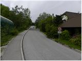 2
2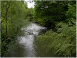 3
3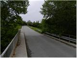 4
4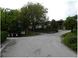 5
5 6
6 7
7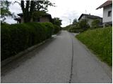 8
8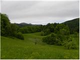 9
9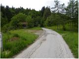 10
10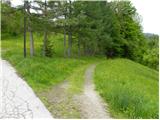 11
11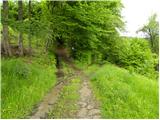 12
12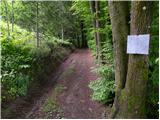 13
13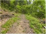 14
14 15
15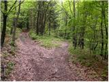 16
16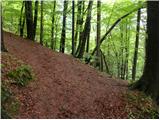 17
17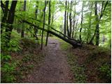 18
18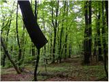 19
19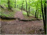 20
20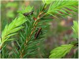 21
21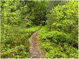 22
22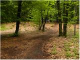 23
23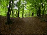 24
24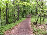 25
25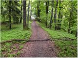 26
26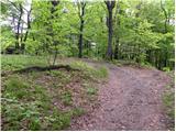 27
27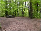 28
28 29
29
Discussion about the trip Hruševo - Vrhe above Dobrova
|
| wolphgang25. 05. 2013 |
nacka. : quoting: "Now you can travel towards Polhov Gradec and Šentjošt with Urban city bus ticket"
what do you mean exactly? Does this line now belong to city transport?
|
|
|
|
| nacka.25. 05. 2013 |
wolphgang - under payment regime these two lines now fall under city public transport, Pay with Urban (or modern mobiles) - same as all city lines. Transport to Dobrova + some further stops incl. Hruševo is zone 1, same city price. To farther stops (from Hrastnice incl.) zone 2 (single ticket 1.80 €).
Bus frequency much lower though. Thought this info important after reading logbook entry days ago: 'As soon as I learned I could go to Dobrova with Urban, I decided on hike to Vrhe'. Locals say to Vrhe, not on Vrhe as logical.
Best regards,
Nacka
|
|
|
|
| wolphgang25. 05. 2013 |
thanks for the info nacka. , gotta go to Vrhe soon, on return stop at Broadway and Aljaž  cheers! cheers!
|
|
|
|
| nacka.12. 12. 2015 |
Now the bus runs twice on Sundays too
|
|
|
To post a comment you must log in:
If you do not yet have a username, you must first
register.