Kaiseburg - Wöllaner Nock
Starting point: Kaiseburg (2055 m)
| Latitude/Longitude: | 46,81180°N 13,77670°E |
| |
Walking time: 20 min
Difficulty: easy marked way
Elevation gain: 90 m
Elevation difference along the route: 90 m
Map:
Recommended equipment (summer):
Recommended equipment (winter): ice axe, crampons
Views: 3.298
 | 1 person like this post |
Access to starting point:
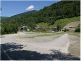
A) Through the Karawanks Tunnel, we drive to Austria, and then continue on the Tauern highway, which we leave at the Villach bypass and continue towards the settlements Treffen am Ossiacher See, Afritz am See, Feld am See, and after the mentioned settlement turn right towards the known ski center Bad Kleinkirchheim. We park on a large parking lot opposite the gas station.
B) From Styria or Carinthia, we first drive to Dravograd and then over the border crossing Vič into Austria, where we follow the signs for Klagenfurt / Celovec. Further, we drive on the so-called South highway, which we leave at Klagenfurt (direction Feldkirchen). Further, we drive on a regional road, by which we arrive at the already mentioned settlement. In Feldkirchen, we continue right in the direction of the mountain pass Turacher Höhe and drive past settlements Himmelberg, Gnesau, Mitterdorf to the settlement Wiedweg, where we continue left towards the known ski center Bad Kleinkirchheim. We park on a large parking lot opposite the gas station.
Route description:
From the parking lot, we first walk to the bottom station of the circular cabin cable car, which leads to Kaiseburg (highest point of the ski area), then buy a ticket and take the cable car to the upper station of the mentioned cable car, where we start our trip.
From the upper station of the cable car, we can climb to the nearby Kaiseburg in 2 minutes, otherwise we continue on the wide path in the direction of the summit Wöllaner Nock. The path first runs along a gentle ridge, then transitions to a slope, where it begins to ascend moderately to occasionally steeply. We follow this wide and increasingly panoramic path all the way to the expansive summit, in the center of which stands a larger cross.
Photos:
 1
1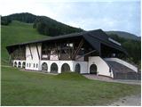 2
2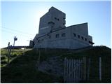 3
3 4
4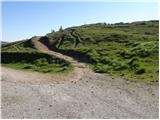 5
5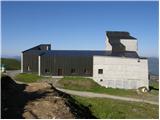 6
6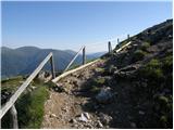 7
7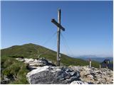 8
8 9
9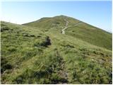 10
10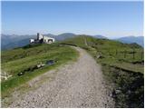 11
11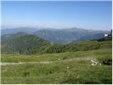 12
12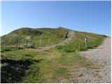 13
13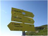 14
14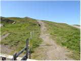 15
15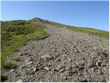 16
16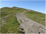 17
17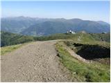 18
18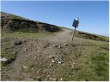 19
19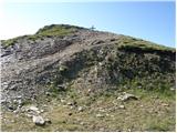 20
20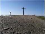 21
21 22
22
Discussion about the trip Kaiseburg - Wöllaner Nock
To post a comment you must log in:
If you do not yet have a username, you must first
register.