Kajfežev rob - Kamniški vrh
Starting point: Kajfežev rob (900 m)
| Latitude/Longitude: | 46,29490°N 14,58250°E |
| |
Walking time: 1 h 15 min
Difficulty: easy unmarked way
Elevation gain: 359 m
Elevation difference along the route: 359 m
Map: Kamniške in Savinjske Alpe 1:50.000
Recommended equipment (summer):
Recommended equipment (winter): ice axe, crampons
Views: 17.432
 | 1 person like this post |
Access to starting point:
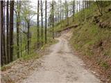
We drive to Kamnik and follow the road ahead towards the valley of Kamniška Bistrica. Just a few dozen meters before the lower station of the cable car to Velika planina, a forest road branches off to the left downhill into the Korošica valley. We head onto this road, which first descends, then crosses a bridge and a little further brings us to a junction, where we continue straight. A little further, we come to the next junction, where we continue sharply left, cross a small wooden bridge and then ascend on an occasionally rather poor macadam road. We follow this road, which crosses numerous landslide-prone slopes, for 2 to 3 km, then park on one of the parking areas by the road.
Route description:
From the parking lot, we continue on the road which still crosses landslide-prone (part of the road was swept away by a landslide on 3.5.2009) and occasionally panoramic slopes. A little further, the road which barely ascends brings us into a dense forest, and here we need to pay attention, because on a smaller clearing (see picture 5) we will notice an old hunting path, which from the road goes left into the forest.
We head onto the mentioned path which starts moderately, then ascends steeper and steeper through the forest. Higher up we come to a smaller junction, where we step onto an also unmarked transverse path. We follow the mentioned path to the left, which in crossing a somewhat steeper slope brings us to the next junction, where we continue sharply right. We follow this occasionally somewhat poorly visible path all the way to the saddle between Kamniški vrh on the left and Planjava on the right.
On the saddle we step onto a marked path, which we follow left in the direction of Kamniški vrh to which we have only about 10 minutes left. The path from the saddle onwards ascends along a wide ridge, which on the right (south) side offers nice views.
From the top, we can continue on the path a little further to a nice vantage point by which there also stands a smaller bivouac.

Photos:
 1
1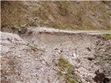 2
2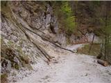 3
3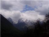 4
4 5
5 6
6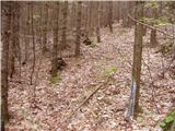 7
7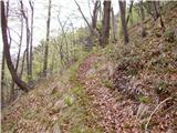 8
8 9
9 10
10 11
11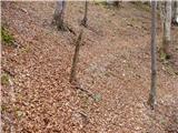 12
12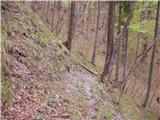 13
13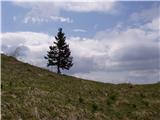 14
14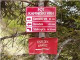 15
15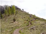 16
16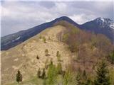 17
17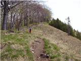 18
18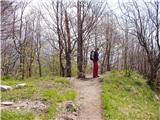 19
19 20
20
Discussion about the trip Kajfežev rob - Kamniški vrh
To post a comment you must log in:
If you do not yet have a username, you must first
register.