Kamnje - Kucelj (na Čavnu)
Starting point: Kamnje (250 m)
Starting point Lat/Lon: 45.901°N 13.8345°E 
Time of walking: 2 h 45 min
Difficulty: easy marked way
Difficulty of skiing: partly demanding
Altitude difference: 987 m
Altitude difference (by path): 1000 m
Map: Goriška 1:50.000
Access to starting point:
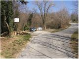
A) From highway Razdrto - Nova Gorica we go to the exit Ajdovščina, and then at the crossroad we turn left in the direction of Nova Gorica. Further, we are driving on a regional road towards Nova Gorica to the village Potoče, where we turn right in the direction of village Kamnje. The road then soon brings us in the mentioned village, where we drive past the church and over a bridge to a crossroad, where we continue left in the direction of Kucelj, Čaven and Mala gora. And only a little ahead at the signs for Kucelj and Čaven we leave the asphalt road and we park on a smaller parking lot by the road.
B) From highway Nova Gorica - Razdrto we go to the exit Selo, after we drive on the old road Nova Gorica - Ajdovščina we continue right towards Nova Gorica. On regional road towards Ajdovščina we drive to the village Potoče, where we turn left in the direction of village Kamnje. The road then soon brings us in the mentioned village, where we drive past the church and over a bridge to a crossroad, where we continue left in the direction of Kucelj, Čaven and Mala gora. And only a little ahead at the signs for Kucelj and Čaven we leave the asphalt road and we park on a smaller parking lot by the road.
Path description:
From the parking lot, we continue on a macadam road which is slowly changing into a cart track. After approximately half an hour of walking, we leave the cart track, because blazes for Čaven point us to the right on a footpath. We continue on the path, that is gently ascending through the forest. And well-marked path a little higher brings us to resting place Šija (bench and table). And the path ahead starts gradually ascending steeper and steeper and higher it brings us to a nice viewpoint named Kopice.
Further, we are for some time ascending through the forest and then we pass over on unvegetated slopes of Mala gora, where also steepness decreases. After additional few steps, we get to the mountain hut on Mala gora from which we continue straight in the direction of Kucelj and Čaven. And few steps ahead from the left cart track joins, which comes from the hunting cottage. Further, we continue on a cart track from which soon a path branches off to the right towards the mountain hut Koča na Čavnu.
Here we continue straight on a cart track ahead, which then brings us on the path from the mountain hut Koča na Čavnu towards Kucelj. Here we continue left on the path which at first runs almost horizontal, and then it starts ascending. This path then soon comes out of the forest, where we already see Kucelj in front of us. Follows only 10 more minutes of ascent on panoramic upper slope of the mountain.
Pictures:
 1
1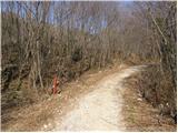 2
2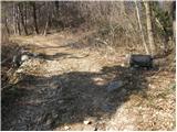 3
3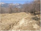 4
4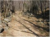 5
5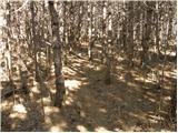 6
6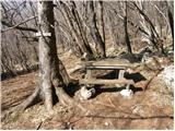 7
7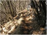 8
8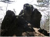 9
9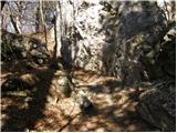 10
10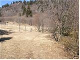 11
11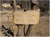 12
12 13
13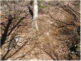 14
14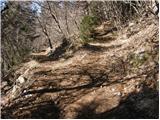 15
15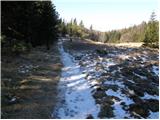 16
16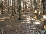 17
17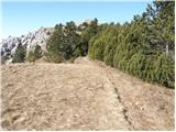 18
18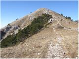 19
19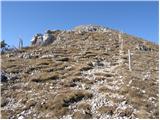 20
20 21
21