Starting point: Kanonir (725 m)
| Latitude/Longitude: | 46,38010°N 14,46190°E |
| |
Walking time: 3 h 45 min
Difficulty: partly demanding marked way, partly demanding unmarked way
Elevation gain: 1008 m
Elevation difference along the route: 1150 m
Map: Karavanke - osrednji del 1:50.000
Recommended equipment (summer):
Recommended equipment (winter): ice axe, crampons
Views: 3.630
 | 1 person like this post |
Access to starting point:
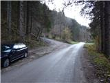
First, we drive to Preddvor or to the settlement of Tupaliče (to here from the Gorenjska motorway or Kranj), then we continue driving in the direction of Jezersko. When we arrive in the municipality of Jezersko, we will soon notice signs for Gostišče Kanonir. Behind the inn, we turn left onto the road in the direction of Dol - Podstoržič and the Kovk farm. Further on, we drive along a somewhat narrower road that leads us past more houses, and after a few hundred meters of further driving, we arrive at a junction where a steep road branches off to the left, along which the marked path to Kozji vrh also continues. We park in a suitable spot at the junction.
Route description:
From the starting point, we continue on the left road in the direction of Kozji vrh, by which we notice that from 20.7. to 20.10. further driving is forbidden. We walk for about 20 minutes on a fairly steep road, then we emerge from the forest onto the edge of the pasture Robci, from where a nice view opens towards the massif of Kočna.
From Robci, which are located on the saddle between Macesnovec (1042 m) on the left and Kozji vrh (1628 m) on the right, we continue right onto a cart track in the direction of Kozji vrh. The cart track quickly takes us into the forest, through which we begin to ascend more steeply. At a few smaller junctions, we follow the blazes; higher up, the cart track turns into a mountain path, which then mostly ascends diagonally to the right, crossing several gullies and steep slopes. In wet conditions, there is a greater risk of slipping on some sections, and even in dry conditions, extra caution is needed in places. Higher up, some views open through the treetops, and the path brings us below the cliffs of Kozji vrh, where there is a greater probability of falling rocks, especially in spring. Below the cliffs, the path leads across a small scree field, mostly along a steep slope. When the traverse ends, the path brings us to an indistinct forested saddle between Kozji vrh on the left and Turni (1432 m) on the right.
Here we leave the marked path, which turns left and leads further to Kozji vrh (about 40 minutes to Kozji vrh), and continue right along an indistinct ridge, where we soon spot an old footpath and a wire fence. When we arrive below the summit of Turni, the footpath completely disappears, and we merely cross the slopes of Turni (if we go right uphill, we can reach the summit of Turni in under 10 minutes).
On the other side of the highest summit of Turni, we arrive at a small saddle, where we notice an old border stone (the border stone separated the region of Kranjska from the region of Koroška). From here, a slight descent follows to the left, then we reach a newer cart track, along which we continue the descent to the lowest point in the ridge from Kozji vrh to Mali Grintovec (1299 m). At the mentioned saddle, the cart track turns slightly left and continues descending, but we continue slightly right onto a clearly visible footpath that runs along or slightly beside the ridge. We continue through dense forest, first ascending gently, then moderately. During the ascent, the path passes several old border stones, and we follow the easy-to-trace footpath to the point where it turns slightly left from the ridge onto the slope. At that point, we leave the nice footpath and continue along the ridge, first pathless, then the path reappears (if we continued left along the path, we would soon realize we are on the wrong route, as that path quickly disappears).
The path ahead leads along the ridge, where we steeply ascend for a few meters over a slightly exposed step, then quickly reach a pleasant viewpoint through a belt of dwarf pines, from where a nice view opens onto the surrounding mountains; the best is, of course, towards the massif of Kočna.
From the viewpoint, we also see part of the path ahead, as the footpath through the dwarf pines is clearly visible. We then ascend diagonally through the dwarf pines, and the path also leads us over a shorter, partly rocky and slightly exposed ledge. Higher up, we reach a side ridge, and behind it a sparse forest covered with grass. We continue along the steep grassy slope, where the footpath quickly disappears. Across this slope, we ascend diagonally to the left (in wet conditions, there is a risk of slipping here), then higher up we again spot a traceable footpath, which we follow to the right. This is followed by an ascent through a belt of dwarf pines, then the path returns to the ridge, which we reach near two gullies. The passage above the gullies, which meet at the ridge, is not difficult, and after them the path enters a longer belt of dwarf pines. The path through the dwarf pines is relatively easy to pass, initially also running along a somewhat exposed ridge. After about 20 minutes of fairly steep ascent through the dwarf pines, we reach the panoramic summit of Licjanovec.
We descend along the ascent path or along the cart track onto which we step below Turni (the cart track lower down turns into a road and leads around Kozji vrh back to the starting point; alternatively, we can continue to the nearby Mali Grintovec and then descend along the marked path over Bašeljski preval).
The description and photos refer to the conditions in 2015 (November).

Photos:
 1
1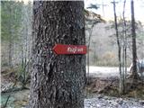 2
2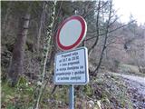 3
3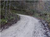 4
4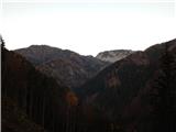 5
5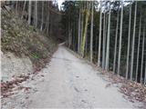 6
6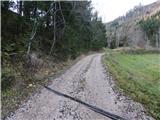 7
7 8
8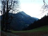 9
9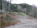 10
10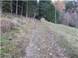 11
11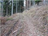 12
12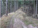 13
13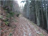 14
14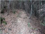 15
15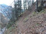 16
16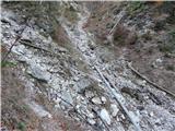 17
17 18
18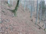 19
19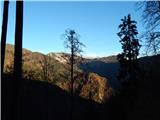 20
20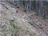 21
21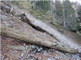 22
22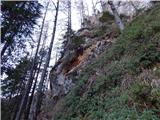 23
23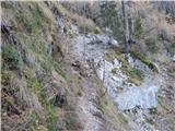 24
24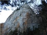 25
25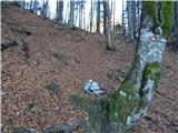 26
26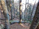 27
27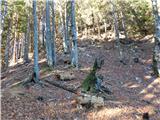 28
28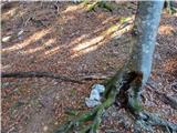 29
29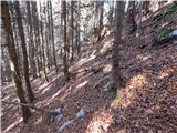 30
30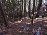 31
31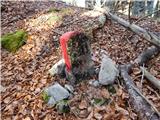 32
32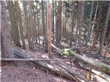 33
33 34
34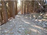 35
35 36
36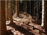 37
37 38
38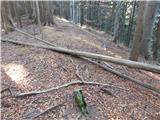 39
39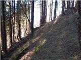 40
40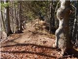 41
41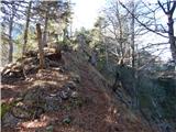 42
42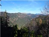 43
43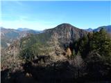 44
44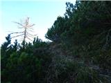 45
45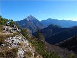 46
46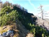 47
47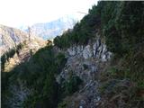 48
48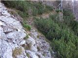 49
49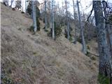 50
50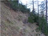 51
51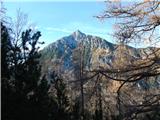 52
52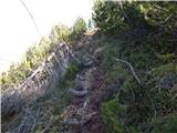 53
53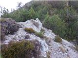 54
54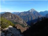 55
55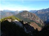 56
56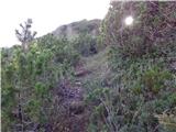 57
57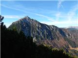 58
58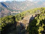 59
59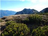 60
60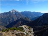 61
61
Discussion about the trip Kanonir - Licjanovec
|
| metod11. 06. 2017 |
Nice tour, the description is also good and easy to follow without problems. The border stone has initials FD; Franc Dolenc, former large landowner or owner of forests in the Koritarce valley.
|
|
|
To post a comment you must log in:
If you do not yet have a username, you must first
register.