Klippitztörl - Ladinger Spitz (Saualpe)
Starting point: Klippitztörl (1644 m)
Starting point Lat/Lon: 46.93637°N 14.67404°E 
Time of walking: 3 h 35 min
Difficulty: easy marked way
Difficulty of skiing: no data
Altitude difference: 435 m
Altitude difference (by path): 595 m
Map:
Access to starting point:
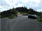
A) Over the border crossing Ljubelj we drive to Austria and follow the signs for Celovec / Klagenfurt am Wörthersee. In Celovec at McDonalds we go right on the south bypass road / Südring, and at the next larger crossroad we go once again right in the direction towards Velikovec / Völkermarkt and Mostič / Brückl. The road towards Velikovec we soon leave because a little after the store Obi we turn right in the direction of highway and Mostič. Further, we go past the store Ikea, where we follow the signs for Mostič and we go past the turn-offs to the highway. When we get to Mostič we follow the signs for Svinec / Eberstein and Hüttenberg. Still before Hüttenberg, more precisely after the settlement Mösel we turn right towards the mountain pass Klippitztörl and settlement Lölling. Further, we start considerably ascending through the valley of the stream Löllingbach, and higher after the settlement Lölling, we gradually go away also from the stream. We follow this road all the way to mountain pass Klippitztörl, where we turn right and we park on a larger asphalt parking lot.
B) Over the border crossing Jezerski Vrh, Holmec or Vič we drive to Austria, and then we follow the signs for Velikovec / Völkermarkt, and from there we follow the signs for Mostič / Brückl. When we get to Mostič we follow the signs for Svinec / Eberstein and Hüttenberg. Still before Hüttenberg, more precisely after the settlement Mösel we turn right towards the mountain pass Klippitztörl and settlement Lölling. Further, we start considerably ascending through the valley of the stream Löllingbach, and higher after the settlement Lölling, we gradually go away also from the stream. We follow this road all the way to mountain pass Klippitztörl, where we turn right and we park on a larger asphalt parking lot.
Path description:
At the beginning of the parking lot, signs for Geierkogel, Wolfsbergerhütte, Forstalpe and other destinations point us on a path which continues above the parking lot and leads us towards the south. We at first walk on a wide mountain path (not road), which is ascending only gently, and after we cross a macadam road, the path gradually becomes slightly steeper and it brings us to a marked crossing.
We continue on the right path in the direction of the mountain hut Wolfsbergerhütte (left - path over Geierkogel), which further in a diagonal ascent crosses slopes towards the right. A little further, we once again cross the forest road, and then we are for some time still gently ascending diagonally. When we leave the forest we ascend a little steeper to an indistinct ridge, where from the left joins approximately half an hour longer path which leads over Geierkogel.
We continue towards the south and we are moderately ascending along the fence, which we higher avoid a little to the right. When we ascend on 2000 meters of altitude, we soon on the right notice an interesting natural window, where there is the stamp of the peak Forstalpe. We continue on a marked path, and soon on the left we notice a smaller hill, where there is the highest point of the mentioned peak, and the peak we recognize by number 398.
From the top of Forstalpe, the path leads quite gently towards the southwest and on a grassy and partly swampy part brings us to a crossing on Hafeneck, where we continue slightly right in the direction of Ladinger Spitz (left - Kleinhinterbergerhütte).
The path ahead continues without large changes in altitude, and the ridge then narrows a little, and the path leads with some short easy ascents and descents. When we get very close to a grassy summit Kienberg, the marked path turns a little to the right and bypasses the highest point, to which we ascend in less than a minute of walking from the marked path.
We go on a marked path which continues on a grassy ridge and gradually we get to a fence, along which we start descending to the saddle at the cross Eisernes Kreuz (1958 meters), where also the path from the hut Weissbergerhütte joins.
We continue towards the south, and the path splits. We choose the slightly right path, which bypasses the peak of Gertrusk (the path over the peak is few minutes longer) and crosses panoramic western slopes. On the other side of the peak, we reach a wide ridge, where we join the path which leads over Gertrusk.
When we again start ascending we get to a crossing, where the path branches off to the left towards huts Offnerhütte and Ladingerhütte, and we continue straight. Further, we moderately ascend below an indistinct peak Kaiserofen, to which we can get to in few 10 strides from the marked path.
On the other side of the mentioned summit, the path for the last time splits, and we choose the slightly left path (right path bypasses Ladinger Spitze and leads further towards the mountain hut Wolfsbergerhütte) and there in a moderate ascent on an ample grassy terrain we ascend to the cross on Ladinger Spitze.
The starting point - Forstalpe 1:40, Forstalpe - Kienberg 0:40, Kienberg - Ladinger Spitze 1:15.
Description and pictures refer to a condition in August 2020.
On the way: Forstalpe (Svinška planina / Saualpe) (2034m), Kienberg (Svinška planina / Saualpe) (2050m), Kaiserofen (2037m)
Pictures:
 1
1 2
2 3
3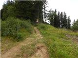 4
4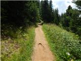 5
5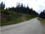 6
6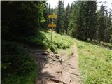 7
7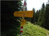 8
8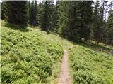 9
9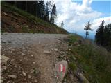 10
10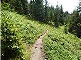 11
11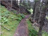 12
12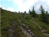 13
13 14
14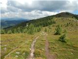 15
15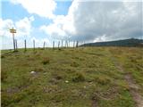 16
16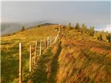 17
17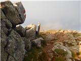 18
18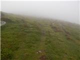 19
19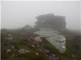 20
20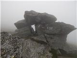 21
21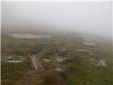 22
22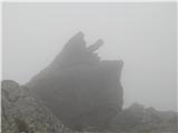 23
23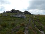 24
24 25
25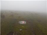 26
26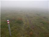 27
27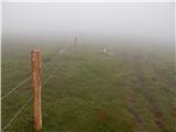 28
28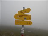 29
29 30
30 31
31 32
32 33
33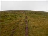 34
34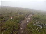 35
35 36
36 37
37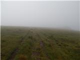 38
38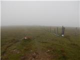 39
39 40
40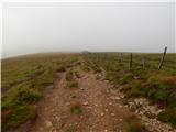 41
41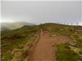 42
42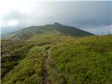 43
43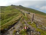 44
44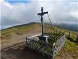 45
45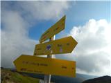 46
46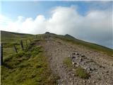 47
47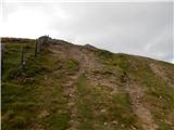 48
48 49
49 50
50 51
51 52
52 53
53 54
54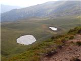 55
55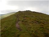 56
56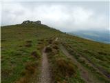 57
57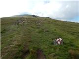 58
58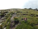 59
59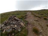 60
60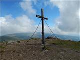 61
61