Soboški prelaz / Koglereck - Kleinalpl
Starting point: Soboški prelaz / Koglereck (1347 m)
| Latitude/Longitude: | 46,66900°N 15,00970°E |
| |
Walking time: 4 h 15 min
Difficulty: easy unmarked way
Elevation gain: 412 m
Elevation difference along the route: 660 m
Map:
Recommended equipment (summer):
Recommended equipment (winter): ice axe, crampons
Views: 127
 | 1 person like this post |
Access to starting point:
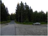
a) We drive to Dravograd, then through the Vič border crossing into Austria to the settlement Labot / Lavamünd, where we turn right towards Graz and Ivnik / Eibiswald. Next follows an ascent to mountain pass Soboški prelaz / Koglereck, where we turn left towards the settlement Ettendorf. Immediately after the crossroads, we will notice a large gravel parking lot on the left side, where we park.
b) We drive to Zgornja Kungota, then through the Jurij border crossing by Pesnica into Austria, from where we follow signs for the settlement Lučane / Leutschach, and then signs for Ivnik / Aibiswald. After Ivnik, we arrive in Aibl, where we exit the roundabout at the Spar store towards the settlement Labot / Lavamünd. Next follows a short ascent, and when the road levels out, we pass by the settlement Sobota / Soboth and lake Sobore / Stausee Soboth. After the lake, we start ascending again, following the road to mountain pass Soboški prelaz / Koglereck, where we turn right towards the settlement Ettendorf. Immediately after the crossroads, we will notice a large gravel parking lot on the left side, where we park.
c) We drive to Radlje ob Dravi, then through the Radeljski prelaz into Austria, from where we follow signs for the settlement Ivnik / Aibiswald. Before the mentioned settlement, in Aibl, we exit the roundabout at the Spar store towards the settlement Labot / Lavamünd. Next follows a short ascent, and when the road levels out, we pass by the settlement Sobota / Soboth and lake Sobore / Stausee Soboth. After the lake, we start ascending again, following the road to mountain pass Soboški prelaz / Koglereck, where we turn right towards the settlement Ettendorf. Immediately after the crossroads, we will notice a large gravel parking lot on the left side, where we park.
Route description:
From the parking lot, we continue a few more meters on the road, and then signposts point us to the right into the forest. At first, we ascend on a wide path through the forest, which brings us to a smaller clearing, from where a view towards the summit Großer Speikkogel opens up. Next follows a shorter descent, which brings us to a crossroad of mountain roads. We continue straight on a narrow road through the forest. Later we join a wider macadam road, on which we then walk for quite some time. The fairly level road ascends gently for most of the time, and occasionally also descends slightly. The road then brings us out of the forest and is followed by some more walking along the mountain pasture to a marked junction.
To the right leads the road to the hut Stiftshütte (5 min), and we continue on the road to the next junction, which is only a few dozen meters ahead. At the junction, we can continue right following the signs »Koralpe, Jauksattel« on the path which bypasses the peak Kleinalpl on the right side. The second option, which is slightly shorter, is to continue straight on the road past the gate and then past the hunting cottage Brandl. In the initial part the road will have two junctions and on both we continue right. The mountain road then turns to the left and then for a long time mostly in a gentle ascent crosses the slope on the western side of the peak Kleinalpl towards the north. We follow the mountain road all the way to a marked junction a few minutes before the saddle Jauksattel, where a path that bypasses the peak Kleinalpl on the right eastern side also joins.
Here we continue to the right (straight Gr. Speikkogel) in the direction of the cottage Dreieckhütte and the settlement Sobota / Soboth and start ascending through a sparse forest. When a few minutes higher the marked path turns slightly to the left, we continue straight on a grassy cart track. A little higher, slightly to the left, we cross another cart track, and then we start ascending towards the summit Kleinalpl.
After a good 15 minutes of ascent on an unmarked grassy cart track path, we reach a spacious grassy peak.

Photos:
 1
1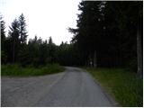 2
2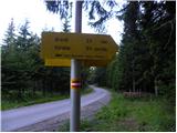 3
3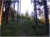 4
4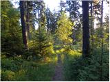 5
5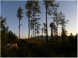 6
6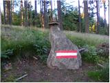 7
7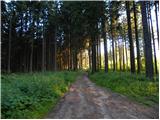 8
8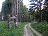 9
9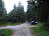 10
10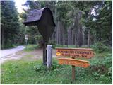 11
11 12
12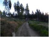 13
13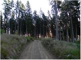 14
14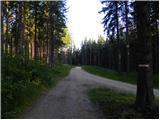 15
15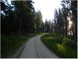 16
16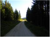 17
17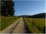 18
18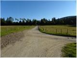 19
19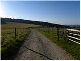 20
20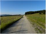 21
21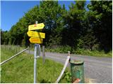 22
22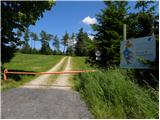 23
23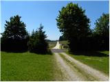 24
24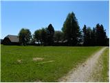 25
25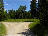 26
26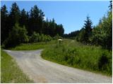 27
27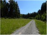 28
28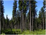 29
29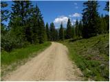 30
30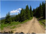 31
31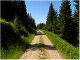 32
32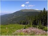 33
33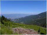 34
34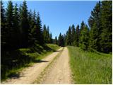 35
35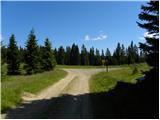 36
36 37
37 38
38 39
39 40
40 41
41 42
42 43
43 44
44 45
45 46
46 47
47 48
48 49
49 50
50 51
51 52
52
Discussion about the trip Soboški prelaz / Koglereck - Kleinalpl
To post a comment you must log in:
If you do not yet have a username, you must first
register.