Koprivna (Šumel) - Lanež (via homestead Haderlap and via Durce)
Starting point: Koprivna (Šumel) (786 m)
| Latitude/Longitude: | 46,45660°N 14,75940°E |
| |
Route name: via homestead Haderlap and via Durce
Walking time: 4 h 10 min
Difficulty: easy unmarked way, easy marked way
Elevation gain: 1139 m
Elevation difference along the route: 1180 m
Map: Koroška 1:50.000
Recommended equipment (summer): helmet
Recommended equipment (winter): helmet, ice axe, crampons
Views: 499
 | 1 person like this post |
Access to starting point:
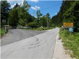
A) We drive to Črna na Koroškem, then continue driving towards Koprivna and Solčava. We then drive along the valley by the Meža River, and when we reach the crossroads where the road to Solčava branches off to the left, the described path starts. We park somewhere nearby at a suitable spot by the road.
B) We drive to Solčava, then follow the signs for Črna na Koroškem. This is followed by an ascent to the Spodnje Sleme pass, then a descent towards Črna na Koroškem and Koprivna. When we arrive in the valley at the crossroads with the road leading from Koprivna towards Črna na Koroškem, we are at the start of the described path. We park somewhere nearby at a suitable spot by the road.
Route description:
From the starting point, we head onto the road towards Solčava, Podolševa and Logarska dolina; the mountain signpost, which used to be by the road signs, now lies hidden nearby. The path first leads past a few more houses, including lodgings and the daytime bar Pri Mojci, then the road enters the forest and ascends through Janšekov graben. After a short ascent, we reach a crossroads where the road forks, and we continue right towards the footpath to Raduha.
Further on, we walk along the road leading to the Janšek homestead, but leave it before crossing the stream and continue left onto a cart track that begins to ascend through the forest. The cart track has several forks higher up; we continue on the wider one, and after a while reach the Haderlap homestead.
Here, we go left and walk to the access road. We continue along the road towards the Spodnje Sleme pass (at the farm, an abandoned path also starts or continues, leading past the Prodnik homestead and joining the marked path to Olševa somewhat further north of the Spodnje Sleme pass). After about an hour and a half from the starting point, we reach a junction at the Spodnje Sleme pass.
From Spodnje Sleme, we continue left towards Koča v Grohotu hut and Bukovnik farm (straight to Solčava, right to Olševa) along the ascending macadam road. A few minutes higher, the road levels out, then forks shortly after.
Slightly left, the marked path to Raduha continues, straight ahead the road leads to Bukovnik farm.
We continue left onto the upper road, closed to public traffic by a sign (straight to Bukovnik farm), and after about 100 metres reach a barrier that physically prevents further driving. A little further, a fine view opens towards Bukovnik farm and the Kamnik-Savinja Alps; when we return to the forest, the path forks.
We continue slightly left onto the marked footpath (straight along the road), which then traverses the slopes to the right, gently to moderately ascending for most of the way. During the traverse, the path takes us over a few short steep sections, which are well maintained and partly fenced, but technically undemanding. After a while, we emerge from the forest onto Planina Grohot, returning to the road, with only a few dozen easy paces to the Koča v Grohotu pod Raduho hut.
From the hut, we continue towards Durce and Raduha, at first still on a poor road or, higher up, cart track.
At the GRS hut, the cart track ends definitively, and we continue on the path turning left. This is followed by some ascent through occasional sparse forest, then we reach a marked junction, continuing left towards Durce (right is the climbing path to Raduha).
Ahead, the path ascends quite steeply, turning increasingly eastwards. The ever more panoramic path then brings us to the scree below the walls of Mala Raduha, where we continue straight (slightly right, the abandoned old path is still visible). Next comes the scree traverse; after crossing the gully, we enter a belt of dwarf pines through which a well-maintained path leads. Along this steeply ascending path, after about 10 minutes more, we reach a marked junction slightly east of Durce.
From the junction, we go left (right to Velika Raduha and one of the paths to Planina Loka) towards Lanež and Koča na Loki pod Raduho, bypassing the watering hole on the right. This is followed by a short descent to a small interesting overhanging cliff, then easy walking with a few short ascents and descents. The easy path then ascends moderately, bringing us with fine views to the broad summit of Lanež, where on the left is the summit logbook in the shape of a miniature Aljaž Tower; the highest point is somewhat further right.
Starting point - Spodnje Sleme 1:30, Spodnje Sleme - Bukovnik 0:20, Bukovnik - planina Grohot 0:40, planina Grohot - Durce 1:25, Durce - Lanež 0:15.
Description and pictures refer to conditions in 2018 and 2019 (July).

Along the route: Haderlap (1120m), Spodnje Sleme (1254m), Izletniška kmetija Bukovc (Bukovnik) (1327m)
Photos:
 1
1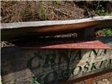 2
2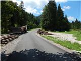 3
3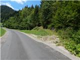 4
4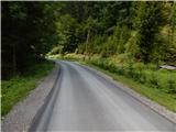 5
5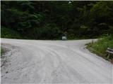 6
6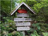 7
7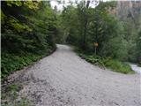 8
8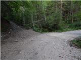 9
9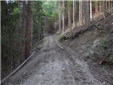 10
10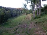 11
11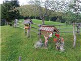 12
12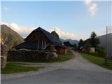 13
13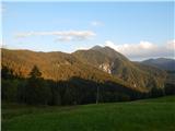 14
14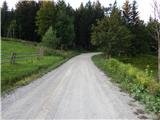 15
15 16
16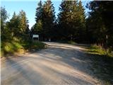 17
17 18
18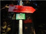 19
19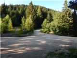 20
20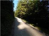 21
21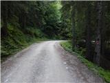 22
22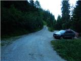 23
23 24
24 25
25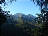 26
26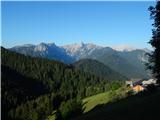 27
27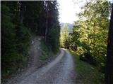 28
28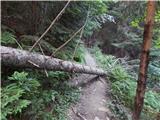 29
29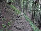 30
30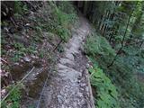 31
31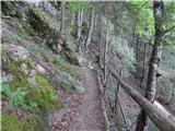 32
32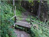 33
33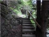 34
34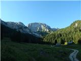 35
35 36
36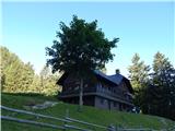 37
37 38
38 39
39 40
40 41
41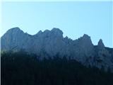 42
42 43
43 44
44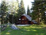 45
45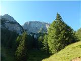 46
46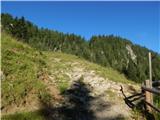 47
47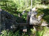 48
48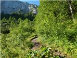 49
49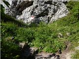 50
50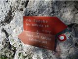 51
51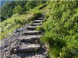 52
52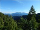 53
53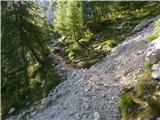 54
54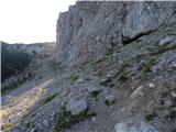 55
55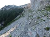 56
56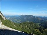 57
57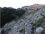 58
58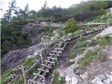 59
59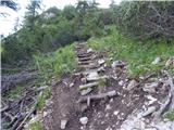 60
60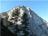 61
61 62
62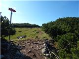 63
63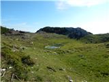 64
64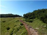 65
65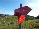 66
66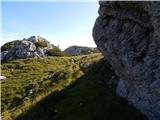 67
67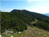 68
68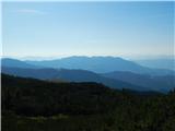 69
69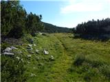 70
70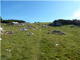 71
71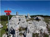 72
72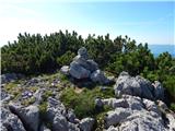 73
73 74
74
Discussion about the trip Koprivna (Šumel) - Lanež (via homestead Haderlap and via Durce)
To post a comment you must log in:
If you do not yet have a username, you must first
register.