Koroška Bela - Dom Pristava v Javorniškem Rovtu (Gajškova pot)
Starting point: Koroška Bela (630 m)
| Latitude/Longitude: | 46,43070°N 14,09820°E |
| |
Route name: Gajškova pot
Walking time: 1 h 40 min
Difficulty: easy marked way
Elevation gain: 345 m
Elevation difference along the route: 345 m
Map: Karavanke - osrednji del 1:50.000
Recommended equipment (summer):
Recommended equipment (winter): ice axe, crampons
Views: 20.016
 | 3 people like this post |
Access to starting point:
From the Ljubljana - Jesenice highway, we take the Lipce exit and drive right towards Jesenice. At the first traffic-light intersection (Javornik), we drive right in the direction of Lj. Then comes the second intersection with traffic lights, where we turn left and drive under the railway underpass, and at the next smaller intersection we head right towards Koroška Bela. We drive past the last bus stop (store on the left) into the village. We find the intersection in the center of the village, where a church marker stands. From here, we follow the main road through the village, which goes barely noticeably uphill towards the northeast. After approx. 100 m, on the right we notice a bridge, but we drive straight for another 50 m, where we come to a left road branch. We take it, and in the uphill we cross another (Koroška) street and continue (church lower on the left) all the way to the spot outside the settlement, where we come to abandoned tennis courts (RC Kres).
Route description:
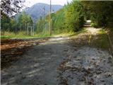
From the starting point, we head along the right path (cart track) uphill, where we come to the blazes. At the second right bend, we notice the barrier (quarry), but we continue along the hill, towards the forest, past the abandoned quarry on the left. The path soon takes us into the forest, where it runs almost level at first straight ahead, later starting to wind. When we reach a junction, we notice a direction sign on a tree that directs us left downhill towards the gully with a streamlet. Here we come to a large pile of landslide debris, before which we cross the mentioned streamlet and turn left uphill, where the path becomes somewhat narrower. For a while we walk through mixed, partly sparser forest, and we also cross another gully with a streamlet. When we find ourselves in a wider forest area (no longer on the slope), the blazes direct us right uphill, where the path seemingly disappears. Towards the "top" of this mentioned ascent, we spot the path, and the marks direct us left, where the path soon levels out and then also descends to the third streamlet, which we cross. Soon the forest area opens up somewhat, and from the left an ascending cart track joins us (on the right a smaller highly fenced hollow). We continue in the same direction, uphill along the cart track. When it starts turning right, we continue along another, somewhat narrower one, leading straight ahead. After a while, a path from Valvazorja joins from the right, and ours levels out or even descends slightly. When the level path starts turning right after some time, we branch off from it onto a trail on the left, which takes us to the bank of the Javornik stream, where after a short descent we cross the mentioned stream over a wooden bridge. We turn left and soon step onto a forest road that leads from Dom Trilobit towards the intersection with the asphalt road. Here we follow it right uphill to the right bend, after which on the left side of the road we notice a marked path leading into the forest. We take it and after a short time cross a forest road, from where we climb another few 10 m uphill towards the asphalt road. When we cross the latter, we ascend somewhat to the left across a meadow to Dom Pristava v Javorniškem Rovtu.

Photos:
 1
1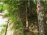 2
2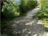 3
3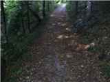 4
4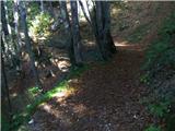 5
5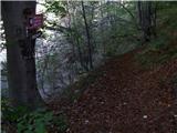 6
6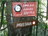 7
7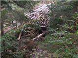 8
8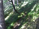 9
9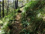 10
10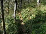 11
11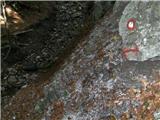 12
12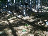 13
13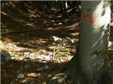 14
14 15
15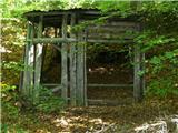 16
16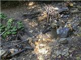 17
17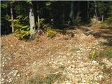 18
18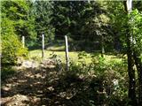 19
19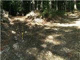 20
20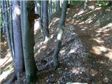 21
21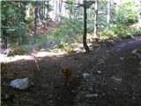 22
22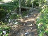 23
23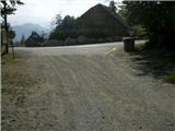 24
24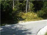 25
25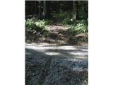 26
26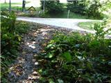 27
27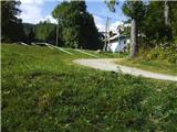 28
28 29
29 30
30
Discussion about the trip Koroška Bela - Dom Pristava v Javorniškem Rovtu (Gajškova pot)
|
| riky6518. 10. 2009 |
what about mushrooms? nothing to see...
|
|
|
|
| heinz18. 10. 2009 |
No worries, Riko, come check my fridge...
Do you still know the address?
|
|
|
|
| gcsaba223. 07. 2011 |
Unfortunately I went on this path today because I planned to go to Golica, and unfortunately I didn't even manage to reach Dom Pristava. The path goes as described, and when it reaches the river we have two directions. On a tree there is a painted mark, but the tree is in the middle between two paths and it's not clear if I should go left or right.
First I went left, and after 10 min, since I didn't see a single mark and the path became non-existent, I decided to turn back. Then I went right, across the river. Again there were no marks, but the path was better. After 15 min of walking I reached the end of the path and entered the forest, where I climbed pathless up to the pasture.
Finally, at the top I saw a car road! I wasn't sure if I should go left or right, so I decided to go left. After 5 min I reached a junction but there was no sign indicating which direction to go and what is in which direction. I think I made a mistake here because I went left but the hut was to the right.
Shame on PD Jesenice for not maintaining the path! Is it really hard to put up one sign saying in which direction the hut is?
|
|
|
|
| heinz24. 07. 2011 |
gcsaba2, I'm sorry, I don't understand what wasn't clear to you.. Which river and motorway are you talking about?
The Gajškova path to Pristava is actually very straightforward, in fact, one wouldn't even need the above description. It might even be too detailed. At least look at the pictures.
At 23. there is a bridge over the stream. The description states regarding this point that you continue to the intersection with the asphalt road, then right uphill etc.. In the worst case, you can ask someone at a house where that hut is.
|
|
|
|
| marezt25. 09. 2011 |
heinz one question for you.
Where is the path that branches off to the right from Gajškova (picture 7) supposed to lead?
I went last time to explore a bit and after about half an hour of walking and climbing over fallen trees the path suddenly ran out 
Best regards
|
|
|
|
| heinz25. 09. 2011 |
Yes, it's true, that path a bit higher near the stream runs out, although on the map a cart track is drawn that joins higher up the marked path Pristava - Valvasor. If you look closely, the path line is exactly at the part where it slightly turns left interrupted, which means it has been washed away somewhere.. Nothing else remains but to head right into the steep valley between the Alničija ridge and Debelo Brdo, and climb up it to sedlo Alničije below D. Brdo, where the logbook is located. From there you can continue towards planina Stamare, or Potoška planina and Valvasor.
Up the mentioned valley towards the top, especially in spring due to the slippery steep terrain it's real torment..
|
|
|
|
| marezt26. 09. 2011 |
I thought it would be something like that yeah.
And thanks for the reply
|
|
|
|
| mk665. 10. 2011 |
I thought I was the only one who doesn't know how to get to Pristava via Gajškova.
Instead of 1 hour on the road, we walked for 3 hours. Even though we knew exactly where we were - we got lost. The path is very poorly marked somewhere in the middle and then it completely disappears.
|
|
|
|
| heinz5. 10. 2011 |
It's a bit harder to understand the sentence: Even though we knew exactly where we were - we got lost.
mk66: did you have a map with you, or the above description? Without one or the other, it's sometimes hard to find your way even on the easiest orientation paths.
Regarding walking time, I should mention that on the marking board at the bridge over Javornik stream in Trebež it says: Pristava - Gajškova pot 1.30 hours.
You need to pay special attention to the descriptions at junctions.
|
|
|
|
| Toni-k6. 10. 2011 |
Since there's already a discussion about this, I think I won't be wrong if I say that many paths in Jesenice municipality are poorly maintained and unmarked. Just look at the remains of the Valvazor sign on Kor beli, broken footbridges Ukova-Jeseniški rovti and more and more. The other picture is the area around Planina pod Golico, where there are personal signposts for all interesting points and paths.
|
|
|
|
| heinz6. 10. 2011 |
there's unfortunately quite some truth in this too..
|
|
|
|
| mk6615. 10. 2011 |
"Even though we knew exactly where we were - we got lost." this sentence is nothing unusual if you know exactly your location - you see the asphalted road, but in front of you the "marked" path disappears. We had the above path description with us. But it doesn't help if the path disappears and there are no markers.
|
|
|
|
| mk6615. 10. 2011 |
I'd rather continue dodging cars and walking to Rovte along the road.:
|
|
|
|
| heinz16. 10. 2011 |
mk66: if you write on which part of the path (at which of the above pictures) you have problems, I can gladly help you, otherwise unfortunately not.
|
|
|
|
| marezt4. 04. 2012 |
I also went along Gajškova to Pristava with this description and got lost at first too, but only because I missed the marker
The next time I checked the description again and got to Pristava without problems. Much much much nicer path than along the road ...especially quieter
|
|
|
|
| Fulcrum13. 10. 2013 |
Dom Pristava has been CLOSED since 1.10.2013.
|
|
|
|
| heinz24. 04. 2018 |
The hut has been operating normally for the last 4-5 years. Back then in 2013 it was closed only briefly.
|
|
|
|
| Jusk4. 12. 2019 |
Today the path is fine, otherwise in the middle part you really need to look a bit ahead to notice the markers, because there aren't many. Obviously not very visited this path, but still pleasant
|
|
|
|
| potpodnoge27. 07. 2023 20:55:10 |
My wife and I also sometimes (not here but on other paths) have a hard time finding the right path if you don't know it or haven't walked it yet. In my opinion, the problem is that the paths are marked by diligent markers who know the path inside out and don't mark as if someone were walking the path for the first time. So at junctions they know exactly where to go, but someone going the path for the first time can only guess. Markers should mark paths from the perspective of inexperienced hikers who haven't walked paths before. Especially at crossroads, one more mark I think is no problem, certainly so that at dubious junctions one can see the next mark.
|
|
|
|
| rensul27. 07. 2023 22:40:32 |
Markers should be visible from one to the next, but markers don't follow that. They should go look at the path from Trilobit to Stamare. Although it's marked with yellow dots, frequency is decisive. When snow falls and covers the path, in the forest only the markers visible ahead help you.
|
|
|
|
| Janez Seliškar28. 07. 2023 09:42:53 |
"rensul", the path from Trilobita to Planina Stamare is not among the marked hiking trails.
|
|
|
|
| rensul30. 07. 2023 17:07:35 |
"Janez Seliškar"-That's completely clear to me, but it's really well marked.
|
|
|
|
| sannja9. 05. 2024 18:31:43 |
Hello, has anyone walked this trail recently? Is it still normally passable?
|
|
|
|
| sannja10. 05. 2024 22:41:46 |
The trail is normally passable, it seemed better marked to me than about ten years ago, there were no dilemmas where to turn this time
|
|
|
|
| TMravinec14. 11. 2025 09:27:19 |
I point out that the coordinates for the starting point of this path are not the correct ones. The correct ones are 46.4307, 14.0982.. the same as in the trip description "Koroška Bela (RC Kres) - Planina Stamare (Gajškova pot)".
|
|
|
|
| Tadej14. 11. 2025 10:36:15 |
Thanks for the notice. I have corrected it.
|
|
|
To post a comment you must log in:
If you do not yet have a username, you must first
register.