Starting point: Krnica (1113 m)
Time of walking: 4 h
Difficulty: very difficult marked way
Difficulty of skiing: no data
Altitude difference: 1359 m
Altitude difference (by path): 1600 m
Map: TNP
Access to starting point:
We need to leave the car immediately when we turn from the main road towards Vršič, next to river Pišnica, because road to the mountain hut Koča v Krnici is on many spots impassable!
Path description:
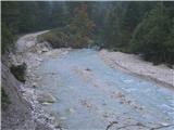
From the mountain hut in Krnica because of rockfall previous path is wrecked so you have to climb over the rocks and you persistently looking for blazes! Path is very panoramic and very nice! Only last hour becomes more demanding! Before the ascend on Špik of course we have to go through the ridge, which is of course precipitous and crumbly therefore a little more caution is needed! Also at last climbing to the summit we have to be careful, because stones are quite crumbly! Descent through Kačji graen and the scree before that are separate issue! A caution is needed at every step - scree has a steep angle, and later the stones are to the end slippery! Most beautiful just before the end are small stream and later river Pišnica with very refreshing and clear water!
Pictures:
 1
1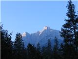 2
2 3
3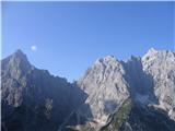 4
4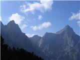 5
5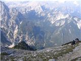 6
6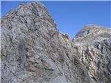 7
7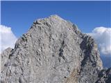 8
8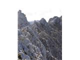 9
9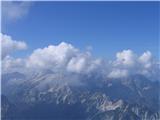 10
10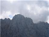 11
11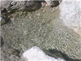 12
12