La AleGra - Bivacco Dino Brollo
Starting point: La AleGra (710 m)
| Latitude/Longitude: | 46,30432°N 13,29983°E |
| |
Walking time: 2 h 45 min
Difficulty: difficult marked way
Elevation gain: 911 m
Elevation difference along the route: 970 m
Map: Tabacco 26 1:25.000
Recommended equipment (summer):
Recommended equipment (winter): ice axe, crampons
Views: 474
 | 1 person like this post |
Access to starting point:
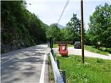
From the road Kobarid – Bovec in the village Žaga we turn towards the border crossing Učja. At the crossroad where the road branches off to the right towards the saddle Karnica and Rezija, we continue left or straight in the direction of the settlement Videm/Udine. The road then runs through the mountain pass Na Meji / Tanamea. Then we follow the road to the signpost for Agriturismo La Alegra. At the sign, we turn right onto a macadam road. At the very beginning of the mentioned road, on the left side, there is a small parking lot and mountain signposts. We can park here or continue along the macadam road for another good hundred meters where there is also some space for parking.
Route description:
From the first parking lot we continue on a gently sloping macadam road which crosses the torrent deposits of the stream Mea. Here a footpath soon branches off to the right towards the cottage Plan dei Ciclamini. We continue along the road to the sign that prohibits further driving. We continue on the macadam road, quickly reaching the well-maintained tourist farm La Alegra, where there are many various domestic animals.
At the tourist farm, we take a footpath and cross a fence. The path leads us into the forest, soon turning slightly to the left and crossing the stream Rio Tapotanor. The path then leads to a crossing where we continue right on path 737 towards Monte Musi and the bivouac Brollo. To the left, the path leads towards the village Mužac.
From the crossing, the path begins to ascend more steeply and passes a climbing area. The path continues to climb steeply, mostly through the forest, crossing several small gullies, with occasional views opening up, mainly towards the south. The path then leads to the slopes on the western side of the peak Tamar, guiding us high above the deep gully of the stream Rio Zalodra. Occasionally, the path is slightly exposed, and on a short section, a steel cable provides assistance. In this section, the path slightly descends and crosses the aforementioned stream.
The path continues to ascend relatively steeply for quite some time. The slopes we are ascending are steep, so occasional caution is still needed. The path alternates between running through the forest and across a grassy slope. Higher up, the path leads from the forest onto a slope more covered with dwarf pines. Here, a view opens up towards the north, where the Muzci ridge is clearly visible. A short ascent follows to a crossing near the bivouac Brollo.
At the crossing, we continue left and, after a short ascent, reach the panoramic peak Monte Ruscie, beside which the aforementioned bivouac is located.

Along the route: Agriturismo La Alegra (742m)
Photos:
 1
1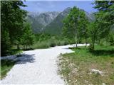 2
2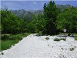 3
3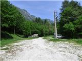 4
4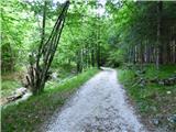 5
5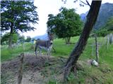 6
6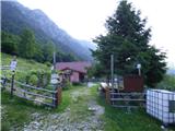 7
7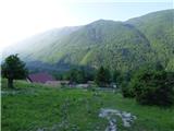 8
8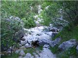 9
9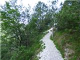 10
10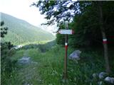 11
11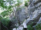 12
12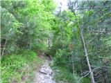 13
13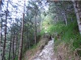 14
14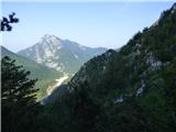 15
15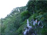 16
16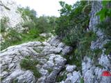 17
17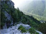 18
18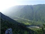 19
19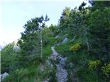 20
20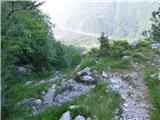 21
21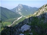 22
22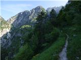 23
23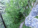 24
24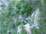 25
25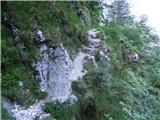 26
26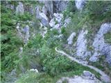 27
27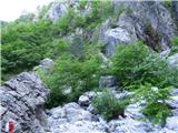 28
28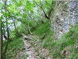 29
29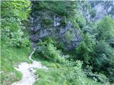 30
30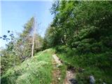 31
31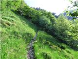 32
32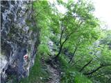 33
33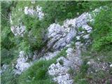 34
34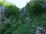 35
35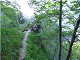 36
36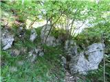 37
37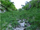 38
38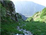 39
39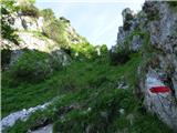 40
40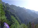 41
41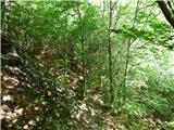 42
42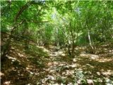 43
43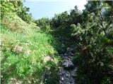 44
44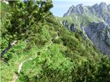 45
45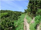 46
46 47
47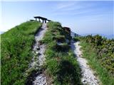 48
48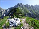 49
49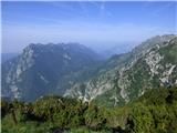 50
50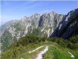 51
51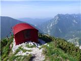 52
52
Discussion about the trip La AleGra - Bivacco Dino Brollo
|
| darinka425. 05. 2026 19:38:50 |
I must say that all three of us were satisfied with the tour past the Dino Brollo bivouac today. And after that climbing part to the western summit. Quite some time had to be waited for favorable conditions. As an interesting fact, a young guy overtook us who was heading to the eastern part. He hadn't been there yet. He asked us for a phone number in case he got lost or something happened to him. We hope he descended safely on that path where he was visible from time to time.
|
|
|
To post a comment you must log in:
If you do not yet have a username, you must first
register.