Mače - Mali Grintovec (through valley of Suha)
Starting point: Mače (586 m)
| Latitude/Longitude: | 46,31310°N 14,41870°E |
| |
Route name: through valley of Suha
Walking time: 3 h 25 min
Difficulty: easy pathless terrain
Elevation gain: 1227 m
Elevation difference along the route: 1227 m
Map: Karavanke - osrednji del 1:50.000
Recommended equipment (summer):
Recommended equipment (winter): ice axe, crampons
Views: 6.758
 | 1 person like this post |
Access to starting point:
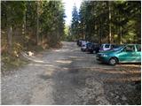
From the Ljubljana - Jesenice motorway, take the Kranj - east exit and continue on the road towards Jezersko, but only as far as the village of Tupaliče. Here, the sign for Preddvor directs us left, and we then follow the road towards the neighbouring village of Mače. Through the village of Mače, follow the mountain signs for Kališče. Shortly after the village, we will notice a marked parking area where we park (further driving is prohibited).
Route description:
From the parking lot, return to the road from which we turned into the parking lot and continue the ascent towards Kališče along it. At first we walk through the forest, and the road approaches the Suha stream a few minutes higher, which it also crosses twice a bit further on. After about 20 minutes we reach a marked junction, where the usual path to Kališče continues left, while we continue right towards Srednji vrh, Kališče via Kozjek and Zavetišče v Hudičevem borštu via Kozjek. The increasingly poor road takes us a little further to a freight cableway leading towards Dom na Kališču, after which the road gradually turns into a wide cart track.
We follow the marked cart track for some time longer, then, when it splits into two parts, we continue along the left wider unmarked cart track (a cairn is at the junction). We continue the ascent along the mentioned cart track, which steeply climbs through a belt of barren slope. Higher up the cart track ends, and we continue along a nicely traceable but quite steep path, which higher enters dense forest. Another approx. 20 minutes of ascent follow and we join a marked path, which we follow left towards Dom na Kališču (right Hudičev boršt).
We follow the marked path for only some 10 metres, then just before the marked path turns sharply left, we leave it and continue the ascent straight ahead along a barely visible trail. The trail quickly disappears in the forest, but we continue in the same direction. The path then quickly takes us out of the forest onto a scree overgrown with brushwood, on and beside which we ascend towards Mačensko sedlo. Although the "path" is harder to follow in some places, orientation poses no major problems, as we continue in the same direction all the time (i.e. towards the saddle between Bašeljski vrh and Mali Grintovec). Higher up we must push through a short belt of brushwood, but the passage is not particularly demanding, as a nicely visible, though completely overgrown trail runs through the mentioned section. Further on the path takes us out of the brushwood and after a few steps of further walking we arrive at Mačensko sedlo, where we rejoin the marked path.
We follow the path right, where it begins to ascend quite steeply along the western slope of Mali Grintovec. After approx. half an hour of walking from Mačensko sedlo we reach a marked junction, where the path from Dolge njive joins us from the right. We continue left and after some 10 steps of further walking we arrive at the summit of Mali Grintovec.
Starting point - Studenci 0:25, Studenci - junction into Suha valley 0:35, junction into Suha valley - Suha valley 1:05, Suha valley - Mačensko sedlo 0:50, Mačensko sedlo - Mali Grintovec 0:30.

Along the route: Studenci (737m), Spodnja postaja tovorne žičnice (800m), Odcep v dolino Suhe (916m), Dolina Suhe (1322m), Mačensko sedlo (1622m), Razpotje pod Malim Grintovcem (1791m)
Photos:
 1
1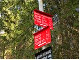 2
2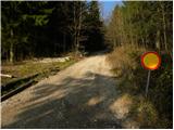 3
3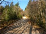 4
4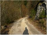 5
5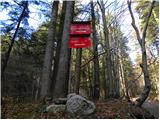 6
6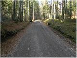 7
7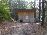 8
8 9
9 10
10 11
11 12
12 13
13 14
14 15
15 16
16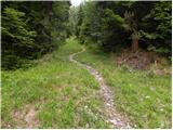 17
17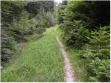 18
18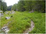 19
19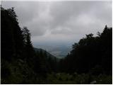 20
20 21
21 22
22 23
23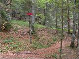 24
24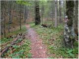 25
25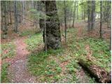 26
26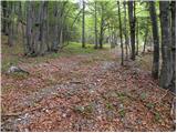 27
27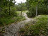 28
28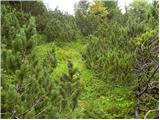 29
29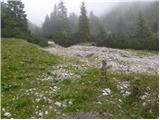 30
30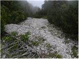 31
31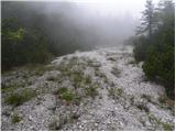 32
32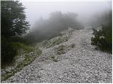 33
33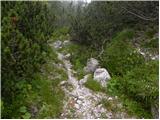 34
34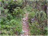 35
35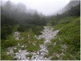 36
36 37
37 38
38 39
39 40
40 41
41 42
42 43
43 44
44 45
45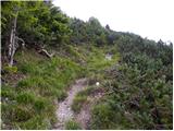 46
46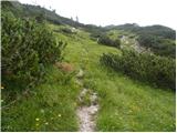 47
47 48
48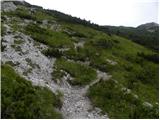 49
49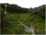 50
50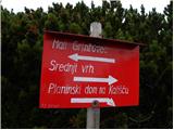 51
51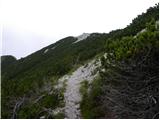 52
52 53
53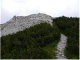 54
54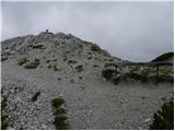 55
55
Discussion about the trip Mače - Mali Grintovec (through valley of Suha)
|
| Anansie27. 05. 2019 |
Yesterday on this trail. The first part to the marked path at Kališče is excellently traceable, then the searching begins. In places it is completely overgrown and the fight with the bushes is quite intense 
|
|
|
|
| Gost31. 05. 2019 |
You probably missed the right path somewhere a bit. In that case, it's really barely passable. Anyway, the path is now cleared, I also set up some new cairns. The orientation loop is at pictures 30 and 31. Here now a large cairn points to the right path. When we come out of the forest and the view opens left and right, a small trail is visible that turns sharply right and takes us to a clearing and a small watering place for wildlife. Nice spot for a short rest. Then we return and go only up the torrent bed. (pic.31) Another tip for those who don't like broken cart tracks. A little above the lower cable car station (pic.10), when the path leaves the cart track, we go another 15 meters along the cart track, and at the cairn turn left onto a well-trodden path that takes us to the marked path to Kališče.(pic.24)
|
|
|
To post a comment you must log in:
If you do not yet have a username, you must first
register.