Maria Waldrast - Lämpermahdspitze (pot preko severnega grebena)
Starting point: Maria Waldrast (1638 m)
Starting point Lat/Lon: 47.13159°N 11.40445°E 
Path name: pot preko severnega grebena
Time of walking: 3 h 15 min
Difficulty: very difficult marked way
Difficulty of skiing: very demanding
Altitude difference: 957 m
Altitude difference (by path): 957 m
Map: Innsbruck und Umgebung, 31/5 1:50.000; Outdooractive Stubai Wanderkarte
Access to starting point:
From Ljubljana, we drive on the highway past Salzburg in the direction towards München. At the multilevel junction Dreieck Inntal we go on the road A93 in the direction of Innsbruck/Kufstein/Brenner. When we return to Austria we continue to the junction with the exit Innsbruck-Mitte. Here we don't turn towards Innsbruck, but we continue on the highway A13 in the direction towards the mountain pass Brenner. We continue on the highway all the way to the settlement Matrei am Brenner, where we go to the exit 19-Matrei. After this we go on the road B182 and we follow it to the village Mützens, where with the help of reliable marks we go to a narrower road which after the gate (toll is 6 euros for personal car) in few kilometers brings us to the parking lot near the inn and monastery church.
Alternatively we can drive through northern Italy: in this case from the main Slovenia on the highway A2 we drive to one of the border crossings with Austria and we continue towards Lienz. Here we continue on the road 100 and past the passage Prato alla Drava we drive into Italy. In Italy we follow the road SS49 all the way to the juncture with highway A22 in the direction towards the mountain pass Brenner. After the mountain pass, we continue in the direction towards Innsbruck to the exit 19-Matrei at the settlement Matrei am Brenner. From there we continue as described above.
Path description:
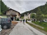
From the parking lot at Maria Waldrast, the highest pilgrimage point in Austria, we follow the signs for Serles and Lämpermahdspitze and we go on the path which immediately behind the church turns to the left in the forest. Through grazing areas we continue on a small footpath which soon crosses scree gully in the eastern walls of Serles. Further a very well-marked path leads through a thinner high mountain forest, which is higher replaced by dwarf pines, and two more times we cross the end of steep gullies, which are on a rocky slope above us. After a good hour of walking from the starting point, we pass on open grassy slopes in the heart of Serles group, and also a nice view opens up towards the south part of the mountain range, where Lämpermahdspitze and Peilspitze stand out. The footpath which in zig-zags crosses moderately steep slope, we follow all the way to the saddle Serlesjöchl, where the path from Maria Waldrast joins the longer path from Kampl in the valley Stubaital.
From the saddle with the help of signpost we go left on at first a little poorly visible footpath which crosses a slope below the steep cliffs of Rote Wand (an easier path, which crosses below the peaks of the south part of Serles group and offers an alternative option to return towards Maria Waldrast, in the beginning of the ascent from the saddle, it runs only a few meters lower). After the passage below a large abyss in the walls of Rote Wand, the footpath crosses scree, on the edge of which, the snow often stays till the summer. After this we climb a steep but not very difficult rocky ascent and in zig-zags we follow characteristic Austrian signs to unnamed grassy ridge peak, from where we see the continuation of the ridge path on Lämpermahdspitze.
Here we follow the signs, which reliably lead directly on in parts exposed ridge or right below it on its west side. On some spots, we have to climb a little (I), otherwise the path on demanding terrain is nicely routed and it is very well marked. After approx. 15 minutes we pass below the upper massif of Lämpermahdspitze, following the signs we cross an exposed part of the crest and we go to the right on the western slopes of the mountain. Further, the traversing runs above the large scree, which is falling deep into Stubai valley, and otherwise a still well-marked path is in parts quite crumbly and slightly exposed. On two spots we have to climb shorter bands (I). Soon the path turns towards the upper ridge of Lämpermahdspitze, to which separates us relatively easy chimney with the only fixed safety gear on the path. Behind it below the secondary peak of Lämpermahdspitze we get on a little wider ridge, which in few minutes comfortably brings us to the panoramic summit with a metal cross.
With the exception of less useful footholds in the chimney, the entire path is unsecured and in parts quite exposed, therefore in spite of a relatively low technical difficulty (difficulty of climbing is up to I+) and a short distance of the ascent from Serlesjöchl, it demands appropriate mountaineering experience and reliable weather conditions. The ascent is usually combined with the ascent on famous Serles, because both mountains are from the saddle Serlesjöchl accessible in one hour of normal walking. On Lämpermahdspitze it is possible to ascend also on an easier path, which to the summit leads from the south.
On the way: Serlesjöchl (2384m)
Pictures:
 1
1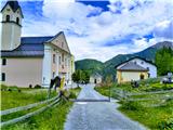 2
2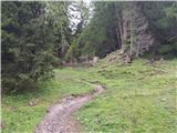 3
3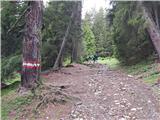 4
4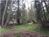 5
5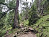 6
6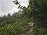 7
7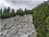 8
8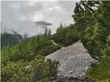 9
9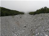 10
10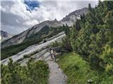 11
11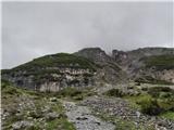 12
12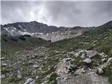 13
13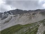 14
14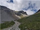 15
15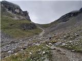 16
16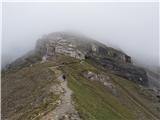 17
17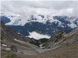 18
18 19
19 20
20 21
21 22
22 23
23 24
24 25
25 26
26 27
27 28
28 29
29 30
30 31
31 32
32 33
33 34
34 35
35 36
36 37
37 38
38 39
39 40
40 41
41 42
42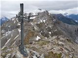 43
43