Mežica - Koča na Pikovem (via saddle Vrh šteng)
Starting point: Mežica (495 m)
| Latitude/Longitude: | 46,52140°N 14,85180°E |
| |
Route name: via saddle Vrh šteng
Walking time: 2 h 15 min
Difficulty: easy marked way
Elevation gain: 497 m
Elevation difference along the route: 575 m
Map: Koroška 1:50.000
Recommended equipment (summer):
Recommended equipment (winter): ice axe, crampons
Views: 958
 | 1 person like this post |
Access to starting point:
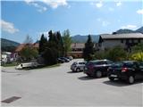
From Črna na Koroškem or from Ravne na Koroškem, or through the border crossing Holmec or Mežica, we drive to the center of Mežica, where we park on the parking lot by Trg svobode Square.
Route description:
From the starting point, we head onto a one-way road that bypasses the parish church of St. Jakob on the left side. Along the road on which we walk, we quickly notice the first blazes; at the crossroads, we follow the signs for Peca or the blazes. After crossing the stream Šumec, we leave the road and over a smaller wooden bridge continue slightly right into the forest. A short ascent through the forest follows, then we reach the macadam road, on which we ascend to the end of the left serpentine. After the serpentine, we ascend through a strip of forest, then ascend for some time along the edge of the forest. On the part where we ascend along the edge of the forest, the blazes are rare, or absent for some time, but when the path returns into the forest, the blazes return as well.
Higher, we reach a smaller hamlet, where the path leads past a trough with water, while we ascend along the road to the route of the former ski slope. Here, the blazes direct us left onto the ski slope, on which we then ascend with nice views. Higher up, the path temporarily takes us into the forest, then returns to the ski slope, which we finally leave a little further on.
We continue right onto a cart track that passes into the forest, and further on we ascend diagonally to the right. For some time we ascend on such a path, then we reach the saddle Vrh šteng, where there is a marked junction and suitable space for a short rest.
From Vrh šteng, we continue left in the direction of Koča na Pikovem (slightly right Jakobe, sharply right Mežica on the road) and continue on the road, which begins to descend lightly towards Podpeca. After a few minutes of descent, we leave the road towards Podpeca and continue left onto the marked path. Further on, we cross the slopes of Jesenik for a short time, then walk for some time along the upper edge of a panoramic meadow, from which a nice view opens towards Raduha and Peca. A little further, the path returns into the forest and from the left joins the path from Mežica with the starting point at the cemetery Mirje; a little further on, the path through Junčarjeva grapa also joins. In both cases, we continue in the direction of Koča na Pikovem and ascend through the forest to a wooden cross, by which there is a quite old bench.
We continue straight (left Pikov vrh) and gradually begin to descend. On the part when we step out of the forest, another path branches off to the left to Pikov vrh, while we continue straight to the nearby homestead Pik, after which the nearby area got its name. A few more minutes of walking on the road follow, from which we first get some views towards Peca, then through the forest we reach the church of St. Helena, behind which is the Koča na Pikovem.
Mežica - Vrh šteng 1:30, Vrh šteng - Koča na Pikovem 45 minutes.
Description and pictures refer to the condition in the year 2018 (April and May).

Along the route: Vrh šteng (1030m), Sveta Helena (992m)
Photos:
 1
1 2
2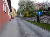 3
3 4
4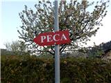 5
5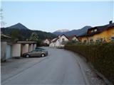 6
6 7
7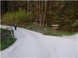 8
8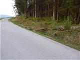 9
9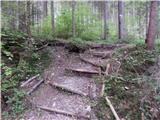 10
10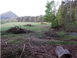 11
11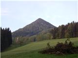 12
12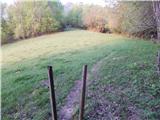 13
13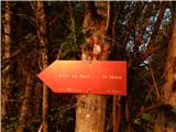 14
14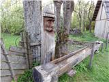 15
15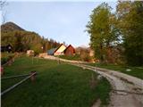 16
16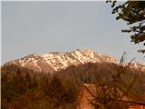 17
17 18
18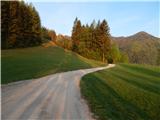 19
19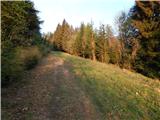 20
20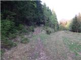 21
21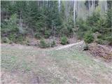 22
22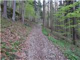 23
23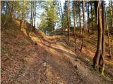 24
24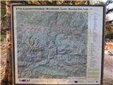 25
25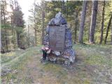 26
26 27
27 28
28 29
29 30
30 31
31 32
32 33
33 34
34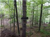 35
35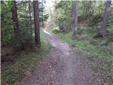 36
36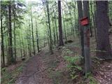 37
37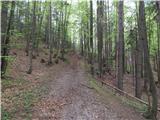 38
38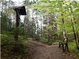 39
39 40
40 41
41 42
42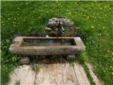 43
43 44
44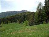 45
45 46
46 47
47 48
48 49
49
Discussion about the trip Mežica - Koča na Pikovem (via saddle Vrh šteng)
To post a comment you must log in:
If you do not yet have a username, you must first
register.