Na kopiš - Bela peč (via Spodnja and Zgornja Konjščica)
Starting point: Na kopiš (1023 m)
Starting point Lat/Lon: 46.3799°N 14.3429°E 
Path name: via Spodnja and Zgornja Konjščica
Time of walking: 2 h
Difficulty: easy marked way
Difficulty of skiing: no data
Altitude difference: 560 m
Altitude difference (by path): 560 m
Map: Karavanke - osrednji del 1:50.000
Access to starting point:
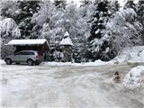
From highway Ljubljana - Jesenice we go to the exit Ljubelj (Tržič), and then we continue driving towards Ljubelj. Just before the gas station in Bistrica pri Tržiču we leave the main road and we continue driving right in the direction of Tržič. Further, we drive through Tržič in the direction of Dolžanova soteska, and then in the settlement Slap we continue right in the direction of Lom pod Storžičem and Grahovše. At the part between Lom pod Storžičem and Grahovše, a road branches off to the left towards the hamlet Potarje and farms Tič, Hariž, Špan, which are all part of the hamlet Potarje. We continue driving past the turn-off for farm Hariž (panoramic turn with a bench) in the direction of Tič, on a little narrower asphalt road all the way to a crossroad below the farm Tič, where the asphalt ends. This is our starting point, named "Na kopiš" (Na kopišču), where there is also a signpost and recycling spot from the mountain farms. We park on an appropriate place by the crossroad (to the right a road branches off for farm Tič and Strmc, left - road for farm Pinč and Urh). On the signpost we also notice signs for mountain pasture Konjščica (left for the variant the macadam road all the way to the mountain pasture Sp. Konjščica-look the third variant of the access and description of the path for mountain pasture Spodnja Konjščica: "Na kopiš - Spodnja Konjščica (on the road), which is more appropriate for cycling, and right for variant past the farm Tič, which runs on the road only at the beginning, and then passes into a pleasant mountain path through the forest all the way to the viewpoint "Na Boštu", which is just below the mountain pasture Konjščica.
Path description:
From the starting point "Na kopiš" to the farm Tič the path isn't marked, further to the mountain pasture Spodnja Konjščica it is, therefore from the parking lot "Na kopiš" we go on the right road (direction Tič, Strmc) and in 5 minutes of walking on the macadam road we get just before the farm Pr Tič (right, below the access road for farm Tič there is farm Strmc, we see both houses).
Here we have two options: we can continue on the left road (short bypass road for timber removal), which just above the buildings of farm Tič joins the road which leads through the yard of the farm. If we continue on the right road (second option) we come on the yard of farm Tič, where we join the marked path on the mountain pasture Konjščica from the direction of Grahovše (past Uskovec), we notice the blazes. We continue through the yard uphill (left vegetable garden, right business building) to the junction with bypass macadam road (first option). We short time continue on the road, and then blazes point us slightly to the left on a marked footpath. If there is a lot of snow and footpath isn't beaten, we can continue just on the road, because the footpath above pastures also returns on the road. We continue on the road through the forest to the next pasture, where from the right joins also the path from the farm Pavšel. With nice views on the ridge of Kriška gora, only a little higher from the mentioned crossing we get to a wooden log cabin, where our path on the road ends (area is called Na Vršeh).
Here we continue slightly left on at first a little more overgrown path, on which we quickly get to a wooden cottage, Potarje 44. We continue uphill, through the forest, we cross the forest road, we then continue at first right, and then left, where the footpath for a short time moderately ascends. Because of numerous smaller crossings we carefully follow the blazes. We cross a stream, then the footpath joins with the cart track, and above a smaller clearing, the path brings us to a forest road. We follow the road to the left and we walk there only few meters, because then blazes and signpost point us to the right on an ascending footpath. The path ahead at first ascends on the slope a little to the right, then straight upwards, and on a rocky landslide it turns to the left and higher returns on the road just next to the viewpoint "Na Boštu" (the viewpoint is from the marked path distant less than 5 minutes). Just below the road, where they cutted part of the forest, a view opens up towards Tržič, Dobrča, Begunjščica and Košuta. When we step on the road, we continue right and after approximately 10 minutes of additional walking, we step out of the forest on the mountain pasture Spodnja Konjščica.
Shepherd hut on the mentioned mountain pasture we bypass on the left side and we continue on a marked path, which gently ascends on the upper edge of the mountain pasture. Here the path goes into the forest and ascends steeper for a short time, and then turns a little towards the left and gradually flattens. Only a little further, we come out of the forest, where we step on an ample mountain pasture Zgornja Konjščica.
In few shorter ascents and descents we walk to other part of the mountain pasture, and then the path passes into the forest, where quickly brings us to a marked crossing. Here we continue right (left mountain hut Koča na Javorniku) in the direction of vantage point Bela peč. The path a little further crosses a wire fence and then quickly ascends on panoramic and precipitous peak.
Na kopiš - Planina Spodnja Konjščica 1:15, Planina Spodnja Konjščica - Planina Zgornja Konjščica 0:30, Planina Zgornja Konjščica - Bela peč 0:15.
Pictures:
 1
1 2
2 3
3 4
4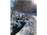 5
5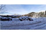 6
6 7
7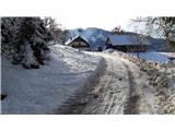 8
8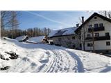 9
9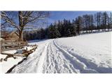 10
10 11
11 12
12 13
13 14
14 15
15 16
16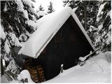 17
17 18
18 19
19 20
20 21
21 22
22 23
23 24
24 25
25 26
26 27
27 28
28 29
29 30
30 31
31 32
32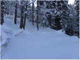 33
33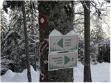 34
34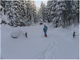 35
35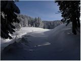 36
36 37
37 38
38 39
39 40
40 41
41 42
42 43
43 44
44 45
45 46
46 47
47 48
48 49
49 50
50 51
51 52
52 53
53 54
54 55
55 56
56 57
57 58
58 59
59 60
60