Osredek - Dom v Iškem Vintgarju
Starting point: Osredek (754 m)
Walking time: 2 h 30 min
Difficulty: easy marked way
Elevation gain: -394 m
Elevation difference along the route: 200 m
Map: Ljubljana - okolica 1:50.000
Recommended equipment (summer):
Recommended equipment (winter):
Views: 6.427
 | 4 people like this post |
Access to starting point:
From Cerknica we continue driving in the direction of the settlement Begunje pri Cerknici. We drive on road 643. Then we arrive at the village Selšček, which is known for the painter master Maksim Gaspari. We continue through Selšček and at the end of the village we drive approximately 350 m. At the crossroads we turn right (signpost Cajnarje). We drive through the village Topol pri Begunjah and stick to the right. When we come through the village Topol we continue driving on the main road (if we come to macadam we've missed it!). Then the first village is Cajnarje, we go through Cajnarje, over the bridge and to Hruškarje (stick to the right). We drive past the fire station (PGD Cajnarje). From the fire station to the next crossroads is approximately 200 m, here we turn right (signpost Sveti Vid). Here the road starts rising, the driving will become more winding, pay attention to cars, buses, trucks, tractors... Then we arrive at the village Bečaje, and again at the village Hruškarje. We drive on the main road to Sveti Vid. When we arrive in Sveti Vid we drive straight on the main road, where after 500 m (from the beginning of the Sveti Vid sign) we turn right (signpost Osredek). We continue to Osredek. We will drive past the village Zala. From Sveti Vid to Osredek is 6 km. We leave the car in Osredek at the agrotourism Ujčevi.
Route description:
From the parking lot we continue walking past the church and at the crossroads after 100 m there is a signpost Vrbica-Iški Vintgar. We turn left, walk 600 m to three houses and there turn right. The path is marked, so it is almost impossible to miss and get lost. We walk past the house with the homemade sign on the house and after 30 m turn right. We walk on the macadam road and start descending towards the forest. When we arrive in the forest we stick to the right and then descent into the forest again. From that bend to the change of the path is less than a kilometer. When we have to turn right we will notice the signpost and blazes (on the right side of the path we will notice the marks). From here on everything is marked. The path ahead constantly rises and descends with large elevation differences up to 50-100 m. In the last part the path only gently descends towards the Dom v Iškem Vintgarju. In winter the hike is not advised because it is necessary to cross the river Iška on foot, as the footbridge collapsed some years ago.
Every year on May 1st a hike takes place, organized by PD Sveti Vid. The path is not for everyone, as there are also some safety protections on the path (be careful especially if there are smaller children, elderly people on the trip...). Along the river Iška there are also many ticks.

Along the route: Vrbica (420m)
Photos:
 1
1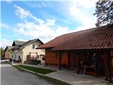 2
2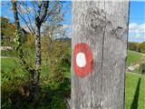 3
3 4
4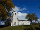 5
5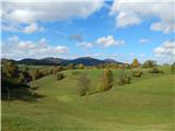 6
6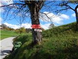 7
7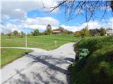 8
8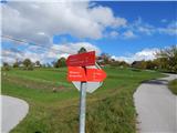 9
9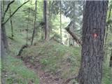 10
10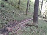 11
11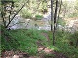 12
12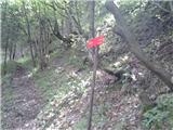 13
13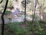 14
14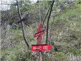 15
15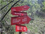 16
16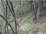 17
17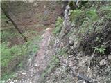 18
18 19
19 20
20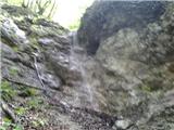 21
21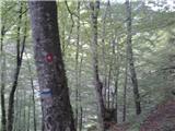 22
22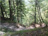 23
23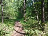 24
24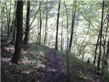 25
25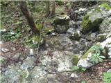 26
26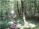 27
27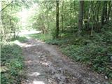 28
28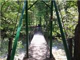 29
29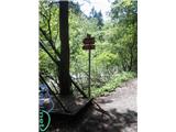 30
30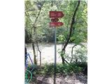 31
31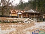 32
32
Discussion about the trip Osredek - Dom v Iškem Vintgarju
To post a comment you must log in:
If you do not yet have a username, you must first
register.