Parkplatz Tappenkarweg - Weißgrubenkopf (Parkplatz Tappenkarweg - Weißgrubenkopf)
Starting point: Parkplatz Tappenkarweg (1196 m)
| Latitude/Longitude: | 47,20974°N 13,33082°E |
| |
Route name: Parkplatz Tappenkarweg - Weißgrubenkopf
Walking time: 3 h 30 min
Difficulty: partly demanding marked way
Elevation gain: 1173 m
Elevation difference along the route: 1173 m
Map:
Recommended equipment (summer):
Recommended equipment (winter): helmet, ice axe, crampons
Views: 241
 | 1 person like this post |
Access to starting point:
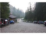
We drive into Austria, then continue on the Tauern motorway towards Salzburg. When we come out of the Tauerntunnel in the Austrian province of Salzburg, we leave the motorway at the second exit after the tunnel, exit Flachau. We turn west towards St. Johann and Wagrain. In the center of Wagrain at the Y junction we turn left towards Kleinarl. We drive on the main road through Kleinarl to the lake Jägersee. We bypass the lake on the left side and drive another 3.5 km on the macadam road to a large parking lot, which is also our starting point. The macadam road is a toll road.
Route description:
From the parking lot on a wide forest path we first ascend to the lake Tappenkarsee. The path is nicely laid out in serpentines to the plateau, where after just a few hundred meters we reach the lake. The path continues along the right bank of the lake, where it is in some places carved into the rock and several small bridges are built. At the end of this path we arrive at the hut Tappenkarseealm. From here we continue past the hut Tappenkarseehütte, which is located slightly higher and further from the lake. Below the hut we follow the misleading time signposts for Weißgrubenkopf. With a normal pace we easily exceed the time indicated on the sign. Over the bridge we cross the stream and begin to climb, first through bushy terrain, then up a grassy slope. The path leads us after an hour of walking to the saddle Weißgrubenscharte (2255 m). From here we ascend only along a rocky slope (with a brief slight descent in between) to the top of the panoramic hill.
(Parkplatz Tappenkarweg - Tappenkarseealm 2 h; Tappenkarseealm - Weißgrubenkopf 1.5 h)

Along the route: Tappenkarsee (1762m), Tappenkarseealm (1768m), Tappenkarseehütte (1820m)
Photos:
 1
1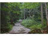 2
2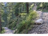 3
3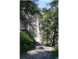 4
4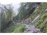 5
5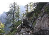 6
6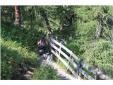 7
7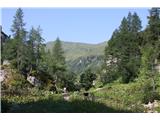 8
8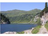 9
9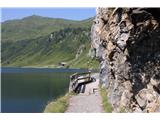 10
10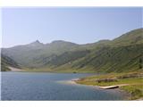 11
11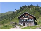 12
12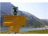 13
13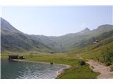 14
14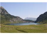 15
15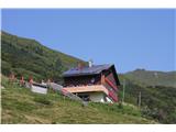 16
16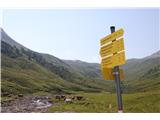 17
17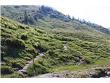 18
18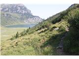 19
19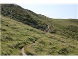 20
20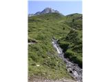 21
21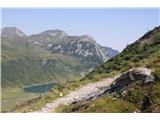 22
22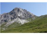 23
23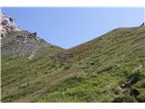 24
24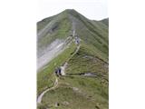 25
25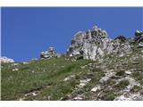 26
26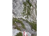 27
27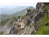 28
28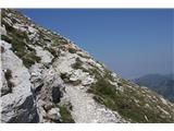 29
29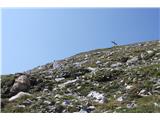 30
30 31
31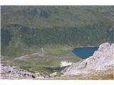 32
32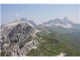 33
33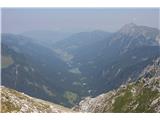 34
34
Discussion about the trip Parkplatz Tappenkarweg - Weißgrubenkopf (Parkplatz Tappenkarweg - Weißgrubenkopf)
To post a comment you must log in:
If you do not yet have a username, you must first
register.