Passo di Costalunga / Karerpass - Cima Latemar / Latemarspitze (via Malga Vallace)
Starting point: Passo di Costalunga / Karerpass (1745 m)
Starting point Lat/Lon: 46.40401°N 11.60932°E 
Path name: via Malga Vallace
Time of walking: 3 h 50 min
Difficulty: very difficult marked way
Difficulty of skiing: no data
Altitude difference: 1055 m
Altitude difference (by path): 1080 m
Map: Tabacco 06 1:25.000
Access to starting point:
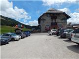
Access from Gorenjska: Through the Karawanks Tunnel, we drive to Austria, and then we continue driving towards Spittal and forward towards Lienz (a little after Spittal highway ends). Further, we drive on a relatively nice and wide road through Drau valley, which brings us in Italy. The road further leads past Dobbiaco / Toblach and Brunico / Bruneck. Only a little after the last-mentioned town, past which leads a bypass road, we turn left into a valley Val Badia. Further, we drive through the mentioned valley past settlements La Vila and Corvara. Next follows an ascent over the mountain pass Passo Campolongo and Passo Pordoi. From the mountain pass Passo Pordoi we then descend on the west side into a valley Val di Fassa. A little after the settlement Pozza di Fassa we turn right towards the mountain pass Passo di Costalunga / Karerpass. We park on a parking lot on the mentioned mountain pass. The parking lot is located on the left side of the road.
From Primorska side: From Nova Gorica, we drive to Italy and drive forward on the highway towards Venice / Venezia. At town Portogruaro we leave the highway towards Venice and continue right on the highway towards Pordenone. At the next highway junction near Conegliano, we continue right towards Belluno. We follow the highway to exit for Belluno. When we leave the highway we come to bigger roundabout, which we leave at exit for Belluno and settlement Feltre. In smaller roundabout in the settlement Belluno we then continue right towards the settlement Agordo. We follow this road all the way to the settlement Moena into a valley Val di Fassa. In the settlement Moena we then continue right towards the settlement Canazei, but only to the settlement Vigo di Fassa where we go left towards the mountain pass Passo di Costalunga / Karerpass. We park on a parking lot on the mentioned mountain pass. The parking lot is located on the left side of the road.
Path description:
From the parking lot on the mountain pass, we go on a macadam road following the signs »Cima Latemar, Latemarspitz«. The path at first leads past the bottom cableway station and it brings us to a ski slope where we soon come to a marked crossing.
At the crossing, we go left following the signs »Latemar Toac«, and right leads the path on the north side towards the notch Forcella Latemar Piccola. From the crossing, we then walk on a macadam road which crosses a ski slope. After gentle ascent the road gets closer to the forest and again brings us to a crossing.
The path towards the mountain pasture Malga Secine branches off to the left, and we continue on the road following the signs »Baita Vallace, Forcella Piccola Latemar«. The road further is still slightly ascending and then turns left in the forest. The road which is for some time ascending through the forest, then passes into a footpath. The path further turns a little more to the left and then for quite some time mostly in a gentle ascent crosses slopes towards the south. The path here crosses some clearings, after that runs mostly by bushes all the way to the mountain pasture Malga Vallace on which there is also a smaller cottage.
On the mountain pasture where there is a crossing, we continue right towards the notch Forcella Latemar Piccola, and to the left leads the path towards the summit Monte Toac and valley Val de Peniola. From the crossing, the path starts ascending a little steeper and short time still runs by bushes and then it brings us into the forest. After a short ascent through the forest we are again at the crossing.
This time from the right joins the path from the top of the ski slope (upper station of the cableway), and we continue left towards the notch Forcella Latemar Piccola. Further, the path crosses little steeper slopes towards the west and brings us out of the forest. The path then still crosses slopes below the summit Cima Pope. Later it ascends a little steeper and it brings us to a little poorly visible crossing on the south side of the mentioned summit.
Here our path turns right and is quite steeply ascending all the way to the notch Forcella Latemar Piccola. On the notch where joins the north a little more demanding path we continue left. From the notch, we are for some time quite steeply ascending towards the slopes of the peak Col Cornon. After that, the path becomes less steep and crosses slopes on the left side of the mentioned of the mountain. When we come on the south side of the peak Col Cornon, the path turns a little to the right and crosses pretty steep slopes towards the west. Further, the path becomes demanding and crosses few shorter gullies through which quite some caution is needed because the path isn't secured. Next follows few shorter steep ascents and crossings, and then the path brings us on the west side of the peak Col Cornon where the path becomes easier and the slope less steep. Next follows an ascent to the secondary peak where there is also a crossing.
Left leads the path towards the bivouac Rigatti and notch Forcella Grande (Große Latemarscharte), and we continue right and on a panoramic ridge we soon reach the peak, which we already see in front of us.
On the way: Baita Valace (1983m), Forcella Latemar Piccola (2526m)
Pictures:
 1
1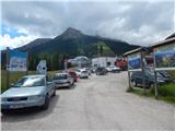 2
2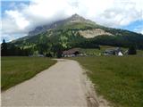 3
3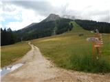 4
4 5
5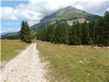 6
6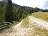 7
7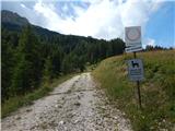 8
8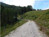 9
9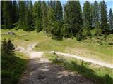 10
10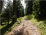 11
11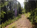 12
12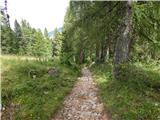 13
13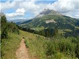 14
14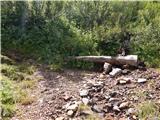 15
15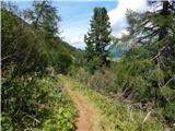 16
16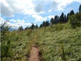 17
17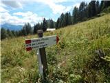 18
18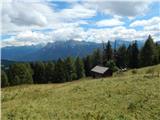 19
19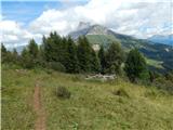 20
20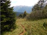 21
21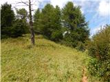 22
22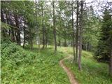 23
23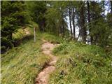 24
24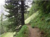 25
25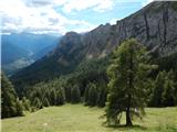 26
26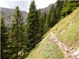 27
27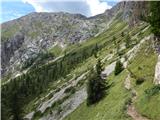 28
28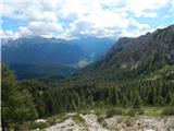 29
29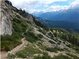 30
30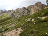 31
31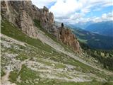 32
32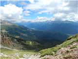 33
33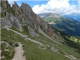 34
34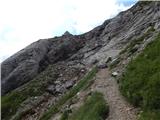 35
35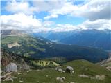 36
36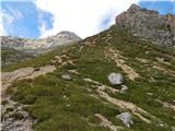 37
37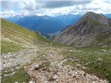 38
38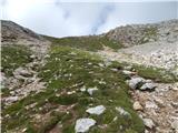 39
39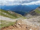 40
40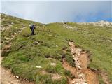 41
41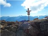 42
42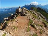 43
43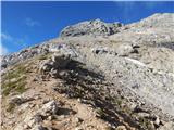 44
44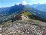 45
45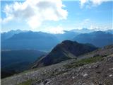 46
46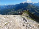 47
47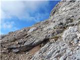 48
48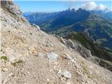 49
49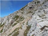 50
50 51
51 52
52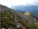 53
53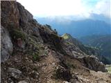 54
54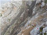 55
55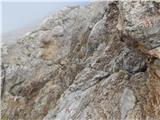 56
56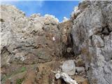 57
57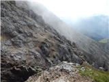 58
58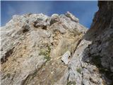 59
59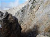 60
60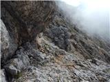 61
61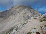 62
62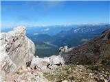 63
63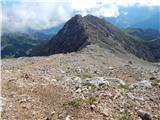 64
64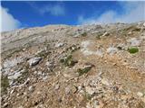 65
65 66
66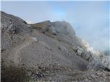 67
67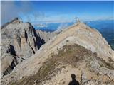 68
68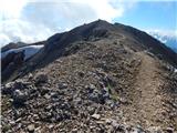 69
69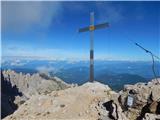 70
70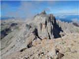 71
71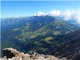 72
72