Piano Fiscalino / Fischleinboden - Bivacco de Toni (Via ferrata Severino Casara)
Starting point: Piano Fiscalino / Fischleinboden (1454 m)
Starting point Lat/Lon: 46.6668°N 12.3536°E 
Path name: Via ferrata Severino Casara
Time of walking: 6 h 20 min
Difficulty: very difficult marked way
Ferrata: B/C
Difficulty of skiing: no data
Altitude difference: 1124 m
Altitude difference (by path): 1460 m
Map: Tabacco 10 1:25.000
Access to starting point:
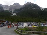
From Ljubljana through Karawanks tunnel to Spittal. Next we drive towards Lienz, where at the roundabout, we continue in the direction of village Sillian in Italy. On the italian side of the border, we quickly come to San Candido, where we continue left in the direction of tourist town Sesto / Sexten. Only a little after town Sesto we come in San Giuseppe / Moss, where signs for Val Fiscalina / Fischleintal point us to the right. Next we drive on an ascending road which we follow to a large payable parking lot (3€ for parking longer then 6 hours, otherwise 0,5€ per hour – August 2015).
Path description:
From the parking lot, we continue few ten meters on the main road and a little before hotel Dolomitenhof we go right on a narrow road which is closed for traffic. At first still paved with asphalt road soon becomes a macadam. From the road, we then go left on a wide footpath which leads further through a scenic valley. On a gentle path, we then soon reach the mountain hut Talschlusshütte / Rifugio Fondo Valle.
At the mountain hut, we continue right following the signs »Rif. Tre Cime« and »Rif. Comici«. After few minutes of walking on a wide footpath we come again to a marked crossing. At the crossing where there is a magnificent view on the northern wall of the peak Einserkofel / Cima Una (2698 meters) we continue left on a path 103 where signs point us to the mountain hut Rifugio Comici / Zsigmondy Hütte, and right leads the path towards the mountain hut Rifugio Locatelli / Drei Zinnen Hütte.
Further, the path turns left and runs on a gentle terrain mostly by dwarf pines towards the valley Val Fiscilina Alta. The path then starts ascending in zig-zags and brings us on slopes on the eastern side of the peak Cima Una. Here the path leads high above the valley below the steep walls and all the time runs towards the south. At first, the path few times crosses a slope with thin forest and then it brings us on even steeper slopes. Since the path is wide an ascent doesn't cause problems. In the winter time, when there's a snow the path is dangerous for slipping. In the last part of the path towards the mountain hut a nice view opens up on the precipitous walls of the peak Collerena 2607 meters, then the path turns slightly right and only the last ascent to the mountain hut Comici follows.
At the mountain hut, we continue left on the path number 103 following the signs »Carducci Hütte«. At first, we slightly descend on a grassy terrain towards the scree below the walls of the peak Croda dei Toni (Zwolferkofel). When we come to the scree, the path turns to the left and we soon come to a crossing.
Sharp right upward leads the path towards the notch Forcella Croda dei Toni (Zwolferscharte), and we continue towards the southeast and start ascending towards the notch Forcella Giralba. We are still ascending diagonally on the scree below the mighty walls of the peak Croda dei Toni and the path brings us to a crossing by the lake Lago Ghiacciato (Eissee).
Left leads the path named Strada degli Alpini (Alpinisteig), and we continue with an ascent towards the notch Forcella Giralba. A little before the notch another path branches off to the left, which after a shorter crossing joins the path which branched off at the lake.
On the notch, we continue on the south side and start descending towards the mountain hut Rifugio Carducci, which we can already see. To the hut path from which we all the time have a breathtaking view to mountain walls of the nearby peaks is all the time descending. From the notch to the hut we descend approximately 130 altitude meters.
Towards the starting point we can return on the ascent route or we continue on a circular path around the peak Croda dei Toni (Zwolferkofel). This path is very demanding and we will need a helmet and self-belay set.
The descent is possible also on the south side towards the settlement Giralba. This path is because of a landslide (July 2015) also demanding and especially in rain is not advised to descent on this path.
From the mountain hut, we continue right on the path 107 towards the bivouac Bivacco de Toni. At first, we cross the slopes towards the southwest and also slightly descend. On the right side we will below the eastern walls of Zwölferkofel notice a lake Lago Nero. The path then starts ascending and brings us on the southeast side of the mountain. The path here becomes demanding and mostly in a gentle ascent crosses steep slopes. The path is only on rare spots secured with a steel cable therefore quite some caution is needed. Next follows a short slightly steeper ascent and the path brings us to the notch Forcella Maria.
On the notch, we continue right where few purple blazes point us to. From here ahead the path becomes significantly more demanding, therefore on the notch we also equip ourselves with a self-belay set. After a short crossing by the steel cable path brings us to a hanging bridge. After the crossing of the bridge a very exposed crossing by the steel cable follows. After that, the path gradually becomes less demanding and brings us on the south side of the mountain Punta Maria. The path here is a little less demanding but occasionally unsecured. Mainly at the crossing of the steep grass therefore some more caution is needed again. We still cross a slope towards the west and occasionally also descend a little. Later, the path again brings us near the walls and it descends on a very crumbly gravel slope by a wall downwards. Here the path is well secured with a steel cable so that the descent isn't too demanding. Further for some time we cross the slopes towards the west, and then the path again becomes demanding. The path here turns a little to the right and leads us on a very exposed ledge above deep gully. On exposed ledge then follows a quite low passage where we also have to crawl a little. And ground can be here also a little muddy.
After that, the path becomes a little wider and further mostly crosses slopes towards the northwest. Next follows a few shorter steeper ascents and then the path brings us to one more deep gully, which we cross over a bridge. Next again follows a crossing and secured path then soon ends.
Next follows an ascent on steep scree where the path is badly beaten and often quite destroyed and also dangerous for slipping. In the last part, the scree becomes a little less steep and on a less demanding path then we soon reach bivouac Bivacco de Toni, which is located by the notch Forcella de l'Agnel.
We descend on the northern side of the notch and after a short descent, we come to a crossing. Left downwards path towards the valley Val Marzon branches off, and we continue on the right path (107) and we cross the scree below the western walls of Zwölferkofel. The path with a view then brings us to a snow field, which usually lasts throughout the year. There's a steel cable over the snow field so that crossing isn't too difficult. From the snow field then follows a short steep ascent by the steel cable, and then the path becomes less demanding. Undemanding path then brings us to a crossing on notch Forcella Croda dei Toni (Zwölferscharte).
On the notch, we continue right downwards and on the path which runs on steep scree we return towards the mountain hut Rifugio Comici and from there back towards the starting point.
Pictures:
 1
1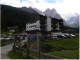 2
2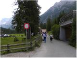 3
3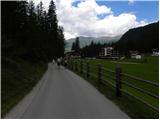 4
4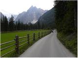 5
5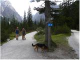 6
6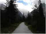 7
7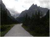 8
8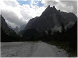 9
9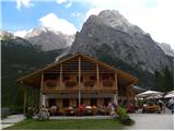 10
10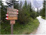 11
11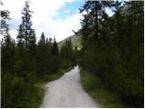 12
12 13
13 14
14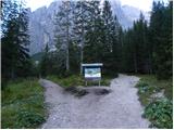 15
15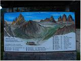 16
16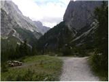 17
17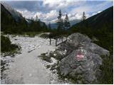 18
18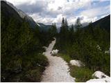 19
19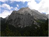 20
20 21
21 22
22 23
23 24
24 25
25 26
26 27
27 28
28 29
29 30
30 31
31 32
32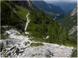 33
33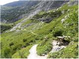 34
34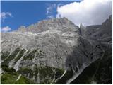 35
35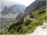 36
36 37
37 38
38 39
39 40
40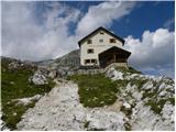 41
41 42
42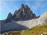 43
43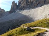 44
44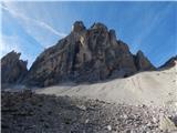 45
45 46
46 47
47 48
48 49
49 50
50 51
51 52
52 53
53 54
54 55
55 56
56 57
57 58
58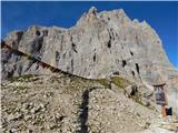 59
59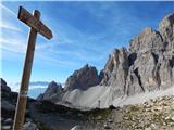 60
60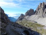 61
61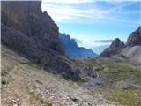 62
62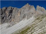 63
63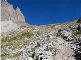 64
64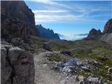 65
65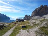 66
66 67
67 68
68 69
69 70
70 71
71 72
72 73
73 74
74 75
75 76
76 77
77 78
78 79
79 80
80 81
81 82
82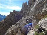 83
83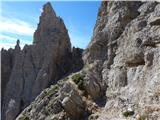 84
84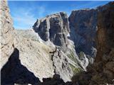 85
85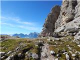 86
86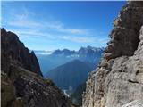 87
87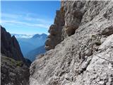 88
88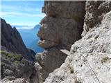 89
89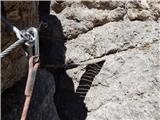 90
90 91
91 92
92 93
93 94
94 95
95 96
96 97
97 98
98 99
99 100
100 101
101 102
102 103
103 104
104 105
105 106
106 107
107 108
108 109
109 110
110 111
111 112
112 113
113 114
114 115
115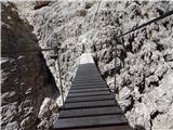 116
116 117
117 118
118 119
119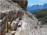 120
120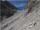 121
121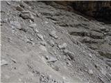 122
122 123
123 124
124 125
125 126
126 127
127 128
128 129
129 130
130 131
131 132
132 133
133 134
134 135
135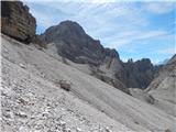 136
136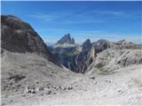 137
137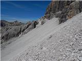 138
138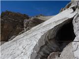 139
139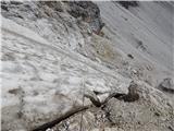 140
140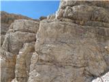 141
141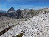 142
142 143
143 144
144 145
145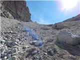 146
146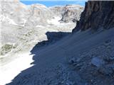 147
147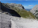 148
148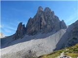 149
149