Planina Blato - Kanjavec (Za Kopico)
Starting point: Planina Blato (1147 m)
| Latitude/Longitude: | 46,31120°N 13,85010°E |
| |
Route name: Za Kopico
Walking time: 5 h 35 min
Difficulty: easy marked way
Elevation gain: 1422 m
Elevation difference along the route: 1575 m
Map: Triglav 1 : 25.000
Recommended equipment (summer): helmet
Recommended equipment (winter): helmet, ice axe, crampons
Views: 62.518
 | 8 people like this post |
Access to starting point:
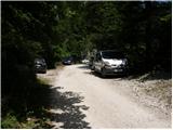
From the Ljubljana - Jesenice motorway, take the Lesce exit and follow the road towards Bled and further towards Bohinjska Bistrica. Continue driving towards Lake Bohinj (Ribčev laz), where you reach a junction, continuing right towards Stara Fužina. In Stara Fužina, at the junction by the chapel, turn sharply left onto the ascending road towards Planina Blato, Planina Vogar and Voje Valley. The road then takes you to the toll and parking fee collection point, but follow it further to the next junction, where you continue left (right to Voje). Then follow the road to the next junction (drive for quite some time), where you turn sharply right towards Planina Blato (straight to Planina Vogar). Follow this road to the parking lot above Planina Blato.
Route description:
From the marked parking lot in front of Planina Blato, return a little back and head onto a wide and initially also steep cart track, along which there are signs for Planina pri Jezeru. After about ten minutes of ascent, you arrive at a marked junction, from where you continue left towards Planina pri Jezeru (slightly right Planina v Lazu and also a steep path towards Planina pri Jezeru).
Continuing on the less steep cart track, which continues to lead through the forest, a marked path joins from the left a little further on, leading past Kosijev dom on Vogar, but we continue right and keep walking along the cart track. Higher up, the path leads through a small narrow passage, then crosses quite steep slopes where there is a high risk of slipping on ice and snow, otherwise the path is not demanding. At the end of the steep slope, the aforementioned steep path joins quite unobtrusively from the right, the cart track turns left here and passes into the rather cool Pungrat valley, where we ascend through mostly spruce forest. When the path levels out higher up, another path joins from the left leading past Planina Vodični vrh, but we keep slightly to the right and continue walking along the cart track, along which the forest begins to thin. A few minutes of easy walking follow and we step onto the pastures of Planina pri Jezeru, where the Koča na Planini pri Jezeru stands on a small hillock.
At the hut, a path branches right towards Planina v Lazu, but we continue left from the hut and descend to a marked junction where there are also a few shepherds' huts.
Choose the wider right path along which there are signs for Planina Dedno polje and Koča pri Triglavskih jezerih (slightly left Pršivec, Planina Viševnik and Črno jezero).
Continuing ascent along the cart track, which is quite rocky on steep sections, after about ten minutes of ascent you arrive at a point where a path branches left over Krištofojca towards Planina Viševnik, but we continue straight along the gradually less steep cart track leading through gradually sparser forest. A bit more easy walking follows along the path, which later turns slightly right, when the path turns back towards the west we already reach the edge of Planina Dedno polje, from where a walk to the central part of the pasture follows, where there is also a marked junction by the shepherds' huts.
Here we leave the wide path leading straight towards Koča pri Triglavskih jezerih and nearby Planina Ovčarija and continue right along the path towards Zasavska koča na Prehodavcih, Vratca pass and Hribarice saddle. The path further leads past a few huts on the pasture, behind which a path branches right towards Planina v Lazu, Planina Krstenica and Vodnikov dom na Velem polju, but we continue straight to the northwest part of the pasture, where the path begins to ascend. Here the path first leads past a dry animal watering place, then the path becomes steeper and ascends through mostly coniferous forest of spruces and larches. After about thirty minutes of steep ascent, the path levels out and takes us to a kind of saddle between Kovačičeva glava on the left and Kredo on the right.
A little further from the saddle, which can be traced by the name Stog, an unmarked path branches right towards Slatna, and we get the first beautiful views of the mountains rising above the Za Kopico valley. A traverse ascent follows above the abandoned Planina Ščavje, the path gradually passes from the slopes of Slatna to the slopes of Prvi Vogal, and higher up the view more frequently catches the interesting rocky peak of Kopica rising on the left, western side of the Za Kopico valley.
Higher up we gradually arrive in the central part of the valley, where from the slopes we enter a series of several small valleys, along which we mostly ascend moderately, only occasionally a shorter steeper section follows. With beautiful views we continue upwards through the wonderful landscape, the valley narrows higher up and at an altitude of 2192 meters we reach the Vratca pass, which separates the Za Kopico valley from the Dolina Triglavskih jezer.
From the pass, located between Velika Zelnarica on the left and Zadnji Vogal on the right, from the marked junction continue straight towards Prehodavci, Hribarice and Dolič (sharply left Mala Zelnarica, Mala Tičarica, Štapce, Planina Ovčarija and Koča pri Triglavskih jezerih) and begin a traverse descent along the scree of Zadnji Vogal. The path further levels out transversely and leads us briefly through more level terrain, then we arrive at the slopes of Vršaki, where the slope gradually becomes steeper, on a shorter section also somewhat dangerous for slipping, when the slopes become less steep we reach a marked junction below Hribarice.
Continue right towards Triglav, Dolič, Kanjavec and Hribarice (left down Dolina Triglavskih jezer, Zasavska koča na Prehodavcih, Trenta, Zadnjica and Špičja ridge) and begin ascending towards the Hribarice plateau. At the beginning of the Hribarice plateau, the first path towards Kanjavec branches left.
Here we leave the path towards Koča na Doliču and Triglav and continue slightly left towards Kanjavec.
The path further takes us into a small and relatively steep valley located between the two peaks of Kanjavec. The increasingly scenic path continuing along the aforementioned valley levels out higher up and takes us to the saddle between the western and eastern peak of Kanjavec.
Here continue right (left western peak along an unmarked path) and in a few minutes ascend to the scenic and precipitous summit.
Starting point - Planina pri Jezeru 1:00, Planina pri Jezeru - Planina Dedno polje 0:30, Planina Dedno polje - Stog 0:30, Stog - Vratca 1:40, Vratca - junction below Vršaki 0:45, junction below Vršaki - junction below Hribarice 0:10, junction below Hribarice - Kanjavec 1:00.

Photos:
 1
1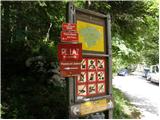 2
2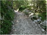 3
3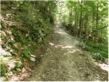 4
4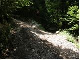 5
5 6
6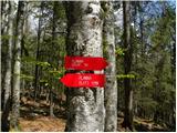 7
7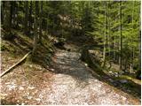 8
8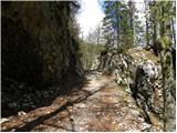 9
9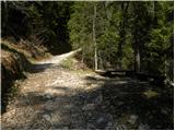 10
10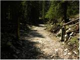 11
11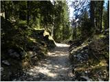 12
12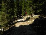 13
13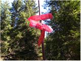 14
14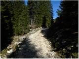 15
15 16
16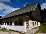 17
17 18
18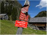 19
19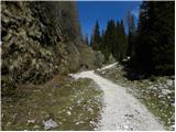 20
20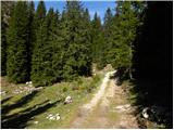 21
21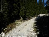 22
22 23
23 24
24 25
25 26
26 27
27 28
28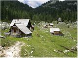 29
29 30
30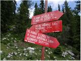 31
31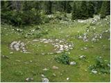 32
32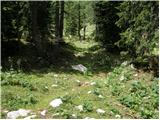 33
33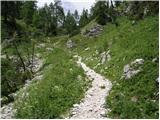 34
34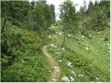 35
35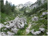 36
36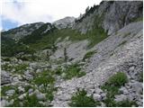 37
37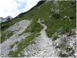 38
38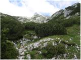 39
39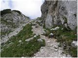 40
40 41
41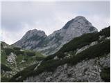 42
42 43
43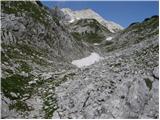 44
44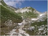 45
45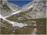 46
46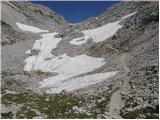 47
47 48
48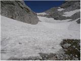 49
49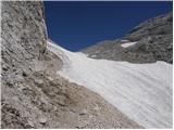 50
50 51
51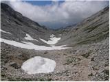 52
52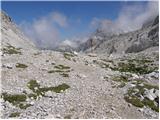 53
53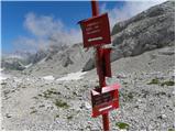 54
54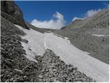 55
55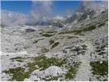 56
56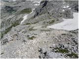 57
57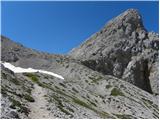 58
58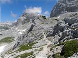 59
59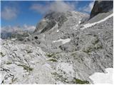 60
60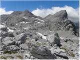 61
61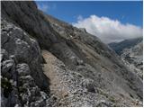 62
62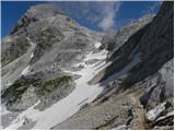 63
63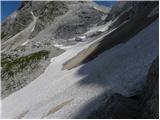 64
64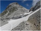 65
65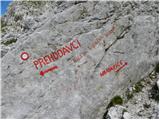 66
66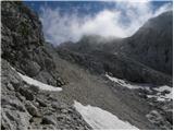 67
67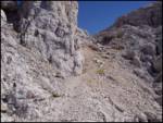 68
68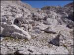 69
69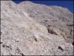 70
70 71
71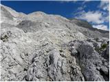 72
72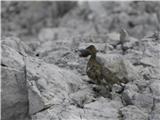 73
73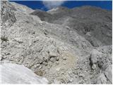 74
74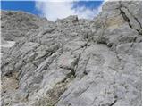 75
75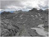 76
76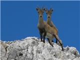 77
77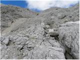 78
78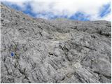 79
79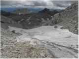 80
80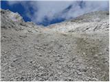 81
81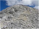 82
82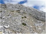 83
83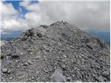 84
84 85
85
Discussion about the trip Planina Blato - Kanjavec (Za Kopico)
|
| Gost25. 01. 2007 |
Really nice path, especially for those who don't like crowds, since the summit is not so "modern", and the path behind Kopica even less!
|
|
|
|
| Gost17. 08. 2007 |
On Wednesday for the holiday, we went with friends along this path. Up to Planina Dedno polje it was quite crowded, traffic reports would say traffic is in a dense column but flowing. Further on, it opens up and hikers you meet are rare. More likely some chamois. Definitely a beautiful path, worth the effort. Perhaps a bit too long for a one-day trip, at least for those with less fitness.
|
|
|
|
| velkavrh20. 07. 2010 |
Yesterday I was already at dawn at the parking lot near Planina Blato. Then in 40 minutes at the hut on Planina pri Jezeru. There I made a stop for tea, then to Planina Dedno polje. I still say it's the most beautiful, still living alpine pasture for me. Then along the path of the valley behind Kopica. Here it's still full of snowfields, so caution is advised when crossing. Behind the Vratca saddle, the most strenuous part of the tour actually begins. We face strenuous Hribarice, which can be very hot on sunny days. I was lucky because it was partly cloudy. Again, extensive snowfields await us. It's well marked, but partly the path runs over terrain where the path trace is poorly visible. In fog, orientation is probably very difficult. Signs for ski touring are mostly down, thus unusable. At the top of Bribaric, just the ascent to Kanjavec remains. The summit is an exceptional viewpoint. Few summits offer such a wonderful view. The summit has a logbook but no stamp. You get it at the hut on Prehodavci. On the way back, you need to be careful because there is a lot of scree on the path from Kanjavec. Then to Prehodavci, through the valley of the Triglav Lakes and to Štapce back to the car. Extremely beautiful tour, for the whole day, only for maximally fit, but safe. Much pleasure on repeats!
|
|
|
|
| Jože.21. 07. 2010 |
The summit has a logbook, but no stamp.....- There IS a stamp.(BPP-bohinjska planinska pot)!
|
|
|
|
| nezica2. 08. 2012 |
Hi. I have a question: At the point where the path from Triglav Lakes joins us, the path to Rjavo jezero also branches off. I'm interested in how long it takes from that point to reach Rjavo jezero. I plan to go to Kanjavec, and wonder if I have time to also check out Rjavo jezero. Best regards
|
|
|
|
| baxon113. 08. 2013 |
Hello,
I'm wondering if this path is exposed anywhere?
Thanks for the reply
|
|
|
|
| Daaam13. 08. 2013 |
NOT exposed.. read the description and take a look at the photos
|
|
|
|
| carniolus16. 10. 2013 |
There are a couple of ledges that are slightly more exposed, but they do not present any special difficulties.
|
|
|
|
| BrankaM16. 10. 2013 |
Do they still charge parking fee at Planina Blato?
|
|
|
|
| s7nf18. 10. 2013 |
Come on. And they will continue until the end of October.
|
|
|
|
| mukica18. 10. 2013 |
in good weather on weekends surely until 1.11. they make good money they make good money
|
|
|
|
| donat19. 10. 2013 |
in their official notice it says from 1 May to 15 October, no comment.
|
|
|
|
| funnyboy19. 10. 2013 |
On 13.10. no one was collecting anymore....
|
|
|
|
| s7nf19. 10. 2013 |
They are no longer so diligent. Now they start collecting a bit later
|
|
|
|
| pok luka20. 10. 2013 |
On 18.10 they were still collecting, as a couple we met at Sedmerih j. said. At Savica they are also still collecting parking fees.
|
|
|
|
| viharnik20. 10. 2013 |
Yes, winter will be long, crisis too . .
|
|
|
|
| ljubitelj gora20. 10. 2013 |
As someone wrote above, until 15.10 they are not allowed anymore, after that date it's ripe for reporting.
|
|
|
|
| merkur20. 10. 2013 |
18.10. just before 8 o'clock no one (yet?) was collecting parking fee for the road to Blato!
|
|
|
|
| JanezKog20. 10. 2013 |
On Saturday 19.10. in the morning they were also still collecting toll.
|
|
|
|
| _sandra_21. 10. 2013 |
@ JanezKog: you must have been quite late, because at 7:30 they weren't collecting yet..
|
|
|
|
| Kokta21. 10. 2013 |
On Thursday 18.10.2013, they weren't collecting it.
|
|
|
|
| JanezKog22. 10. 2013 |
Because of the shorter tour I was really late (around 8 o'clock)
|
|
|
|
| mkonci4. 08. 2014 |
Has anyone gone from Planina Blato to Kanjavec, then to Dolica and then back to Planina Blato via Velska dolina? In one go (don't plan to overnight). How much time does it take if I'm completely average?
|
|
|
|
| mkonci9. 08. 2014 |
Yesterday did the tour, starting point Planina Blato, Planina Dedno polje, Za Kopico, Kanjavec, Dolič, Velo polje, Mišelski preval, Lazovski preval, Planina Laz, Planina Blato.
All together it's not demanding, but physically and at the end mentally quite strenuous. For the mentioned I needed 13h 19min with breaks (from Planina Laz to Planina Blato the path descends abnormally long and my legs were already burning so much that I walked more with the help of poles).
I would add a few warnings. Between Vrh Vrat and the crossing to Hribarice there is still a lot of snow under Vršaki that cannot be bypassed, there is a great risk of slipping, which would not end well. Similarly, on the way to Kanjavec there is still a lot of snow, some can be bypassed, others not, but here no major dangers, markings are in very poor condition.
Special care is needed between Mišelski and Lazovski preval, one part runs on a goat path that is washed out for tens of meters and full of very slippery soil, the slope is very steep and long.
|
|
|
|
| Metuljcica1238. 08. 2017 |
Nice path, but the markings towards the top are very poorly visible.
|
|
|
|
| toni989. 07. 2021 15:01:31 |
Has anyone been to Kanjavec via this trail these days, is there still any snow?
|
|
|
|
| bo_zl9. 07. 2021 16:38:46 |
The trail to Kopico is still quite snowy. Up to Vratc I can say it goes without winter gear, at least around noon when the snow softens. Beyond that I don't know. On Wednesday I returned from Zeljnarica via this trail, no problems, met some people ascending without winter gear and without issues.
|
|
|
|
| mirank9. 07. 2021 16:43:52 |
Only the crossing from Vratc onwards is tricky, I wouldn't venture into snow crossing there without gear.
|
|
|
To post a comment you must log in:
If you do not yet have a username, you must first
register.