Planina Podvežak - Lake Vodotočno jezero (Veža)
Starting point: Planina Podvežak (1500 m)
Starting point Lat/Lon: 46.3319°N 14.6726°E 
Time of walking: 1 h 45 min
Difficulty: easy marked way
Difficulty of skiing: partly demanding
Altitude difference: 350 m
Altitude difference (by path): 450 m
Map: Kamniške in Savinjske Alpe 1:50.000
Access to starting point:
First, we drive to Luče, then continue driving into the Podvolovjek valley (direction Kamnik and Kranjski Rak). At the road marker between 11 and 11.5 km, we arrive at a smaller intersection, where the road to the Planinšek farm and mountain pastures Podvežak, Ravne and Vodole branches off to the right (the turn-off is marked). We head onto this initially still asphalted road, which we follow at the intersections in the direction of the mountain pasture Podvežak. After a relatively long and in the upper part also poorer macadam road, we arrive at the parking lot below the mountain pasture Podvežak (at the starting point there is a barrier and numerous hiking signposts).
From Kamnik we drive towards the Črnivec pass, but only to the intersection where the road to Kranjski Rak branches off sharply to the left (the turn-off is marked and is located only 500 m before the mentioned pass). At the intersection at Kranjski Rak we continue straight on the main road, which starts to descend into the Podvolovjek valley. In the mentioned valley, only 100 m past the Gams bar, we arrive at an intersection where the road to the Planinšek farm and mountain pastures Podvežak, Ravne and Vodole branches off to the left (the turn-off is marked). Continue following the above description.
Path description:
From the parking lot we head onto the footpath (or road) towards the mountain pasture Podvežak. Both the road and the footpath, which during the ascent crosses the forest road, bring us in 15 minutes of moderate ascent to the shepherd's hut on the mountain pasture Podvežak, from which a beautiful view opens towards Rogatec and Lepenatka.
From the mountain pasture we continue on the marked but initially poorly visible path, which soon enters the forest. The path through the forest ascends somewhat more steeply, then transitions into a smaller unvegetated valley, above which it completely flattens. This is followed by a few minutes' traverse of the slopes below the side ridge of Deska, then the path brings us to a less noticeable junction, where a newly marked path branches off to the left towards Deska and Vodotočno jezero.
We continue on the mentioned path, which begins to ascend transversely towards the saddle between Deska and Tolsti vrh. From the junction where we left the better-trodden path, we first ascend through a belt of dwarf pines, then across increasingly panoramic grassy slopes. This is followed by a somewhat steeper transverse ascent over a small scree, and the path brings us to the aforementioned saddle.
Here we continue straight (left Deska 5 minutes, right Tolsti vrh 10 minutes) along the path, which brings us lower into a small valley, along and beside which we then descend to Vodotočno jezero.
Pictures:
 1
1 2
2 3
3 4
4 5
5 6
6 7
7 8
8 9
9 10
10 11
11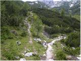 12
12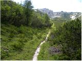 13
13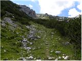 14
14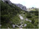 15
15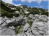 16
16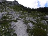 17
17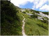 18
18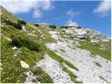 19
19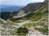 20
20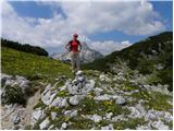 21
21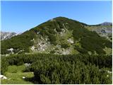 22
22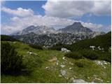 23
23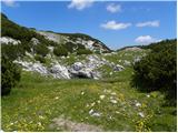 24
24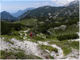 25
25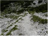 26
26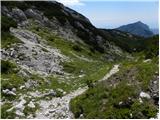 27
27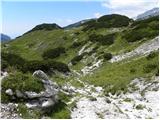 28
28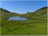 29
29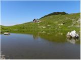 30
30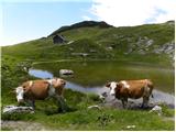 31
31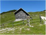 32
32