Starting point: Plave (100 m)
| Latitude/Longitude: | 46,04250°N 13,58630°E |
| |
Walking time: 2 h 30 min
Difficulty: easy marked way
Elevation gain: 712 m
Elevation difference along the route: 712 m
Map: Goriška 1:50.000
Recommended equipment (summer):
Recommended equipment (winter):
Views: 49.754
 | 2 people like this post |
Access to starting point:
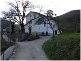
From Nova Gorica, we drive towards Tolmin or vice versa. In the village of Plave, we turn left (from the Tolmin direction, right), cross the bridge and then at the intersection after the bridge, we continue straight upwards and follow the road to the church beside which we park in a suitable place.
Route description:
Soon after the church, at the last house in the village, the road ends and it changes into a cart track which turns right and starts moderately ascending through the forest. The cart track a little higher starts ascending more steeply and after a good half an hour of walking brings us to the forest road. After approximately 15 minutes of walking on the road, at a smaller torrent we notice a blaze, which directs us left upwards. Here we have some steep steps, and then we continue the ascent on a moderately steep forest path. The path, which then becomes even more level, brings us at a pleasant spring to the forest road which comes from the village Zamedveje. Further, we continue on the road which slightly ascends and after a few minutes of further walking brings us to a smaller hamlet, where blazes direct us left among the houses upwards. The path ahead moderately ascends, partly on a grassy slope, partly through the forest. At the top of this ascent we come to an asphalt road, where we continue right, but only about 20 m. After 20 m blazes direct us left upwards, where in a diagonal ascent over a grassy slope we ascend to the next road. We continue left on the road which turns right and goes into the forest. In the forest from the road a path branches off to the left upwards to the church of St. Genderce, we here continue on the road which again passes from the forest onto panoramic grassy slopes. A little further, we come to the parking lot, where a poorer road branches off to the left upwards, which after 100 m of walking brings us to the shelter on Korada. From the shelter we continue left on the path which crosses a shorter stretch of forest and then on the panoramic summit ridge brings us to the top of Korada.
PS: We can descend past the church of St. Genderce, where we come back to the road.

Photos:
 1
1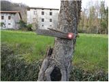 2
2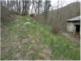 3
3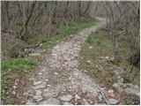 4
4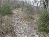 5
5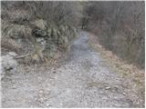 6
6 7
7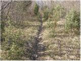 8
8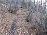 9
9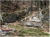 10
10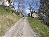 11
11 12
12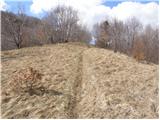 13
13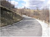 14
14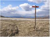 15
15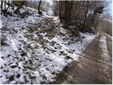 16
16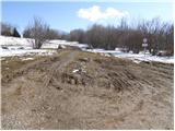 17
17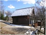 18
18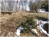 19
19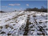 20
20 21
21
Discussion about the trip Plave - Korada
|
| darh1. 02. 2011 |
We climbed to Korada along this described path last Sunday. The hike was really pleasant, too bad we missed a better view from the top due to clouds. We returned along the road to the village Zamedveje. I described the entire path in more detail here.
|
|
|
|
| mojca96425. 04. 2011 |
I plan to visit Korada soon, and I'm interested if there is any access by car, as I will be time-limited, thank you for the answer
|
|
|
|
| wolphgang25. 04. 2011 |
With a car you can go from Vrhoveli pri Kojskem, you can get 20 min from the top or hut.
|
|
|
|
| wolphgang25. 04. 2011 |
Yes, keep to the right all the time until you see the Korada sign, there is also space to park. Have a nice trip
|
|
|
|
| mojca96426. 04. 2011 |
Thank you, maybe I'll go tomorrow, hope I find it, as I'm from Gorenjska and this area is completely unknown to me
|
|
|
|
| mojca96427. 04. 2011 |
I was today on Matajur, Korada and Trstelj, really nice trip, especially because it was sunny, now that I've come home it's raining in Gorenjska - really good feeling
|
|
|
|
| sunshine27. 04. 2011 |
I was on Korada on Monday, a thunderstorm caught us, we were disappointed because the hut was closed, a hot tea would have been nice.
|
|
|
|
| TK11. 12. 2011 |
Well-marked trail, friendly hut owner! nice outing, too bad a little rain chased us on the way back.
|
|
|
|
| Alpski Slovenc12. 12. 2011 |
The weather held up okay, but no views worth mentioning to really feast the eyes.
|
|
|
|
| Janiel7410. 03. 2012 |
Today I collected 2 more SPP stamps: Trstelj and this one from Plave to Korada. Especially this one is a really nice hike for the start of the season and building fitness for higher goals Very little wind and one little sunbeam Very little wind and one little sunbeam
|
|
|
|
| Kokta28. 04. 2012 |
Start from the nice village Plave. The trail is poorly marked in the middle section. At the top awaits a really nice view towards Matajur and the Julians. In the hut fine Čemaž soup and njoki Really nice hike.
|
|
|
|
| valeri12313. 08. 2012 |
I was on Korada 09.08.12 and must praise the owner for friendliness and very good dinner
|
|
|
|
| soraya18. 02. 2013 |
We were on Korada on 8.2.2013, two adults with a 10-year-old child. Ideal hike, just varied enough so the child won't be discouraged from ascents in the future. The view is breathtaking, clear, no clouds, a little windy... in short, ideal trip for Culture Day. And don't forget the hut keeper, she's great and very hospitable, with her father they're a real team. The little one wanted turnips, potatoes and sausage and says she's never eaten so well. Keep it up!
|
|
|
|
| balon4. 05. 2014 |
Great path, I recommend it to families with younger children. The hut keeper is great. Fantastic views.
Baloncki
|
|
|
|
| slavkovoda5. 08. 2014 |
Although it properly "washed" us on the return about halfway, soaked to the skin, we don't regret the trip. Pleasant path, nice view, friendly talkative host, draught beer....what more could you want!
|
|
|
|
| masker6. 04. 2015 |
Today I was with mountaineering friends at the top of Korada. It was quite enjoyable, especially after yesterday's Easter celebration. From the top there was a beautiful view of the surrounding hills, which offered pleasant grazing for the eyes. For the start of the mountaineering season, this two-hour hike up the hill is just right. The stop at the hut also fit perfectly with hot mountaineering tea with rum and pleasant chat with fellow climbers......good luck!!
|
|
|
|
| Tolminc18. 11. 2017 |
Today my wife and I climbed to Korada from the village Plave. We noticed that on the signpost placed at the starting point, the walking time is estimated at 2 hours, 30 minutes. I agree that you can reach Korada in 2 hours, even sooner, but still it would make sense to align the walking time in the trail description with the signposts placed by PD Valentin Stanič Kanal. Safe step.
|
|
|
|
| Tadej20. 11. 2017 |
Thanks for the notice. I've corrected it.
|
|
|
|
| Tolminc20. 11. 2017 |
@Tadej, thanks. Best regards
|
|
|
|
| mirank24. 11. 2025 18:09:26 |
Nice hiking route, dude; Solkan by train to Plave, to Korada and from there to Sabotin and back to Solkan
|
|
|
|
| Clemente20. 12. 2025 20:30:32 |
Cool, I walked back to Solkan today (along the cycle path).
|
|
|
To post a comment you must log in:
If you do not yet have a username, you must first
register.