Pocol de ra Crosc - Ra Bujela (Via ferrata Maria e Andrea Ferrari)
Starting point: Pocol de ra Crosc (1928 m)
Starting point Lat/Lon: 46.52914°N 12.08067°E 
Path name: Via ferrata Maria e Andrea Ferrari
Time of walking: 2 h
Difficulty: extremely difficult marked way
Ferrata: C
Difficulty of skiing: no data
Altitude difference: 329 m
Altitude difference (by path): 340 m
Map: Tabacco 03 1:25.000
Access to starting point:
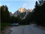
A) Access from Gorenjska: From Rateče or Predel we cross the border to Trbiž / Tarvisio and then on the highway in the direction of Videm / Udine to exit Tolmezzo. From Tolmezzo we follow the road in the direction of village Ampezzo and mountain pass Passo Mauria. The road then descends and it brings us to a crossroad, where we continue left (possible also right) in the direction of Cortina d'Ampezzo. At all next crossroads, we follow the signs for Cortina d'Ampezzo. In Cortina d'Ampezzo then we follow the signs for Alpine mountain pass Passo di Falzarego. This ascending road we then follow to the spot, where the road in the direction of the mountain hut rifugio Dibona branches off to the right (turn off is at an altitude approx 1700 meters). On a narrow asphalt road we drive to a crossroad where the road towards the mountain hut Duca d'Aosta branches off to the right. We park near mentioned crossroad where by the road are some smaller parking spots.
B) From Primorska: We drive on the highway towards Venice / Venezia. At town Portogruaro we leave the highway towards Venice and continue right on the highway towards Pordenone. At the next highway junction near Conegliano, we continue right towards Belluno. Near Belluno the highway ends and at the next crossroads we continue in the direction of Cortina d'Ampezzo. Further, we follow the description above.
Path description:
We go right on a macadam road towards the mountain hut Duca d'Aosta. The road from the crossroad is ascending through the forest and it quickly brings us to a ski slope. We still follow the road which further runs on a ski slope. From the path beautiful views start to open up on the mountain groups Sorapiss and Antelao, and even nicer is visible south wall of the nearby Tofana di Rozes. Later road brings us near a little wider ski track where a view opens up towards Cortina d'Ampezzo. Here the road turns to the left, and the forest soon ends. Next follows only the last ascent on the more and more panoramic road to the hut Duca d'Aosta.
From the mountain hut, we continue left towards the mountain hut Rifugio Pomedes and secured path Ferrata de Ra Bujela. Macadam road which leads towards the mountain hut Pomedes quickly brings us below the slopes of the peak Ra Bujela where there is a crossing.
Here signpost points us to a narrow path which leads towards the wall of the peak Ra Bujela. In front of the entry into a climbing part of the path, we equip ourselves with a helmet and self-belay set, the use of climbing gloves is also recommended.
In the beginning of the secured path we ascend steeply by the steel cable, and we also get help from few stemples (difficulty B/C). The path then turns to the right and brings us into a vertically wall. The path is here very exposed and at climbing we get help from numerous stemples (difficulty to C). Difficulty then decreases and we are already at the bridge, which crosses a steep gully. After the crossing of the bridge path from eastern slopes brings us on the south side of the mountain where the ascent is slightly less demanding (difficulty B). Further, we are still ascending by the steel cable, and from the path, we have a very nice view towards a ski track where also world cup races in alpine skiing are taking place. We soon come to another bridge, which crosses deep gully. Next follows traversing to the right, which brings us to a ridge. Here we continue left and we are ascending on a steep ridge. Ascent again becomes more demanding (difficulty to C). Higher, the path becomes less demanding and on a shorter part also fixed safety gear are not necessary. Next follows path on and by a little narrower ridge and we few times descend into a smaller notches. A little below the summit, we come to a crossing where we continue right and on narrow exposed ridge we quickly reach the peak.
From the top, we return to the mentioned crossing and we descend on the southwest side. From the crossing, we at first cross a slope below the summit, and then follows a little steeper descent where we get some help from stemples (difficulty B). For some time we are still descending by the steel cable towards the west, after that the secured path ends.
The path then soon brings us to an unmarked crossing. In case if we want to descend back towards the mountain hut Rifugio Duca d'Aosta, at the crossing we continue right downwards. And if we want to continue towards the mountain hut Rifugio Pomedes we go left.
Pictures:
 1
1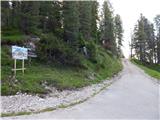 2
2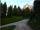 3
3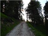 4
4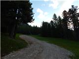 5
5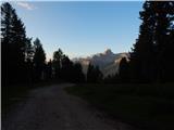 6
6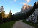 7
7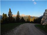 8
8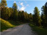 9
9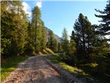 10
10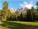 11
11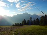 12
12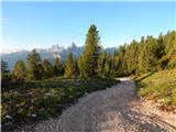 13
13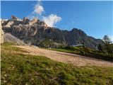 14
14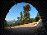 15
15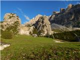 16
16 17
17 18
18 19
19 20
20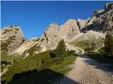 21
21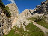 22
22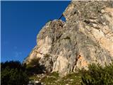 23
23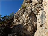 24
24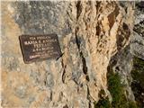 25
25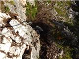 26
26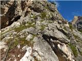 27
27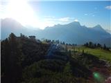 28
28 29
29 30
30 31
31 32
32 33
33 34
34 35
35 36
36 37
37 38
38 39
39 40
40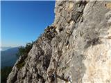 41
41 42
42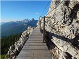 43
43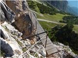 44
44 45
45 46
46 47
47 48
48 49
49 50
50 51
51 52
52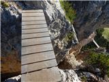 53
53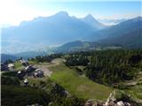 54
54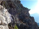 55
55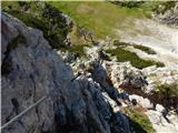 56
56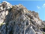 57
57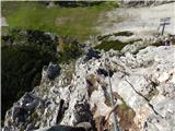 58
58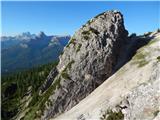 59
59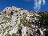 60
60 61
61 62
62 63
63 64
64 65
65 66
66 67
67 68
68 69
69 70
70 71
71 72
72 73
73 74
74 75
75 76
76 77
77 78
78 79
79 80
80 81
81 82
82 83
83 84
84 85
85