Pod Peco (Koželj) / Koprein-Petzen (Koschiel) - Govca (Olševa) (via Zadnji travnik)
Starting point: Pod Peco (Koželj) / Koprein-Petzen (Koschiel) (1040 m)
Starting point Lat/Lon: 46.5032°N 14.6884°E 
Path name: via Zadnji travnik
Time of walking: 4 h 45 min
Difficulty: easy marked way, easy unmarked way
Difficulty of skiing: no data
Altitude difference: 889 m
Altitude difference (by path): 1150 m
Map: Kamniške in Savinjske Alpe 1:50.000
Access to starting point:
A) Over the border crossing Jezerski vrh or Pavličev vrh we drive to Bela / Bad Vellach, and from there we continue driving towards Železna Kapla / Bad Eisenkappel. At the beginning of Železna Kapla we notice signs for Lepena / Leppen, which point us to the right. Further, we drive on a little narrower asphalt road which leads us at first by the bottom of the valley, and then at the hamlet Koprivna / Koprein - Sonnseite it starts ascending steeper. Further, we get to a hamlet Pod Peco / Koprein - Petzen, and few 100 meters after the homestead Koželj / Koschiel we get to a marked crossroad, where the marked path branches off to the right towards Bela / Vellach. We park on an appropriate place by the crossroad.
B) From Dravograd or Slovenj Gradec we drive to Ravne na Koroškem, and then we continue driving in the direction of border crossing Holmec. When we drive into Austria we at first drive towards Pliberk / Bleiburg, and then we follow the signs for Globasnica / Globasnitz. After approximately 13 km from the border crossing Holmec we get to Globasnica, from there we continue driving left towards the upper part of the settlement. From Globasnica we continue on a narrower and ascending road in the direction of hamlet Pod Peco / Koprein - Petzen. Further, we are for quite some time ascending by Globaška grapa, and then the road brings us on an indistinct saddle (saddle Luža / Luschasattel, where we get to a smaller crossroad). We continue slightly right (left mountain pasture Luža) and past the church of all religions we reach inn Riepel, after which the road starts steeply descending. Lower, when we already get by the stream Mošenik / Muschenigbach, on the left we notice signs for Bela / Vellach, and by the sign on an appropriate place by the crossroad we park.
Path description:
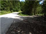
From the starting point, we continue in the direction of Bela / Vellach and we walk on an ascending macadam road which is with a traffic sign and a gate closed for public traffic. In few longer zig-zags we ascend on a saddle east from the peak Gorelca / Gorelza, where a religious symbol (cross) is situated. Further follow few smaller crossroads, where we follow the blazes, and then after the next gate we descend to a wider road which we follow left upwards.
Further, the road leads us above the farm Zgornji Mozgan / Obermosgan, and then we continue past another gate. Here a beautiful view opens up mainly on Austrian part of Karawanks, and we continue on a marked road. Higher, the road leads us past more hunting observatories, and after a little longer crossing towards the right it brings us to the other road which we follow left upwards. On this part again a nice view opens up, and we leave the road and on a marked path we ascend diagonally above the road. A little higher, above the nearby crossroad we once again cross the road, and then we ascend on a border ridge, where we reach the cart track which comes from Slovenian side. On the cart track, we walk only few steps, and then we continue slightly right on a marked path which continues on a little overgrown ridge. Here once again a nice view opens up, after that ridge becomes more overgrown. A little further, the marked path avoids the ridge slightly to the right, so that it bypasses the very peak of Snežnik (to the summit we can ascend in few 10 strides). Next follows few minutes of a crossing, and then we reach the other forest road, on which we continue towards the west. The road short time leads on the ridge and then gradually passes on the northern slopes of Špičasti vrh. On the mentioned part on the left we notice a blaze, which from a road points us left, on at first an overgrown footpath, on which in few 10 strides we ascend on a forested Špičasti vrh.
On Špičasti vrh path turns a little to the left and starts descending steeper on the ridge, where used to run state border between Koroška and Štajerska, on which we are reminded by old border stones. A little lower path becomes for some time quite overgrown, and then we quickly descend to a forest road which we reach on the saddle, by which there is a bigger metal cross, and a little further also bilingual caption on a metal plate, which is attached on a bigger rock.
From the saddle, where we also notice a notification, that we are in an area, where lives brown bear, we continue straight, at first still on a marked path which continues on the road. When the marked path from the road turns slightly to the right, we still continue on the road, and further it isn't marked anymore. On the road which gradually starts descending steeper we follow to its end, and from there slightly right to the national border. Further, we are descending by the national border, and then on the right we notice a worse, partly already overgrown cart track, on which we descend to a marked path which leads from the mountain hut on farm Kumer towards Olševa.
We follow the mentioned path to the right, and then we quickly get to some sort of the parking lot on Zadnji travnik.
From an unregulated parking lot we continue left in the direction of Olševa on the path which continues on a cart track and which after few meters goes into the forest. About 3 minutes we walk on a cart track, and then blazes point us slightly to the left on a beaten and with arrows marked footpath. A little higher again blazes show up, and the path returns on a cart track. We continue the ascent on a gradually steeper cart track which higher flattens a little and turns to the right. From the spot, when the cart track turns to the right, we walk there only few 10 meters and then blazes point us to the left on again steeper footpath, and it quickly brings us to the hunting bivouac Foršnerca.
From the hunting bivouac we continue straight and then after few meters left uphill. Further, the path starts ascending steeper through partly larch forest, which higher gets thinner. After few minutes of the ascent, the path flattens and brings us into a smaller cirque. Next follows few minutes of a moderate ascent, and then the path again becomes a little steeper, and it leads over more panoramic shady slopes of Olševa. Higher, the path turns left and it ascends diagonally to a smaller gully, through which on a gravel we ascend on the ridge of Olševa.
We reach the ridge at the marked crossing, where we continue right in the direction of Govca, highest peak of the before mentioned ridge (left saddle Spodnje Sleme and Raduha). The path ahead continues on the left, mostly south side of the ridge, where it crosses some even steeper and on two spots also exposed slopes (mainly in wet and snow dangerous for slipping). Further slope flattens a little, and the path a little steeper ascends. With nice views towards the mountains above the valley Logarska dolina we quickly reach some kind of side ridge, on which we ascend in few minutes to the main ridge of Olševa. Here the path turns to the left and after few 10 strides of additional walking brings us on Govca.
The starting point - Snežnik 2:10, Snežnik - Špičasti vrh 20 minutes, Špičasti vrh - Zadnji travnik 30 minutes, Zadnji travnik - Govca 1:45.
Pictures:
 1
1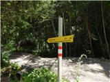 2
2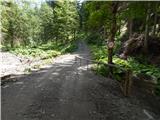 3
3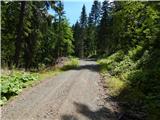 4
4 5
5 6
6 7
7 8
8 9
9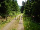 10
10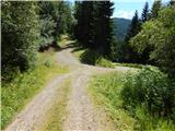 11
11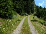 12
12 13
13 14
14 15
15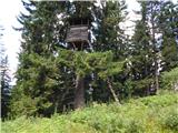 16
16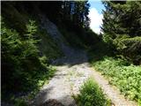 17
17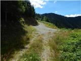 18
18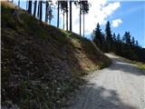 19
19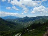 20
20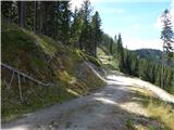 21
21 22
22 23
23 24
24 25
25 26
26 27
27 28
28 29
29 30
30 31
31 32
32 33
33 34
34 35
35 36
3637
 38
38 39
39 40
40 41
41 42
42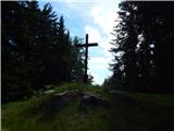 43
43 44
44 45
45 46
46 47
47 48
48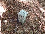 49
49 50
50 51
51 52
52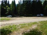 53
53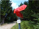 54
54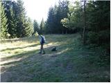 55
55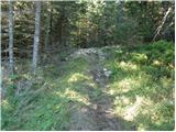 56
56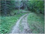 57
57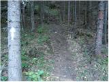 58
58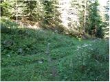 59
59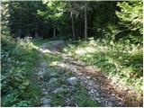 60
60 61
61 62
62 63
63 64
64 65
65 66
66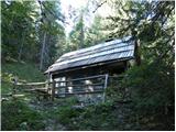 67
67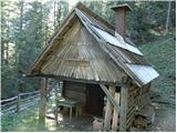 68
68 69
69 70
70 71
71 72
72 73
73 74
74 75
75 76
76 77
77 78
78 79
79 80
80 81
81 82
82 83
83 84
84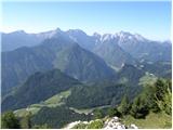 85
85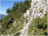 86
86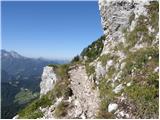 87
87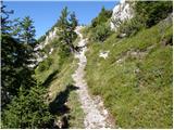 88
88 89
89 90
90 91
91 92
92 93
93 94
94 95
95 96
96