Podkilavac - Dom Hahlić (Mudna dol)
Starting point: Podkilavac (320 m)
Route name: Mudna dol
Walking time: 3 h 30 min
Difficulty: very difficult marked way
Elevation gain: 777 m
Elevation difference along the route: 950 m
Map:
Recommended equipment (summer): helmet, self belay set
Recommended equipment (winter):
Views: 4.780
 | 3 people like this post |
Access to starting point:
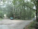
We leave the Zagreb-Rijeka / Reka highway at the Grobniško polje, Čavle exit. We drive into the settlement Čavle, where we will notice signs for the village Dražice. We turn right in the direction of Dražice and after a few minutes arrive at the mentioned settlement. In Dražice, just past the gas station, we reach a roundabout, where we continue toward the village Podkilavac (not marked, best to ask, but as the official start of this trail is in Dražice, trail blazes are visible). In Podkilavac, we continue straight along the main road to the end of the village, where we will see mountain signposts near a small bridge.
Route description:
From the crossroad, we go over a small bridge, where we will immediately leave the poorer asphalt. The turn-off brings us to a wider cart track (because blazes are poor in this part, we can orient ourselves by the power line), which we quickly leave and go left onto a narrower cart track. This time, we walk along the cart track to a crossing, where we will choose the right footpath that slightly descends (straight to the mountain hut Hahlić - path along the ridge). The path ahead brings us to a large meadow with a few scattered trees, where we will turn left to the north. Along the path, there will also be an abandoned farm.
After the farm, we reach a spot where we must turn sharply right and slightly downward (the turn-off is not well marked). Next, there are a few well-marked turn-offs, and after crossing a stone wall, we will step onto a smaller meadow, where a path branches off to the right for Platak. We go straight and quickly reach the beginning of Mudna dol.
Mudna dol is a kind of gorge of the stream Sušica. At the beginning of Mudna dol, there is another crossing, where a path branches off to the right along the eastern ridge, but we go straight. The gorge becomes narrower and narrower, and the ground changes to stones.
About twenty minutes from the crossing, we will reach the head of the gorge, where it seems the path ends, but we will quickly notice a steel cable and a few pegs on our left side. Here, we ascend and enter a natural basin, which is very interesting. From the basin, we ascend again, this time on an almost vertical but fairly smooth rock, where a steel cable assists us.
After this demanding part, we continue into the main part of Mudna dol. Next follow a few smaller rocky jumps, which are somewhat challenging. For a short time, the gorge widens, then we reach the most difficult part of the path, where a steel cable assists us. The path here is almost vertical, and consequently, the difficulty is very high (in wet conditions, the passage is quite challenging). There are no pitons or pegs, only a few small footholds in the rock. After the first ascent, we reach a basin, where a ladder helps us move forward. At the top of the ladder, there is also a logbook.
From the spot where the book is, we ascend upward on the rock with the help of a few pitons.
After the most difficult part, we reach the narrowest part of Mudna dol. Next follows a steep ascent, where we quickly gain altitude, but a direct ascent is soon interrupted by a jump, which we bypass on the right side. Above the jumps, the gorge starts to widen, and we reach the last steel cable, where we cross a smooth rocky slab. After a few minutes, we reach an interesting scree, and behind it, we will finally leave the riverbed of the stream and ascend steeply upward onto a grassy slope. Here, it seems we must ascend all the way to a rocky outcrop, where there is an exceptional viewpoint, but by a cairn, we turn right.
The path ahead enters the forest and becomes steep again. Higher up, we leave the forest and reach a meadow. The path is well-trodden, and winter blazes also assist us. At the end of the meadow, we reach a cart track and go left.
The cart track brings us to two crossings. At the first, we go left, and at the second, we go straight (left is the peak Vidalj with a great view).
From the saddle, which is also the highest point of our path, the path starts descending through the forest. When we leave the forest, we are again on a meadow. Here, blazes are rare, but the path is well-trodden, and there are no orientation problems. We soon reach the next saddle, where there is another crossing (right to peak Fratar, left to peak Dnić), where we continue straight.
Here, blazes are again rare, but we stick to the meadow, where we will notice signs for the mountain hut Hahlić on the only tree. We continue, and after a small saddle, the path leads us into the forest, where we quickly reach the mountain hut Hahlić.
Mudna dol is the longest gorge in Croatia. The path is not passable during and after rain.

Photos:
 1
1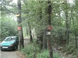 2
2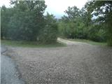 3
3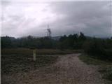 4
4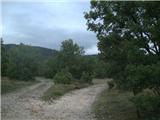 5
5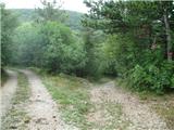 6
6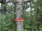 7
7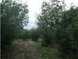 8
8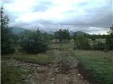 9
9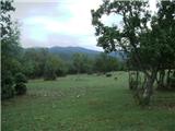 10
10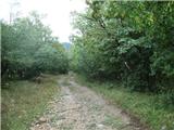 11
11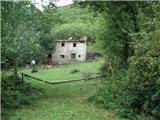 12
12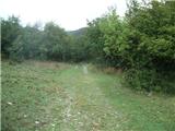 13
13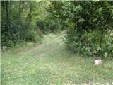 14
14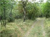 15
15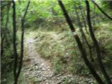 16
16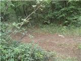 17
17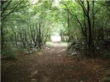 18
18 19
19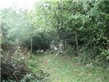 20
20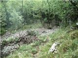 21
21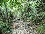 22
22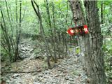 23
23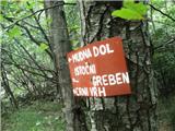 24
24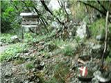 25
25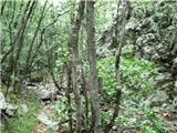 26
26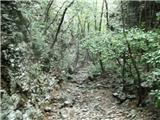 27
27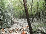 28
28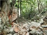 29
29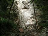 30
30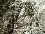 31
31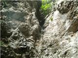 32
32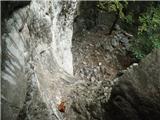 33
33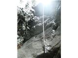 34
34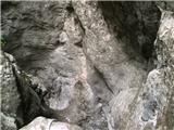 35
35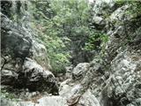 36
36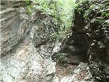 37
37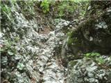 38
38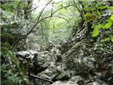 39
39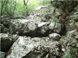 40
40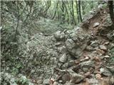 41
41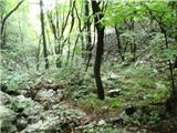 42
42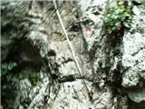 43
43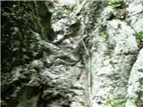 44
44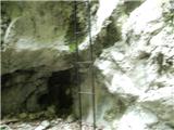 45
45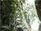 46
46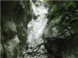 47
47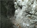 48
48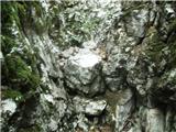 49
49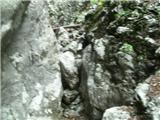 50
50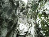 51
51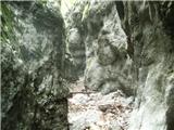 52
52 53
53 54
54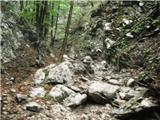 55
55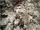 56
56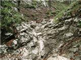 57
57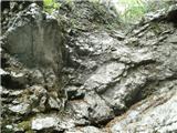 58
58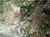 59
59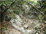 60
60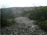 61
61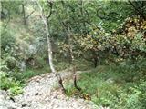 62
62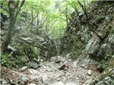 63
63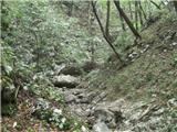 64
64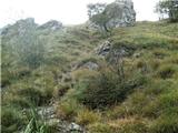 65
65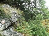 66
66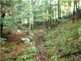 67
67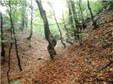 68
68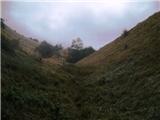 69
69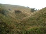 70
70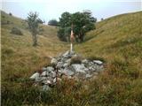 71
71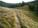 72
72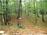 73
73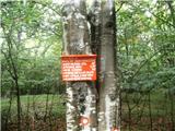 74
74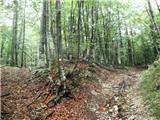 75
75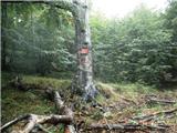 76
76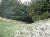 77
77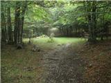 78
78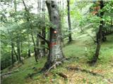 79
79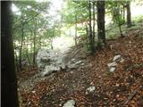 80
80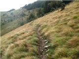 81
81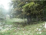 82
82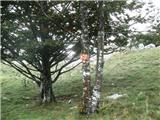 83
83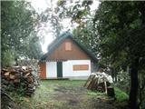 84
84
Discussion about the trip Podkilavac - Dom Hahlić (Mudna dol)
|
| nisa8. 10. 2015 |
Very nice and interesting path. As already mentioned, passable in dry weather.
Recommended.
|
|
|
|
| ben19. 02. 2017 |
I must warn that the path through Mudna dol is currently impassable!! The ladder is missing on photo no. 45. Progressing over the 3-meter overhanging step is impossible for an ordinary hiker!!! There are NO warnings at the entrance or exit!! The caretaker at Dom Hahlić told me that the closure notice is on the internet, if you know where to look for it! 
|
|
|
|
| smatjaz28. 05. 2018 |
Nicely passable and nice tour, definitely in dry weather, as Mudna dol is the canyon of the torrent Mudna and after rain and during rain it is even more dangerous there
|
|
|
|
| smatjaz28. 05. 2018 |
....correction, the torrent Sušica and not Mudna...
|
|
|
|
| majase2116. 11. 2020 |
Beautiful and very attractive trail, but it's really only suitable when it's very dry.
|
|
|
To post a comment you must log in:
If you do not yet have a username, you must first
register.