Podljubelj - Veliki vrh (Košuta) (via Matizovec)
Starting point: Podljubelj (658 m)
| Latitude/Longitude: | 46,39790°N 14,28760°E |
| |
Route name: via Matizovec
Walking time: 4 h 15 min
Difficulty: easy marked way
Elevation gain: 1430 m
Elevation difference along the route: 1430 m
Map: Karavanke - osrednji del 1:50.000
Recommended equipment (summer):
Recommended equipment (winter): ice axe, crampons
Views: 23.814
 | 1 person like this post |
Access to starting point:
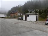
From the highway Ljubljana - Jesenice, we take the exit Podtabor (Tržič, Ljubelj), then continue driving towards Ljubelj. After approximately 6 km of driving from the gas station at Bistrica pri Tržiču, we leave the main road, as the signs for Podljubelj direct us to the right onto a local road. A little further, we arrive at the next crossroad, where we continue right and then after some 10 m park at a suitable place in the middle of the village.
If at the crossroad when we drive into Podljubelj we turn left, we will hardly find a suitable parking spot.
Route description:
From the starting point, we return some 10 m back to the crossroad, from there we continue on the asphalt road in the direction of Matizovec and Kofce. The road ahead starts to ascend moderately through the village, then flattens and brings us to a smaller crossroad, where we continue right in the direction of Kofce.
Ahead we ascend for quite some time on the asphalt road, which past a smaller cross brings us to a hamlet of a few houses (Pod Košuto). Here we continue straight on a somewhat steeper road again, which soon loses the asphalt surface. Some 10 m ahead there is a large macadam parking lot, which we bypass on the right side. From the road, from which occasional views open up on Dobrča and surrounding mountains, a few turns higher a marked footpath branches off to the right, which crosses one turn. The footpath returns to the road at the last turn before the farm Matizovec.
From Matizovec we continue on a rougher road in the direction of Dom na Kofcah, carefully following the blazes at several successive junctions. After a few minutes of walking on the rougher road or cart track, the blazes direct us onto a steep footpath, which first ascends diagonally to the left, then transitions to a forested ridge, where it turns slightly to the right. Further we ascend on a steep mountain path, which higher crosses a cart track and then gradually flattens behind it. A little further the forest thins, the marked path turns right into the forest and a little higher joins the cart track, which ascends diagonally to the right. The cart track higher turns left, and from the right a marked path from Kal also joins.
From the junction ahead the forest ends, and the increasingly scenic path brings us to Dom na Kofcah in 5 minutes of further walking.
From the mountain hut we continue in the direction of Veliki vrh and Kladivo on an initially somewhat less visible path that begins to ascend across a panoramic meadow. After 15 minutes of walking from Dom na Kofcah we reach a nice viewpoint at the cross.
The path then descends slightly and in a few minutes brings us to the steeper slopes of Košuta. The path then ascends through a belt of dwarf pines, bringing us to a junction. We continue straight (right to Kladivo and Kofce gora) on the path that ascends diagonally across increasingly steep slopes. The path, which continues on an unvegetated slope, soon brings us to a short steep section, where a steel cable assists us (undemanding). After passing this section the path turns slightly to the left and then ascends relatively steeply across the grassy slope. The increasingly scenic path then brings us into a small valley, up which we climb almost to the border ridge, where the ridge path joins from the right. The path then from the valley passes again onto the southern slopes, where it bypasses the peak »Toplar (2000m)« on the southern side and brings us below the summit slope of Veliki vrh. The path, which for a while ran along the ridge, here moves away from it and continues in a traversing ascent on the sunny slopes. Higher the path turns sharply right and brings us to the panoramic summit in a few minutes.
Podljubelj - Matizovec 1:15, Matizovec - Kofce 1:15, Kofce - Veliki Vrh 1:45.

Photos:
 1
1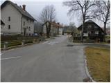 2
2 3
3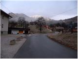 4
4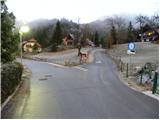 5
5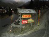 6
6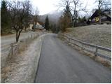 7
7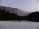 8
8 9
9 10
10 11
11 12
12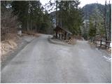 13
13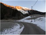 14
14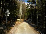 15
15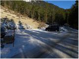 16
16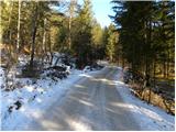 17
17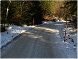 18
18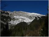 19
19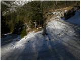 20
20 21
21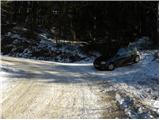 22
22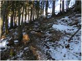 23
23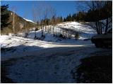 24
24 25
25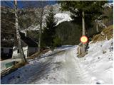 26
26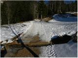 27
27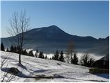 28
28 29
29 30
30 31
31 32
32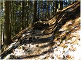 33
33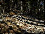 34
34 35
35 36
36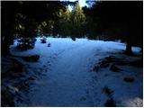 37
37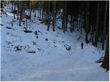 38
38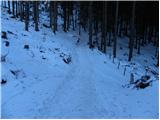 39
39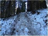 40
40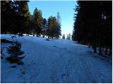 41
41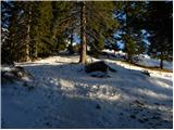 42
42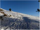 43
43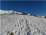 44
44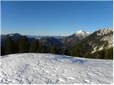 45
45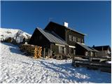 46
46 47
47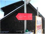 48
48 49
49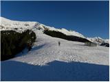 50
50 51
51 52
52 53
53 54
54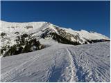 55
55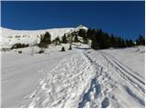 56
56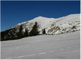 57
57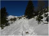 58
58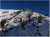 59
59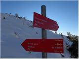 60
60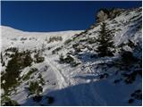 61
61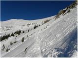 62
62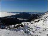 63
63 64
64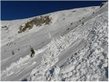 65
65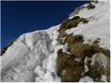 66
66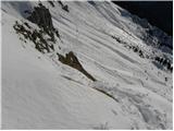 67
67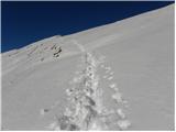 68
68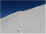 69
69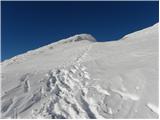 70
70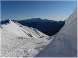 71
71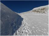 72
72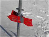 73
73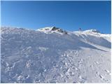 74
74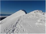 75
75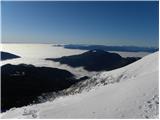 76
76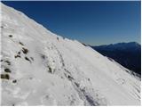 77
77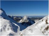 78
78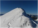 79
79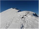 80
80 81
81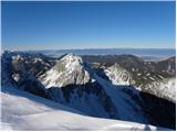 82
82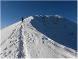 83
83 84
84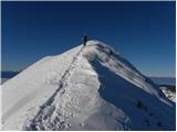 85
85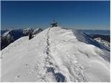 86
86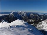 87
87
Discussion about the trip Podljubelj - Veliki vrh (Košuta) (via Matizovec)
|
| falcon1. 01. 2012 |
Nice hike. In winter conditions attention needed before the summit.
|
|
|
|
| misace18. 05. 2017 |
On Tuesday 16.5.2017, a bit different. Last asphalt turnoff about a kilometer lower to the right and on gravel to Vasovnik. On nice tracks and steep scree to the ridge below Kofce, to VV, and through Malo Kladivo and pastures Šija past the now permanently open Planšarija to Kofce back 
|
|
|
To post a comment you must log in:
If you do not yet have a username, you must first
register.