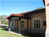
Podmelec (railway station) - Koča na planini Razor (on slope of Jalovnik and Kobilja glava)
Starting point: Podmelec (railway station) (230 m)
Starting point Lat/Lon: 46.15951°N 13.81406°E 
Path name: on slope of Jalovnik and Kobilja glava
Time of walking: 5 h 20 min
Difficulty: easy unmarked way, easy marked way
Difficulty of skiing: no data
Altitude difference: 1085 m
Altitude difference (by path): 1250 m
Map: Julijske Alpe
Access to starting point:
We go with a train - Podmelec is a railway station on "Bohinj railway line" Jesenice-Most on Soči.
If we drive with a car (Baška grapa), in the settlement Kneža we turn from the main road towards the settlement "Sela nad Podmelcem", we park after approximately 1 km before the village Podmelec, on a smaller parking lot.
Path description:
From the railway station Podmelec we go towards the center of the village Klavže, across the river Bača, we at first turn right - signpost points us towards Jalovnik (3 hours) - and immediately after this we cross the road and we continue on the asphalt road (we turn left). At the end of the village, we follow the signpost Sela nad Podmelcem, which points us on a concrete road which later turns into a cart track. In the hamlet Borovnice, where we go past few holiday cottages, we then cross an asphalt road and on a cart track we ascend to the village Sela nad Podmelcem. On the road, we go to the turn-off of a cart track which points us on a meadow. On meadow ridge we ascend to a macadam road. We soon notice a nice signpost for Jalovnik, and if we go on the mountain pasture Razor, we follow the signpost to the right (Planina Razor 3 hours), a macadam road in few steps it brings us to a viewpoint, and later alos occasionally a view opens up towards Porezen and Tolmin - Bohinj mountains. The road is getting worse and later turns into a footpath which runs on a steep slope. Later we get to a fence, and the cart track is again becoming more distinct and it brings us to the abandoned mountain pasture Temna brda. Here we follow the bottom path, on which we soon get to a clearly visible path towards the mountain pasture Lom, which we reach in approximately one hour and a half from the signpost for Planina Razor. On the mountain pasture Lom we reached the marked path, actually a road, on which we at first reach the mountain pasture Podkuk, and then also the mountain pasture Razor.
On the way: Sela nad Podmelcem (830m), Planina Temna brda (opuščena) (1008m), Planina Lom (1060m), Planina Podkuk (1140m)
Pictures:
 1
1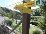 2
2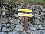 3
3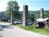 4
4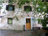 5
5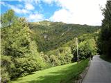 6
6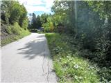 7
7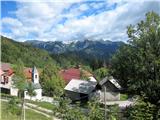 8
8 9
9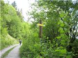 10
10 11
11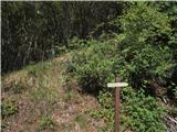 12
12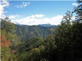 13
13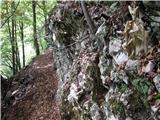 14
14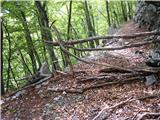 15
15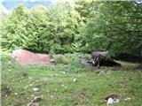 16
16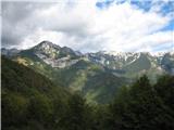 17
17 18
18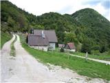 19
19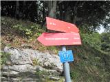 20
20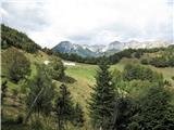 21
21