Podmežakla (Jesenice) - Snežna jama on Mežakla (via Zakop and Planski vrh)
Starting point: Podmežakla (Jesenice) (580 m)
Path name: via Zakop and Planski vrh
Time of walking: 2 h 30 min
Difficulty: easy marked way
Difficulty of skiing: partly demanding
Altitude difference: 550 m
Altitude difference (by path): 740 m
Map: TNP 1 : 50.000
Access to starting point:
From highway Ljubljana - Jesenice, we go to the exit Lipce and we drive right towards Jesenice (at the traffic light left). Here in the center of the town we follow signposts for Podmežakla. When we drive through the underpass, we turn right, and nearby we can notice hockey hall. We drive additional 350 meters, when before highway underpass we notice a parking lot. Here is our starting point.
Path description:
From the parking lot, we go through the underpass, on which on the right side we run into the first blaze. When we step through it, on the left we notice a path which leads from the road uphill (trail blaze on asphalt). We go there, we ascend few meters and turn right (west) towards power line. The path which is at first only moderately ascending, and later more and more, after some time brings us to a crossing. Here we go left (straight Mala Mežakla), a little more steeply uphill towards the south. We soon reach the forest road which through double turn brings us to the turn-off of cart track which is steeply ascending on the right in the direction southeast. We go there, and we follow it for quite some time, meanwhile we ignore the right turn-offs of smaller shortcuts.
The path through the forest is occasionally ascending in zig-zags, at first a little towards the left. When we are past bigger right turn, blazes point us to narrower path on the right. Now we are turned in the direction of southwest. From here further, the path gradually in large or smaller zig-zags ascending even steeper towards the top on the left. When we come below the rocks on the left, we are already near top of plateau, and here we soon run into a crossing of marked footpaths, which means, that there are available two variants.
First is straight (direction southwest) on which soon, when the steepness decreases we come on Zakop, where we run into a forest road, we turn left, and we notice monument and benches (smaller event venue). The second option is left (direction southeast), steeply uphill towards top of plateau, where we run into same road which in the direction towards the left runs towards the destination. Soon the road ends, and we continue on a path in the same direction, where we ignore left turn-offs of cart tracks. When the path is again ascending, we reach the forest road for the second time, which we cross. After few meters, we get to the edge of plateau at Škrbina, near of which (left 2 min) is located television transmitter Mežakla. Here a view opens up into a valley, and we continue right uphill, by the edge of the plateau. Soon, when the steepness decreases we walk on a panoramic path on the top of northern walls of Planski vrh. After a good 15 minutes of walking from Škrbina, about 20 meters below the path, on the left we notice relatively large rocky natural bridge, to near of which we can carefully descend (dangerous for slipping). The path which continues in the same direction, soon turns right, and crosses top of the plateau. Pointing in the direction of southeast, the path descends to overgrown cart track, where it turns right downwards, and soon after that also left, through the forest, and goes towards the east. After some time, the path over individual fallen trees, which is at the same time all the time descending, diagonally crosses a forest road, and is still descending in the direction of east. When the path is turning slightly towards the right, we run into a plain by the end of the forest road. We go right, on this road and we follow it only few minutes, whereupon blazes and signs by the road point us to the left on a cart track which at first turns left and it ascends a little and then on diverse forest terrain in few minutes of walking, it brings us to the turn-off towards the cave Snežna jama (sign on a tree), which is situated on the left side, only few meters away from the cart track. Equipped with a lamp on the more and more slippery path we descend at first for good 15 meters, into karst sinkhole, from where we continue left, through with a short ladder equipped low passages, all the way to bigger hall, 72 meters long karst cave, in which we run into numerous characteristic limestone formations, and in its gable also on water.
Pictures:
 1
1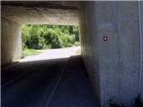 2
2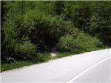 3
3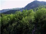 4
4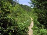 5
5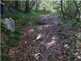 6
6 7
7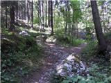 8
8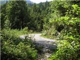 9
9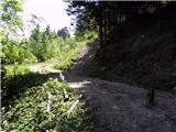 10
10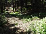 11
11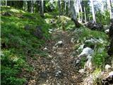 12
12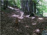 13
13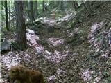 14
14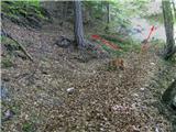 15
15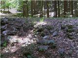 16
16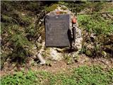 17
17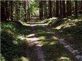 18
18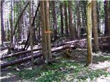 19
19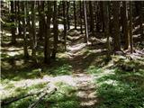 20
20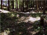 21
21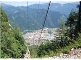 22
22 23
23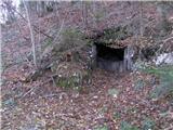 24
24 25
25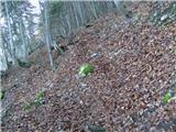 26
26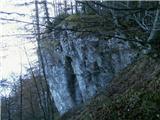 27
27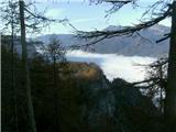 28
28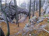 29
29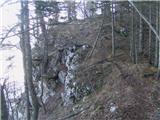 30
30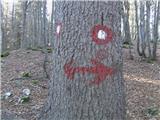 31
31 32
32 33
33 34
34 35
35 36
36 37
37 38
38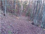 39
39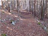 40
40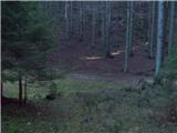 41
41 42
42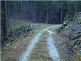 43
43 44
44 45
45 46
46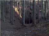 47
47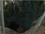 48
48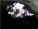 49
49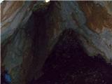 50
50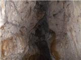 51
51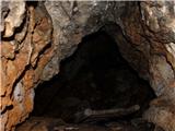 52
52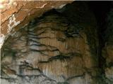 53
53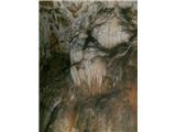 54
54