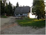
Poštarski dom pod Plešivcem - Dom na Uršlji gori (via Kal)
Starting point: Poštarski dom pod Plešivcem (805 m)
Starting point Lat/Lon: 46.496°N 15.0125°E 
Path name: via Kal
Time of walking: 2 h 35 min
Difficulty: easy marked way
Difficulty of skiing: no data
Altitude difference: 875 m
Altitude difference (by path): 900 m
Map: Koroška 1:50.000
Access to starting point:
A) From highway Ljubljana - Maribor we go to the exit Žalec, and then we follow the road in the direction of Velenje, where in main roundabout in the middle of the town we continue right in the direction of Slovenj Gradec. In Slovenj Gradec, near the gas station, we continue left in the direction of settlements Podgorje, Sele and Ravne na Koroškem. Further, we drive on a regional road towards Ravne na Koroškem, after that at settlement Vrhe we continue left in the direction of village Sele and church of St. Rok. From the church, we continue on the asphalt road which only a little higher brings us to a crossroad, where the road which leads to Poštarski dom branches off to the left. Local road we then at the first crossroad follow right, in second left (both times in the direction of Poštarski dom). The mentioned road, we follow all the way to the mountain hut Poštarski dom, where we park on a parking lot near the mountain hut.
B) First, we drive to Ravne na Koroškem, and from there we continue driving towards the settlement Kotlje and forward towards Slovenj Gradec. After a smaller mountain pass, where the road flattens, behind the bus stop we continue right in the direction of the settlement Sele. Further, we drive on a little narrower road which brings us in the mentioned settlement, after the settlement we join the road which leads past the church of St. Rok (we join the road from description A). The mentioned road, we follow right, a little further at the marked crossroad left in the direction of Poštarski dom. When we get to Poštarski dom we park on an appropriate place by the mountain hut.
Path description:
From the hut, we continue on the road ahead in the direction of Uršlja gora in the direction of the path over Kal. The road which is at first ascending through the forest soon brings us on meadows, where we get to the last houses in the village. Behind the last house the road changes into a cart track which already at the very beginning has a crossing. We go on the left bottom cart track, that starts to descend a little. After a short descent, the path soon starts ascending and a little higher turns into a footpath which ascends even steeper. After that, the path crosses a worse road and on the other side of it comes to a large meadow.
We continue on the right side of a meadow, where we soon notice a footpath which goes into the forest. In parts quite overgrown footpath (in the summer time) in a moderate ascent brings us to a forest road, where we continue right. We follow the road only few minutes, to a crossing, where we go right on a cart track in the direction of Uršlja gora. Cart track, which only rarely steeply ascends we follow to the spot, where the footpath branches off to the right. Short footpath already after a minute of walking, it brings us on the road which we only cross. We again continue the ascent on a cart track, mostly slightly upwards. Cart track slowly turns into a footpath, and it brings us to water, which in dry periods dries up. After that, the path again becomes a cart track which brings us on the forest road, where we continue right to the spot, where we again turn right on a footpath. The path ahead in few steps it brings us to a crossing, where joins the path from the lake Ivarčko jezero and the other path from our starting point.
We continue straight and the path quickly again brings us on the forest road. After a short walk on the road at the left turn foot path branches off to the right to the summit of Uršlja gora. Forest by the path then becoming thinner, so we have a nice view towards the surroundings. The path few steps before hut again brings us on the road which we follow to the mountain hut Dom na Uršlji gori.
Description and pictures refer to a condition in the year 2007 (May).
Pictures:
 1
1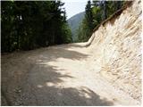 2
2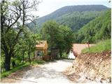 3
3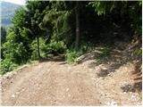 4
4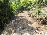 5
5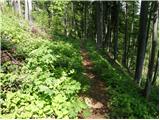 6
6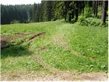 7
7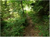 8
8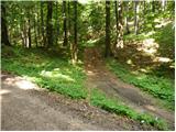 9
9 10
10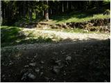 11
11 12
12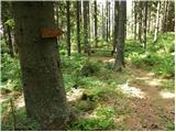 13
13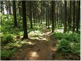 14
14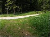 15
15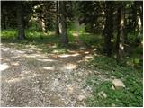 16
16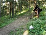 17
17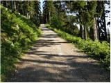 18
18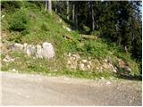 19
19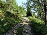 20
20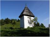 21
21 22
22 23
23