Starting point: Povir (410 m)
| Latitude/Longitude: | 45,69660°N 13,93400°E |
| |
Walking time: 1 h 10 min
Difficulty: easy marked way
Elevation gain: 193 m
Elevation difference along the route: 193 m
Map: Slovenska Istra - Čičarija, Brkini in Kras 1:50.000
Recommended equipment (summer):
Recommended equipment (winter):
Views: 11.072
 | 1 person like this post |
Access to starting point:
A) From the Ljubljana-Koper highway, take the Divača exit, then continue driving towards Divača. From Divača, continue towards Sežana, and after a few kilometers of additional driving, arrive at the settlement Povir, where leave the main road and continue left towards the center of the settlement. Further, drive through the center of the village, and after the overpass over the railway track, turn left. Further, drive past a few more residential houses, and then the asphalt ends. Park a few hundred meters ahead from the end of the village, on an appropriate place by the road.
B) First, drive to Sežana, and then continue driving on the old road towards Divača. When arrive at the settlement Povir, leave the main road and continue right towards the center of the settlement. Further, drive through the center of the village, and after the overpass over the railway track, turn left. Further, drive past a few more residential houses, and then the asphalt ends. Park a few hundred meters ahead from the end of the village, on an appropriate place by the road.
Route description:
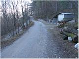
From the starting point, we continue on the macadam road which at first ascends gently through the forest. The forest soon changes into shrubbery, and the road, which slowly turns towards the right, brings us to the marked junction, where we continue on the right road in the direction of Stari tabor (left Lokev and Strmec). From the junction ahead we continue on a quite gently sloping road, and it soon brings us to the next junction.
We continue straight in the direction of the easier path to Stari tabor (left harder path), and it only a few meters ahead brings us to the Hudičkov spodmol rock shelter, which is only 30 meters distant from the path.
From the rock shelter ahead we walk for some time on the gently sloping road, and then we arrive at a smaller junction, where we continue on the right, somewhat worse road. At the next junction we go left, and then continue on a noticeably steeper road, from which soon to the right branches a path to the other rock shelter (Šprinčnca spodmol), to which it is a 5-minute walk. Higher the road ends, but we continue on the marked path, to which first from the right joins a less trodden path from Vilenica cave, and a little further also the path from Lokev village. At both junctions we continue left and then without difficulty arrive at the panoramic summit.

The trip can be extended to the following destinations: Stari tabor
Photos:
 1
1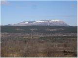 2
2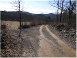 3
3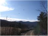 4
4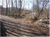 5
5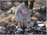 6
6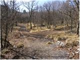 7
7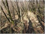 8
8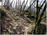 9
9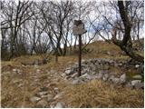 10
10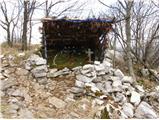 11
11 12
12
Discussion about the trip Povir - Stari tabor
|
| wolphgang21. 02. 2011 |
on Friday I was among other things also here and must admit it quite surprised me with wide views of the vast karst landscape
|
|
|
|
| Ingrid7911. 05. 2020 |
Very nice walk .. How close we have such beautiful nooks. Once I must also take the harder path.
|
|
|
|
| darinka44. 09. 2022 18:48:57 |
Very nice hike. We were there this afternoon with Maksij. Didn't meet anyone. Descended via the longer or easier path. On the way also went to Visok hrib. At the top there are rocks and stones. You won't get lost, because the entire path is marked.
|
|
|
To post a comment you must log in:
If you do not yet have a username, you must first
register.