Starting point: Preval (924 m)
| Latitude/Longitude: | 46,16960°N 14,19190°E |
| |
Walking time: 50 min
Difficulty: easy marked way
Elevation gain: 293 m
Elevation difference along the route: 293 m
Map: Škofjeloško in Cerkljansko hribovje 1:50.000
Recommended equipment (summer):
Recommended equipment (winter):
Views: 17.226
 | 4 people like this post |
Access to starting point:
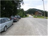
From Škofja Loka we drive towards Železniki or vice versa, but only to the village Praprotno, where signs for Stari vrh point us to the left (from the direction of Železniki after the village Bukovica we continue sharply right) on the road which brings us to the foot of the ski center Stari vrh. We continue on the asphalt road which a little further brings us to a junction, where we continue sharply left in the direction of the village Zapreval. From Zapreval we continue driving towards the village Javorje, but only to a smaller pass named Preval. Here we notice signs for guesthouse Stari vrh - right, and we continue left, where we park on a parking lot by the road.
Access is also possible from Poljanska dolina.
Route description:
From the starting point, we go on an ascending road in the direction of Gostišče Stari vrh. The road at first gently ascends by the edge of the ski track (in the summer meadow), then crosses a short strip of forest and then starts to ascend more steeply. This relatively steep road, from which a nice view opens up on the nearby Lubnik, we follow all the way to the mountain hut on Stari vrh.
From the mountain hut, we continue on a cart track which starts at the upper station of the six-seater chairlift Stari vrh. The cart track quickly goes into the forest, where it ascends for approximately 20 minutes, and then it brings us to a ski track, which we cross and along which we then ascend to a log cabin. Near the log cabin, we notice signs for a vantage point, which point us on a forest footpath which at first ascends to the forested Stari vrh, and then starts descending towards the vantage point, where there is also a stamp box.
Photos:
 1
1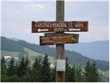 2
2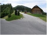 3
3 4
4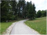 5
5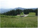 6
6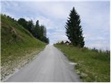 7
7 8
8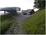 9
9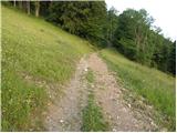 10
10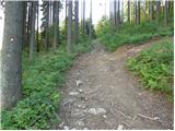 11
11 12
12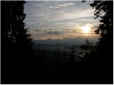 13
13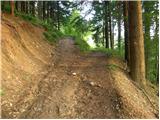 14
14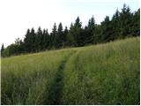 15
15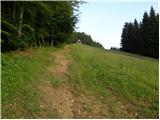 16
16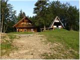 17
17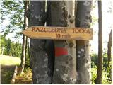 18
18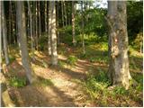 19
19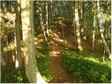 20
20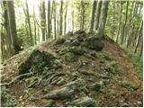 21
21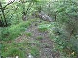 22
22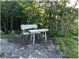 23
23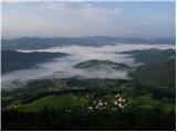 24
24
Discussion about the trip Preval - Stari vrh
|
| andrej jerina24. 12. 2008 |
Today on the pre-holiday day I went with skis from the lower cable car station via the upper station to the very top. I had hoped for nice views, but in the morning there were none, as all peaks were in fog, as was Stari vrh itself. The trail for hikers from the upper cable car station is well made along the left side of the ski slope to the very top. The descent itself was really a pleasure. LP Andrej
|
|
|
|
| štempilka2. 07. 2009 |
It's also very nice to go steeply from Podvrh. You reach a viewpoint. Very nice view of Blegoš. Everyone welcome. Best regards.
|
|
|
|
| donat3. 07. 2016 |
In the logbook box, it would be good to make 2 small holes at the bottom so that water or condensation can drain away. The logbook is completely wet and almost full.
|
|
|
To post a comment you must log in:
If you do not yet have a username, you must first
register.