Prtovč - Gladki vrh (Ratitovec) (via Po(v)den)
Starting point: Prtovč (1011 m)
| Latitude/Longitude: | 46,22750°N 14,11350°E |
| |
Route name: via Po(v)den
Walking time: 1 h 35 min
Difficulty: easy marked way
Elevation gain: 656 m
Elevation difference along the route: 656 m
Map: Škofjeloško in Cerkljansko hribovje 1:50.000
Recommended equipment (summer):
Recommended equipment (winter): ice axe, crampons
Views: 10.199
 | 1 person like this post |
Access to starting point:
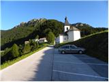
At first, we drive to Škofja Loka, and then we continue driving towards Železniki. In Železniki we come to a crossroad, where a road towards Kropa branches off to the right. Here we continue straight and follow the main road only about 100 meters and then signs for Prtovč point us to the right on an ascending road which we follow to a large parking lot near the church in the mentioned village.
Route description:
From the parking lot, we walk past the church and NOB monument to the beginning of the village, where we come to a well-marked crossroad. We continue left in the direction of Ratitovec over Po(v)den (slightly right Ratitovec over Razor) on the road which at first ascends past houses and then turns to the left and slightly descends. The road then changes into a wide cart track, that starts moderately ascending through the forest.
After approximately half an hour of walking, we step on the saddle Po(v)den, where there is also a well-marked junction. On the saddle, we continue right in the direction of Ratitovec, on at first gently sloping path, which ascends through a lane of raspberry bushes, and then passes into the forest, where it starts ascending steeper. The path higher flattens and brings us to a poorer forest road which we follow only some 10 m and then the blazes point us to the right on an increasingly steep footpath. The path soon passes out of the forest and brings us on steep grassy slopes (in snow great risk of slipping and avalanche), on which we ascend towards the right. Higher, the path past rocky towers brings us on the main ridge, where it turns sharply to the left and entirely flattens. There follows an easy and pleasant path, on which in 10 minutes of additional walking on a panoramic slope, we ascend to the mountain hut Krekova koča na Ratitovcu.
From the mountain hut, we continue straight on a somewhat steeper path in the direction of Gladki vrh. We then follow this increasingly panoramic path all the way to Gladki vrh, and we reach it after 5 minutes of additional walking.

Along the route: Po(v)den (1264m)
Photos:
 1
1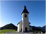 2
2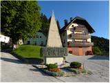 3
3 4
4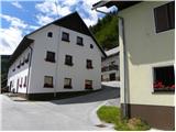 5
5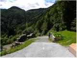 6
6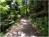 7
7 8
8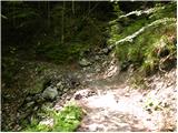 9
9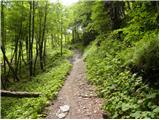 10
10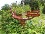 11
11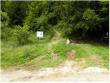 12
12 13
13 14
14 15
15 16
16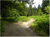 17
17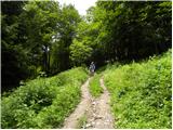 18
18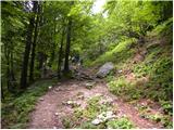 19
19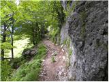 20
20 21
21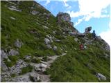 22
22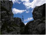 23
23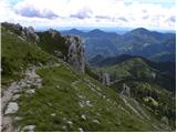 24
24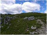 25
25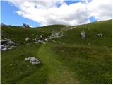 26
26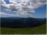 27
27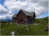 28
28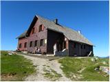 29
29 30
30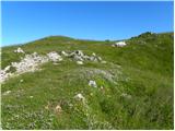 31
31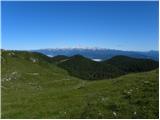 32
32 33
33
Discussion about the trip Prtovč - Gladki vrh (Ratitovec) (via Po(v)den)
|
| POLONA ROB26. 12. 2015 |
Hello,
Today, 26.12., on the path from Ratitovec to Prtovč, Senčna pot, Povden path, we lost a black camera in a black bag.
Please have the finder call 041/873 341. Thank you.
Senčna pot, the upper part is icy, crampons are mandatory.
Best regards
|
|
|
|
| PV23. 04. 2018 |
Please for information, is it possible to drive by car to Povden saddle and park there? Good 650 elevation meters from Prtovč would be a bit too much for our little one.
|
|
|
|
| Daaam23. 04. 2018 |
In principle yes, if you have a decent off-roader.. or park where it goes.. (from Torka direction). Or also past the hunting hut further.. again until you don't want to risk the car.. all these roads are forest roads so condition depends on weather... and working foresters 
|
|
|
|
| PV24. 04. 2018 |
Thanks. Very useful.
|
|
|
|
| borutd3. 01. 2020 |
Today 3.1.2020 I ascended Ratitovec via Povden and descended via Razor. The path via Povden is almost completely snow-free, the descent via Razor was on a frozen path down to 1200m.
|
|
|
To post a comment you must log in:
If you do not yet have a username, you must first
register.