Rakitna (Rakiško jezero) - Rakitna (Forest and archaeological learning trail Rimski zid - Rakitna)
Starting point: Rakitna (Rakiško jezero) (789 m)
Starting point Lat/Lon: 45.8872°N 14.4321°E 
Path name: Forest and archaeological learning trail Rimski zid - Rakitna
Time of walking: 1 h
Difficulty: easy marked way
Difficulty of skiing: no data
Altitude difference: 0 m
Altitude difference (by path): 75 m
Map: Ljubljana - okolica 1:50.000
Access to starting point:
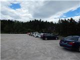
A) From highway Ljubljana - Koper we go to the exit Brezovica, and then we continue driving in the direction Podpeč (to Podpeč we can also come from Črna vas or Ig). In Podpeč we continue in the direction of Borovnica, Krim and Rakitna and continue driving for a short time by the edge of Ljubljana marshes, and then signs for Rakitna point us to the left on a steep ascending road. The road then leads us through Preserje, where it also starts descending. After a short descent, we continue left in the direction of Krim and Rakitna, and then we follow mostly ascending road to Rakitna (after the turn-off for Krim the road starts descending), where on a parking lot by lake Rakiško jezero we park (parking lot is payable).
B) First, we drive to Cerknica, and then we continue driving in the direction of Begunje, when we get to Begunje we follow the signs for Rakitna. When we get to Rakitna we park on a parking lot by lake Rakiško jezero (parking lot is payable).
Path description:
Forest and archaeological learning trail Rimski zid - Rakitna starts on the eastern side of the lake, or there where there is access to Hotel Rakitna. At the beginning of the path stands an information board, where there is a map with all 22 learning boards. We at first walk by the lake, where we already notice first blazes, and the path quickly passes on the south side of the lake, where we at first cross wetland, and then we walk to an asphalt road which we follow to the left. On the road, we walk only for a short time, and then at the left turn we continue slightly right on a cart track, on which continues the learning path. We continue by the right edge of a meadow, in a gentle ascent, we quickly get to the information board number 6, where the path splits into two parts.
We continue left on the upper edge of a meadow, and when we step into the forest footpath again appears. Through the forest, we at first moderately ascend, and then we step on the next meadow, where the footpath starts vanishing. The path at first turns left, where leads us past the bench, and then slowly in a semicircle starts turning right. On this part it is a little hard to follow the real path, but if we carefully follow on map drawn path and occasional blazes, we will go correctly. When the path becomes again easier to follow, it leads past a boulder and then through another meadow to learning board number 10, after which we go in the forest. Through the forest, we for a short time considerably ascend, and then the path turns right and past boards with numbers 11 to 13 brings us to "animal traces" in concrete. A little further, we reach the macadam road which we follow to the left, and we walk there to the left turn. From the mentioned turn at the board number 15 we continue straight on a cart track, on which usually runs a smaller stream and from there already after few steps we go left into the forest. Through the forest, we are few minutes relatively steeply ascending, and when the path flattens, blazes point us to the right, where we quickly get to board number 17 (Schengen system from 3rd century). Here the path at first turns left and then semicircular turns to the right and it brings us on a cart track, on which usually runs a stream. On the mentioned cart track we descend back to the board number 15, where we step on the road, on which we already walked, and we walk there all the way to the spot, where in the direction "upwards" we reach the road, and then on a footpath to the board number 14, where behind the bench we turn left and we descend to a meadow at the board number 6, from where on "ascent route" we descend back to the starting point.
Description and pictures refer to a condition in the year 2016 (July).
Pictures:
 1
1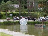 2
2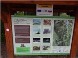 3
3 4
4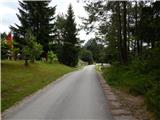 5
5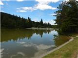 6
6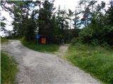 7
7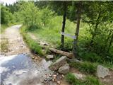 8
8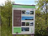 9
9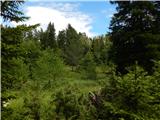 10
10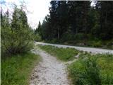 11
11 12
12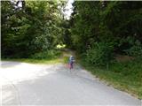 13
13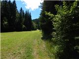 14
14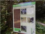 15
15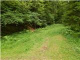 16
16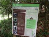 17
17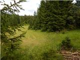 18
18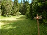 19
19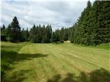 20
20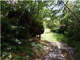 21
21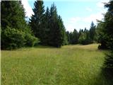 22
22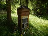 23
23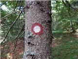 24
24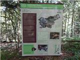 25
25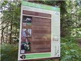 26
26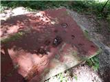 27
27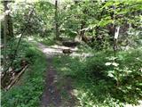 28
28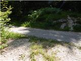 29
29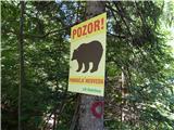 30
30 31
31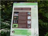 32
32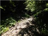 33
33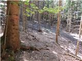 34
34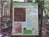 35
35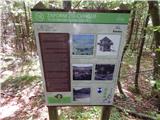 36
36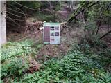 37
37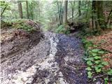 38
38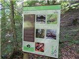 39
39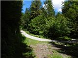 40
40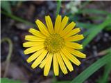 41
41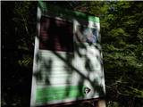 42
42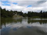 43
43