Rakitna - Županov vrh (east path)
Starting point: Rakitna (789 m)
| Latitude/Longitude: | 45,89070°N 14,43970°E |
| |
Route name: east path
Walking time: 35 min
Difficulty: easy unmarked way
Elevation gain: 210 m
Elevation difference along the route: 210 m
Map: Ljubljana - okolica 1:50.000
Recommended equipment (summer):
Recommended equipment (winter):
Views: 5.959
 | 1 person like this post |
Access to starting point:
A) From the highway Ljubljana - Koper we go to the exit Brezovica, and then we continue driving in the direction of Podpeči (to Podpeči we can also come from Črna vas or Ig). In Podpeči we continue in the direction of Borovnica, Krim and Rakitna and continue driving for a short time along the edge of the Ljubljana Marshes, and then signs for Rakitna point us to the left on a steep ascending road. The road then leads us through Preserje, where it also starts descending. After a short descent, we continue left in the direction of Krim and Rakitna, and we follow the mostly ascending road to Rakitna (after the turn-off for Krim the road starts descending), where we park on a parking lot at the church.
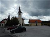
B) First, we drive to Cerknica, and then we continue driving in the direction of Begunje; when we get to Begunje we follow the signs for Rakitna. When we get to Rakitna we park on a parking lot by the parish church on Rakitna.
Route description:
From the parking lot, we go on a marked path or at first road in the direction of Krim, Dom v Iškem Vintgarju, farms Benko and Ustje, Vrbice and village Osredek. The road at first leads past the chapel, Mercator store, and after a short ascent, it brings us to the spot, where the road branches off to the left towards the nearby snack bar Okrepčevalnica Krimček, and we go a little to the right and we still continue on a marked road. The road then leads us past some more pastures and houses, and then splits into two parts.
We continue left upwards (right leads the road towards health resort MKZ Rakitna) on the road which after a short ascent again splits. This time we continue straight in the direction of Krim (right partisan hospital Krvavice and Iški Vintgar) on a worse macadam road which is becoming a little steeper. The marked path soon turns right (left west path on Županov vrh) and for a few minutes it continues on a cart track. After the nearby turning point the cart track passes into a wide mountain path, which is diagonally ascending towards the saddle between Županov vrh and Rotovc. And by the path which is all the time moderately steep, we notice a larger number of marks of a learning trail. Some 10 steps before the saddle, where there is also a marked crossing, at the crossing of cart tracks we continue left on a relatively new unmarked cart track. The mentioned cart track further ascends towards the left and then it quite quickly splits into two parts. We continue on the right worse cart track (cart track which continues straight a little further ends), which ascends a little steeper. When higher the cart track at the electric fence flattens, we leave it and we continue left through the electric fence, behind which we soon step out of the forest. Next follows only a short walk with nice views to antennas on Županov vrh.
Description and pictures refer to a condition in the year 2014 (August).

The trip can be extended to the following destinations: Rotovc
Photos:
 1
1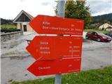 2
2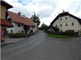 3
3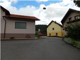 4
4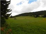 5
5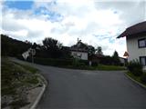 6
6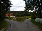 7
7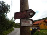 8
8 9
9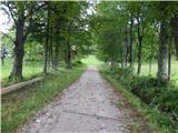 10
10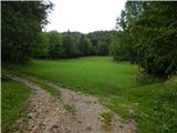 11
11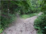 12
12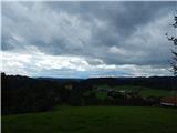 13
13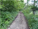 14
14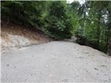 15
15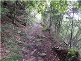 16
16 17
17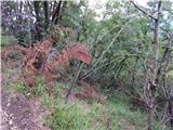 18
18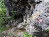 19
19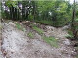 20
20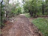 21
21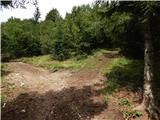 22
22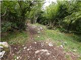 23
23 24
24 25
25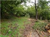 26
26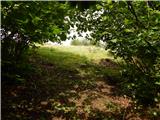 27
27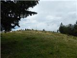 28
28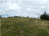 29
29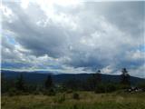 30
30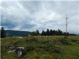 31
31
Discussion about the trip Rakitna - Županov vrh (east path)
|
| grega_p11. 06. 2015 |
Interesting that this trip still has no comments.
Nice short trip near the capital, where there is no crowd of hikers (at least on the section from the junction to the top) and where you can admire interesting views of the Notranjska hills and the church of Sv. Lenart above Krvava Peč. To the north you can see something too, but the trees are steadily growing.
Nice to discover new paths.
|
|
|
|
| milenula28. 01. 2021 |
Winter variant of a walk through snow and beautiful weather, while there is fog in the valleys. The excursion can be extended along the entire ridge to the road on Krim and return via another path running a little lower below the summit. Views fantastic, all hills from KSA to Karavanke and Julian Alps as on the palm. The hill is a fantastic viewpoint!
|
|
|
To post a comment you must log in:
If you do not yet have a username, you must first
register.