Ravenska Kočna - Jezerska Kočna (past the cableway and on Kremžarjeva pot)
Starting point: Ravenska Kočna (1000 m)
| Latitude/Longitude: | 46,38500°N 14,53640°E |
| |
Route name: past the cableway and on Kremžarjeva pot
Walking time: 5 h
Difficulty: very difficult marked way
Elevation gain: 1540 m
Elevation difference along the route: 1540 m
Map: Kamniško Savinjske Alpe 1:50.000
Recommended equipment (summer): helmet, self belay set
Recommended equipment (winter): helmet, self belay set, ice axe, crampons
Views: 145.961
 | 14 people like this post |
Access to starting point:
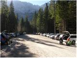
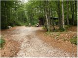
From the Ljubljana–Jesenice highway, take the Kranj–East exit and follow the road ahead in the direction of Jezersko. In Zgornje Jezersko, just a little behind the gas station, we will notice a road which branches off to the right from the main road (direction Planšarsko jezero). The road then leads us past the mentioned lake and behind it for a short time steeply ascends. Higher, the road flattens and at the beginning of a large meadow loses the asphalt covering. We then follow the macadam road to a larger marked parking lot.
Route description:
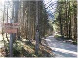
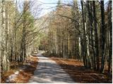
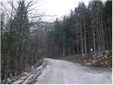
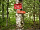
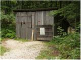
From the parking lot, we continue on a macadam road following the signs »Češka koča, Ledine« and after approximately 15 minutes of walking, we come to a cargo cableway.
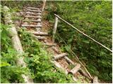
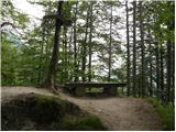
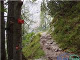
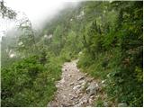
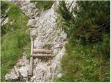
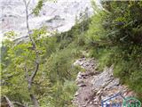
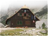
At the cableway, the path goes behind the bottom station of the cableway in the direction of the mountain hut Češka koča and at first gently ascends on a wide path, which in a few minutes brings us to a bigger clearing. The path over this clearing is usually quite muddy, therefore be careful. After 20 minutes of walking, the path brings us to an indistinct small ridge, where there is a bench. The path then continues through the forest and after a further 20 minutes brings us to a crossing, where from the right the path from a meadow (lower starting point) joins. We continue left and already after a few further steps we get to the next crossing, where from the right the path from Makekove Kočne (neighbouring valley) joins. After that, the path out of the forest passes to scenic slopes, where with the help of some steel cables and a ladder we ascend towards the mountain hut Češka koča (Hudičevi klanci). This part of the path in dry is not difficult and does not pose a greater risk (more caution is needed in late autumn, when the gullies are iced over and in the winter, when there is snow). The path then flattens and brings us to Mrzla dolina (1500m), where cold air often lingers. Next follows only a good 5 minutes long moderate ascent and the path brings us to the mountain hut Češka koča na Spodnjih Ravneh.
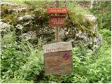
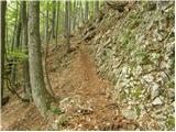
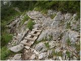
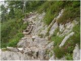
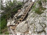
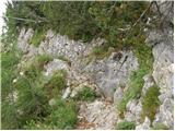
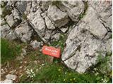
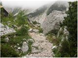
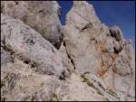
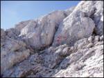
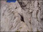
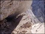
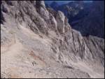
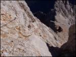
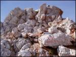
From the mountain hut, we continue right on the path in the direction of Kočna, Grintovec and Vratca (left mountain hut Kranjska koča through Žrelo). After a short ascent, we come to flat ground with sign H (intended for helicopter landing). The path ahead runs on initially gentle scree, which is partly overgrown with dwarf pines. In the lower part of the scree, the path to Vratca branches off to the right, and we continue straight in the direction of Kočna and Grintovec. After approximately half an hour of walking from the hut, we come to the next crossing. We continue right in the direction of Kočna (left Grintovec over Mlinarsko sedlo) and continue ascending on partly overgrown scree to Zgornje Ravne. On Zgornje Ravne the path turns sharply right and ascends over the scree. Higher, the path, which continues turning right, brings us to a side ridge of the central Grintovci. Here a nice view opens up towards the north, where we clearly see most of the peaks that surround Jezersko. Here, where we turn sharply left, the climbing part of the path starts. A well secured and in dry not too demanding climbing path with nice views and past a natural window, which we will notice on the right side, after almost three hours of walking from Češka koča brings us to the main ridge of Grintovci (Zdolška škrbina), where there is a crossing. We continue sharply right in the direction of Jezerska Kočna (left Grintovec, straight Cojzova koča) on the path which quickly brings us to one of the most interesting passages in Slovenian mountains. The path brings us to a potbellied passage through which we have to crawl. The ceiling above us is so low that otherwise it is not possible (watch your head). The path ahead passes to a short scree after which we step onto a steeper path, where some pitons and steel cables assist us. We then follow this increasingly panoramic path to the slightly spacious summit.
Ravenska Kočna - Češka koča 1:30, Češka koča - Zdolška škrbina 2:45, Zdolška škrbina - Vrh 45 minutes.

The trip can be extended to the following destinations: Kokrska Kočna
Photos:
 1
 2
 3
 4
 5
 6
 7
 8
 9
 10
 11
 12
 13
 14
 15
 16
 17
 18
 19
 20
 21
 22
 23
 24
 25
 26
 27
 28
 29
 30
 31
 32
 33
 34
 35
 36
 37
 38
 39
 40
 41
 42
 43
 44
 45
 46
 47
Discussion about the trip Ravenska Kočna - Jezerska Kočna (past the cableway and on Kremžarjeva pot)
Show older messages
|
| vasja30. 09. 2006 |
I fully agree with the description. It's one of the most beautiful and ingeniously laid out paths we have. It's exposed but in dry conditions it's really not dangerous at all. The safety gear is just right.
|
|
|
|
| Damijan1. 10. 2006 |
The path to Jezerska Kočna is extremely interesting and fun, especially the part where you have to crawl on your belly, it's insanely good. Recommended!
|
|
|
|
| John26. 05. 2007 |
On Thursday 25.5.07 my colleague and I set off for Kočna (via Češka koča). We followed the markings and then our "problem" appeared. The marked path we followed did not lead us to the pot-bellied passage. It seemed to me as if we were crawling along the marked path directly towards the summit.. the marked path suddenly ended, the markings only continued downhill. Is it possible that this "pot-bellied passage" was still snow-covered and simply couldn't be noticed?
|
|
|
|
| Jenny P.3. 07. 2007 |
On Saturday I have this path planned. I'm interested if, assuming good weather, the path is too dangerous to set off on it without a self-belay kit? What about the direct path from Kočna to Grintovec then? Is it demanding?
|
|
|
|
| Gost4. 07. 2007 |
When I went on this path I didn't see anyone with a self-belay kit. A helmet is quite necessary though.
|
|
|
|
| Gost9. 07. 2007 |
THE PATH IS EXTREMELY WELL MARKED. THERE ARE PLENTY OF MARKINGS. ALL THANKS TO PD JEZERSKO.
|
|
|
|
| Gost14. 07. 2007 |
I went via Cojzova koča via ovnova čeri. The path is catastrophic...at the beginning there isn't even a single peg or steel cable. The path is very demanding especially when you have to climb crumbly walls. Above all, the scree destroys you, which covers about a third of the path. HELMET MANDATORY! NOT RECOMMENDED FOR BEGINNERS.
|
|
|
|
| fpetel130. 07. 2007 |
I'm wondering whether I'd choose the path from Česka koča to Kočna or rather from the Kokra valley via Grdi graben? On Friday I went from Mrzli dol to Križ, and I'm interested in a comparison with the path to Kočna (Kremžarjeva) from the north.
|
|
|
|
| Gost12. 08. 2007 |
The path from the Czech hut is excellently secured and marked, dangerous and difficult but exceptionally beautiful for that reason
|
|
|
|
| Gost19. 08. 2007 |
dr pika
On 01 September my son and I plan to climb Jezerska Kočna. We have already decided to start at the lower station of the cargo cableway. I'm just wondering if the paths are accurately marked, because the predecessor in the May hike mentioned that he and his colleague missed it!
|
|
|
|
| John25. 08. 2007 |
Hello dr pika!
The path to Jezerska Kočna is very well marked, also further to Kokrsko Kočna, although the path to Kokrsko seems a bit more "dangerous" to me and the first part unsecured with cables where they would be needed... but with concentration and care nothing bad happens. Yes, it's true that my colleague and I on the May ascent "missed" the path.. well actually we didn't, a marked descent downwards confused us so we gave up and descended back to Češko koča. That was a very smart decision, because then there was a bad thunderstorm... luck in misfortune so to speak. Best regards
|
|
|
|
| Gost31. 08. 2007 |
D.J.
Is the path from Kokra comparable in difficulty to the path to Jalovec via the notch !!
|
|
|
|
| Tadej31. 08. 2007 |
Personally, the path to Kočna is easier than the one to Jalovec. Best regards
|
|
|
|
| Gost15. 10. 2007 |
Very easy. To the top in 3 hours
|
|
|
|
| jamesjoyce8. 11. 2007 |
With a friend we went on 4.11. from Češka koča to Jez. Kočna. To the base of the wall we saw a somewhat old track probably of one single hiker. In the walls everything was snowy and we ourselves blazed the trail approx. 200 vertical meters. Then we stopped, it was already too dangerous, and we don't have winter experience yet. In places in the wall there is half a meter of snow and ice, you need to have winter experience and knowledge.
|
|
|
|
| Gost9. 11. 2007 |
At this time from the Jezerska side the path is very dangerous, suitable for hikers with mountaineering knowledge and winter experience. On Ravne it's lively even in winter, so don't let individual tracks confuse you. However, we like to check our route even in winter. But there's always something new, and you don't always have to step on the top, just enjoy nature, cheers!!!
|
|
|
|
| velkavrh2. 07. 2008 |
Brane V. Today went to Jezerska Kočna from Kokrska Kočna. To Kokrska Kočna from Kokra from Suhadolnik via Taška, Grdi graben, bivouac below Kokrska Kočna. Returned via screes and gravel which bring you below the bivouac. Paths are equipped with signs and marked. This approach is however relatively long - 4 hours and demanding and little used.
|
|
|
|
| Mikič16. 07. 2008 |
Is there still any dangerous snow on this path?
|
|
|
|
| fpetel131. 08. 2008 |
Personally, I think the path from Češka koča to the summit is easier than the one to Grintovec via Mlinarsko sedlo. All difficult sections are secured. We must be careful mainly due to the high friability of the rock and a lot of scree on the path. Otherwise, it's a fantastic path - my girlfriend and I saw chamois that posed and we could take pictures with them.
|
|
|
|
| grahlck7. 11. 2008 |
Is the path very exposed? Thanks
|
|
|
|
| Klin8. 11. 2008 |
Not really. The difficult sections are well secured.
But you're too late for this year. snow is coming
|
|
|
|
| grahlck8. 11. 2008 |
I'm asking for next year. Thanks.
|
|
|
|
| grahlck22. 12. 2008 |
One more thing I'm interested in. What's the road like to the lower station of the cable car in Ravenska Kočna? Is it very rough? Can you get there with a regular car?
|
|
|
|
| Tadej22. 12. 2008 |
When the road is clear you can reach the lower cable car station without problems. Only at the place where the road crosses the torrent more caution is needed.
|
|
|
|
| klemo19. 05. 2009 |
Which of the four trails is the least dangerous. I still lack Kočna for the complete transfenzalo
|
|
|
|
| igva20. 05. 2009 |
The least dangerous is from Suhadolnik via Dolce and Zdolška škrbina, but in my opinion this trail to the saddle is also the most boring especially uphill. In general though, no approach to Kočna can be called safe. Klemo if you only lack Kočna in the tranzenzal, then given the difficulty of the other mountains you can choose any route to the top.
|
|
|
|
| klemo29. 06. 2009 |
And does anyone know if there's still any snow on the above-mentioned path?
|
|
|
|
| viharnik29. 06. 2009 |
Snowfields on Kremžarjeva path to Kočna definitely are there. The path was hiked this year by the caretaker of Češka koča only with trekking poles, which I advise against for everyone else!
|
|
|
|
| mirccar11. 08. 2009 |
My wife and I plan to go to Jezerska Kočna via Kremžarjeva pot this weekend, so I'm wondering if anyone can tell me whether a via ferrata kit is needed for this path?
|
|
|
|
| John11. 08. 2009 |
Mirrcar, regarding the via ferrata kit it is recommended, you can see that on this forum or on this page too. Personally I didn't use it and it went without problems. Caution, concentration and physical fitness are self-evident anyway.
|
|
|
|
| NEIC00818. 08. 2009 |
Is there no way to avoid the so-called "belly passage"? What about the path from Kokr. Kočna to Jezersko?? Difficulty? Protection?
Thanks!
|
|
|
|
| nata2418. 08. 2009 |
The Belly Passage is not particularly difficult, you just push your backpack in front of you and crawl through. From Kokrska to Jezerska Kočna it's a bit of climbing, but there are enough fixed protections, so no panic.
Best regards, Nataša
|
|
|
|
| John18. 08. 2009 |
NO WORRIES, if you follow the markers you definitely won't be walking through that scree
|
|
|
|
| NEIC00822. 07. 2010 |
Finally did this tour too. Interesting path (left-right, up-down etc.). We could significantly shorten the tour if someone made a direct path from the end of the scree to the top, instead of first right then a bit down, a bit up, a bit left..
The belly passage is not for the bellied, so only skinny ones can reach the top of J. Kočna.
P.S.
On the way back, not far from the Czech hut, found a student ID. If someone misses it, send PM.
|
|
|
|
| andrej7812. 08. 2010 |
Yesterday my colleague and I set off on this path to Kočna. I should mention that I was surprised by the poor protection on certain sections of the path, there are indeed many sections where you have to climb without protection up to grade 2 difficulty. Kočna is definitely a mountain that demands respect and is not for inexperienced hikers, it seems to me even more demanding than the Kopiščar path to Prisojnik and is in the range of the Bamberg path to Triglav.
On the descent we used a very nice scree slope and a snow patch below, where we saved almost an hour of path, so we completed the ascent and descent in under 8 hours, at a moderate pace.
Regards, Andrej
|
|
|
|
| mosovnik12. 08. 2010 |
Andrej78: with all due respect, but on the mentioned marked and secured path nowhere even remotely can you talk about any climbing of grade II. The path is well secured (walked it last autumn) and if you're not "from the couch" (excuse me), better not evaluate the matter in terms of the grade of alpinistic ascent/difficulty, so as not to mislead someone unnecessarily who would like to visit this western beauty of KSA.:
|
|
|
|
| Skuta13. 09. 2010 |
With this route we really cannot talk about any alpinistic feat. The path is excellently secured, beautiful and exciting. Caution is never superfluous anywhere and never in the mountains. And best regards
|
|
|
|
| NEIC00813. 09. 2010 |
he he then I am a climber-alpinist.. Super, so I climbed 2nd degree of difficulty.. Bravo me..
P.S.
If we were joking, of course.. There is none of that on this path..
|
|
|
|
| Fiona24. 04. 2011 |
Kočna is one of my favorite Slovenian mountains, which has completely thrilled me, addicted me and won my heart.
This year I'm counting on it again
|
|
|
|
| gasperv3. 07. 2011 |
Hiked the path today. No issues. Dry overall.
Continued to Kokrska Kočna then returned via Kremžarjeva to start. Nice weather. Clouds played tricks, view suffered at times...
|
|
|
|
| klemenmon10. 07. 2011 |
Was on Kočna. Interesting, fairly strenuous hike. A gentleman with crutches came to the summit behind me. Unbelievable! 
|
|
|
|
| cjendaw11. 07. 2011 |
Does anyone have info on the condition of the trail via Frischaufova pot? Regarding snow and fixed protections?
|
|
|
|
| mailman13. 08. 2011 |
Today I chose this Jezerska Kočna. The weather wasn't as forecasted, but maybe that's even better. Less thirst anyway, and the views still very nice.
|
|
|
|
| garmont16. 08. 2011 |
The Kremžarjeva pot walked today will remain in my memory for the pot-bellied passage unmatched in our mountains. Everything has already been said about the genius of natural passages. No doubt, the path is par excellence.
Regards
|
|
|
|
| Janiel745. 09. 2011 |
Yesterday on this trail It really is an extremely interesting varied trail, but as a novice hiker I miscalculated drinking and eating But managed anyway!
|
|
|
|
| matz13. 09. 2011 |
Please for some more opinions on how dangerous this path is - can one self-belay on all the more dangerous/exposed sections? How does it compare to the Slovenian path to Mangart?
|
|
|
|
| mici526. 09. 2011 |
At the beginning of September we set off along Kremžarjeva pot to Kočna. Given that it's widely talked about how hikers should be properly equipped: helmet, via ferrata set, gloves and psychophysical condition and, of course, enough liquid, the ascent didn't worry me. We had everything expected of a hiker.
But I have to admit that I am very disappointed with Kremžarjeva pot to Kočna.
The trail is NOT well secured and at some-very exposed places-it is completely without any aids for the hiker. Since this is a very
demanding-possibly exposed in places hiking, marked and (as written) secured trail, one would expect it to be really so. But I cannot confirm that. A hiker cannot even use their equipment - even if they have it. At many places there's nothing to hold onto, nothing to step on.
I'm not surprised that there are more accidents in the mountains than years ago.
Hiking trails in our mountains need to be secured so that a fit and properly equipped hiker in good weather conditions can manage them - lacking cables, lacking pegs and lacking steps. This applies also to Kremžarjeva pot to Kočna.
And not to forget to mention one thing about parents,
who drag children to Kočna and then ask them how they would rate the difficulty of the trail they walked. I strongly condemn such parents and ask if they are of sound mind.
I'm a bit worried that popularity with such types outweighs all dangers in the mountains. Thank God it works for them - for now. About the fact that their children's lives are too precious to gamble with, they think about it after they manage to get down, if they think at all. I'm afraid that for them trophy boasting about ascents they do with their own or neighbors' children to dangerous and poorly equipped summits is more important - than the sensible judgment of a responsible parent.
So - Kočna is still waiting for me. And without doubt I will conquer it too - some fine day...
|
|
|
|
| Keko26. 09. 2011 |
Reading your thoughts on protecting mountain trails, Mici5, I got the feeling that you use the Kremžarjeva path as your commute to work, and since you have to use this path, it should in your opinion be better secured so nothing happens to you while rushing to work.
I think the paths in our mountains are quite exemplarily secured. You have excellently secured paths, exemplarily secured paths, and also very poorly secured paths available. Every mountaineer chooses paths they are up to. If you're not up to certain ones, you just choose easier ones. In the internet age, there is plenty of information online about paths, so there shouldn't be major surprises. If the Kremžarjeva path were much better secured, it would be much easier as a result, there would be many more hikers on it, even with less experience than you have. A mom with a 6-month-old baby would soon claim that the Kremžarjeva path is too narrow for her stroller and dangerous because the stroller with the child could plunge into the abyss.
Please don't push into the mountains because you can fall and get injured. No hard feelings.
|
|
|
|
| ljubitelj gora26. 09. 2011 |
Our paths are very well secured and well taken care of.
|
|
|
|
| nevi27. 09. 2011 |
I agree with Primož, but I also understand Mici. I think the Kremžarjeva path is too often described as excellently secured. This is particularly emphasized and you really get the impression that anyone can go on it. It is well secured and beautifully routed, but not better than most paths in our mountains. There is at least one spot on it where it would be good to install a cable. Right there I met a guy who was fully equipped and theoretically knowledgeable, but lacked mileage. He was angry at those who write that the path is so heavily secured.
|
|
|
|
| Sam.volk27. 09. 2011 |
The Kremžarjeva path should remain as it is. That's my opinion. Regards
|
|
|
|
| dprapr27. 09. 2011 |
I think the main problem is that people walk our mountain paths with via ferrata gear. Actually, these aren't via ferratas at all and then they have nowhere to "clip in". All that's missing is to carve steps everywhere and fence paths with cables. In the past, on mountaineering and alpine courses, they taught us not to bite off more than we can chew, but to approach things gradually. Now most want to go straight to difficult paths and preferably to pathless summits.
|
|
|
|
| metod27. 09. 2011 |
Our paths are sufficiently secured, one just has to know how to set one's own limits and when they come, turn back and descend safely, even if the summit is not reached. Mici5 did this wisely. Regarding children, it's more complex because parents have to decide for them, even though they don't fully know their limits. Therefore, both need even more experience before venturing into demanding climbing paths.
Descriptions and ratings of "security"
of individual paths are completely subjective. Every rating includes a whole bunch of criteria (exposed, technical difficulty, friability, slipperiness, etc.), which we perceive and tolerate differently. Therefore again: when you reach your limit, you have to know how to turn back and say goodbye to the summit. It's not about honor, but we prove maturity with that.
But I would emphasize once again: I really don't want to have railways in Slovenian mountains.
|
|
|
|
| garmont27. 09. 2011 |
Mici, what did you understand by the label "very demanding path"? On such paths, you actually need to use your hands at larger sections, protections are not necessary (if there are enough natural holds). On the Kremžarjeva path there are quite a few such places and, if you imagined that the steel cable would be stretched from the start of the wall to the top, you were mistaken. Obviously, it's the mileage that's missing for you (you obviously have enough gear), but once again it showed that gear alone is not enough, experience is needed. From the beginning best in company (of course, if you're not a "mountain lover"), preferably with an experienced mountaineer who has already walked such a demanding path.
Best regards
|
|
|
|
| joža x27. 09. 2011 |
When you have enough mountain mileage, you won't need a self-belay set, "psycho-conditioner" etc. on the Kremžarjeva path.. protections will mostly be superfluous for you, in mountains gradual progression is very important, e.g. jumping to Boč and then Kremžarjeva, no, you need to hike A LOT in between.
|
|
|
|
| urbancek27. 09. 2011 |
Well on this path I don't know what you're looking for with the full kit... OK, at the beginning you can clip in a bit if you're unsure/dizzy, then it's soon over...
|
|
|
|
| matz27. 09. 2011 |
Let me join the debate too, because I encountered a similar "problem" on the path to Koroška Rinka. Let me emphasize that I agree with most things written - that entire paths can't be railed, that the security rating is subjective, that the feeling of (in)security depends on mileage, that gradual progression is necessary, that one must know how to turn back etc.
But I think nevi highlighted the problem best - about many paths on this forum (and elsewhere) it's written that it's impeccably secured, tons of iron, cable from bottom to top etc. and one really gets the feeling that one can belay everywhere on more demanding sections. Reality is often very different and especially those of us who have just started venturing into very demanding "secured" paths can be quickly misled, and I myself have been angry at people who love to use words like impeccable or excellently secured.
Let me emphasize that 2 years ago I didn't even think I'd ever walk very demanding paths. After many summited peaks I felt the need for more, got gear, read some literature, trained first on Grmada and Gradiška tour (where demanding parts are actually secured) and started looking for paths that would be the next step - here the above described problem appears - almost any path you read everyone writes about almost brilliantly secured paths, but the difference in practice is huge and here I miss quality path descriptions from the perspective of the above criteria - exposure, technical difficulty, security, objective danger etc. Quite a lot of this info is in the book 55 secured climbing paths, but even there I miss a more detailed description of the security itself, which plays a big role for me at least. I believe that even (or especially) very experienced hikers with huge mileage can put themselves in the shoes of less experienced ones and warn them of possible problems or more demanding/dangerous/unsecured sections of the path (even if they themselves had no issues there).
Don't forget that you were all at this point once, thanks for understanding.
|
|
|
|
| jax27. 09. 2011 |
Well, I'll add something on this topic since I'm in the mood anyway. About Kremžarjeva, I haven't gone that way yet, but I can tell some general things.
First, I'd like to comment on the remark that we're now in the internet age and everyone can find enough information about paths anyway. That's only partially true. The internet offers such scattered data and lack of responsibility that it can cause more harm than good for less experienced hikers. So on hribi.net, you can find comments recommending a belay (not self-belaying!) on Prisojnikov greben, as well as those claiming that the Italian ferrata on Mangart is nothing special. It's clear that all such statements should be taken with a grain of salt, and a guidebook is still much more reliable for solid information than the internet (which is great for current conditions!). Well, part of the reason for this confusion is also the useless path classification, where any path that requires a bit of climbing is already quite difficult. Then big differences appear between them.
Second, what I'd like to say is on the topic of difficulty and protection. The fact is that this year I went to the mountains several times more after a long break, and I have to say that it happened to me several times that I had the biggest problems on the path where I didn't expect them according to the description. Two examples: the aforementioned Prisojnikov greben. Ferrata from the window to the ridge: easy. A few nice, fun passages, somewhat exposed, always super protected. Pleasure. But in no description did I find the totally scree-covered descent into the notch somewhere halfway up the ridge. There - scree-covered slabs, exposed descent, unprotected. As far as I'm concerned, it's clear where I had more trouble. And this wasn't in any description. Second example: Korenova on Krn. First half - western drežniška - protected only exceptionally, extremely slippery passages over steep grass, where every step potentially means slipping, and the path is extremely narrow. Often unpleasant, psychologically demanding, difficult. The Korenova itself - pure pleasure. Super protected, nice climbing, the closer to the top, the bigger the smile. Ladders? Same as climbing a cherry tree at home. Again - the part defined as difficult seemed great to me, but I had trouble on the "easier" part. And I understand micijin's post and the reactions to it in this light. I believe the path is super protected. But on every path there are places that aren't. And there a person (or at least me) has even more trouble, especially if, as is the rule here, scree is added. Even if they are perhaps technically "easier". By the way, this is also the reason why I'm skeptical about self-belaying in the mountains, except on extremely difficult paths. Simply, I think that in Slovenian mountains, the trickiest spots are often those where nothing helps at all, and this even on protected paths.
Finally, one more thought: when protecting, in my opinion (at least on some paths), you also need to consider descent. And it's clear that in ascent you can climb over many things even without protections. But the question is whether the cable that seems completely unnecessary in ascent would be the same when descending along it. That's why I think this should also be considered when equipping paths.
That's all from me, sorry for the off-topic, have a nice evening and next day everyone. And by the way, if anyone is going to Grintovec tomorrow, we might meet...
|
|
|
|
| Keko28. 09. 2011 |
Since I see that quite a debate has ignited about path protection in the mountains, info on the net, mountain guidebooks, etc., I'll share some of my experiences with these matters too.
Until this year, I visited the mountains more occasionally and mainly easier paths. This spring, however, a kind of breakthrough happened, caused by an acquaintance, a mountain guide. He invited a couple of us to climb Gonžarjeva peč. My wife and I joined, and so we did that climbing. Since the guide additionally belayed each of us with a rope from above despite the belay set, the climbing or rather pulling on the rope was safe and really pure pleasure without present fear.
After this experience, I got the guidebook 55 Secured Paths by Mašera and studied the paths described in it. With my wife, we started with easier tours and continued with harder ones: Brana, Peca via climbing, Raduha via climbing, Storžič through the gully, Montaž via Pipanova ladder, Mala Mojstrovka via Hanzova, Prisank via Kopiščarjeva, Ceria-Merlone path in Italy, and finally Bočičev vrh in Železna Kapla. So it doesn't seem irresponsible, let me say that the last two paths were under the watchful eye of a qualified guide. And now a comparison of these paths from my perspective. The paths differ quite concretely in difficulty.
Hanzova to Mala Mojstrovka - Excellently protected, recommended for introduction to harder ferratas.
Ceria Merlone path - very long, all along between 2000 and 2500m, protected only where necessary, with loose cable, without a single peg or bracket on the entire path, very exposed, dangerous descents on rubble-filled gullies and one of the nicest tours I've done so far.
Kopiščarjeva - Harder parts very well protected, ridge part somewhat less.
Bočičev vrh ferrata - exceptionally well protected from start to finish without cable interruption even on easy sections.
Among these paths, I'd highlight especially two as examples. Hanzova to Mala Mojstrovka and Ceria-Merlone path are marked with the same difficulty 3 by Mašera. If I evaluated these two paths based on danger and level of protection, there's a big difference between them. Although Bočičev vrh is the hardest described ferrata in the guidebook with difficulty 6, I felt much safer on it than on Ceria-Merlone path.
With these comparisons, I wanted to point out mainly that guidebooks' difficulty rating shouldn't mislead you, as from it you can only infer how much physical strength you'll need to overcome the path, little does it tell about the dangers on the path itself.
|
|
|
|
| urbancek28. 09. 2011 |
Of course, there can be a big difference between two paths in classification, since one can chase the lower limit of the class or difficulty, the other right at the upper limit..
|
|
|
|
| matz28. 09. 2011 |
I agree with Keka - for me too, the technical difficulty and length of the tour generally don't cause problems, but the exposed, dangerous, scree unprotected sections are unpleasant. And there's very little talk about this even in various guidebooks.
The mentioned guidebook namely speaks of good, excellent or flawless securing of the paths for most routes - but since this is viewed through the eyes of a very experienced mountaineer, it gives less experienced hikers too little information about the differences between paths. I myself felt immeasurably better on the Gradiška tour, which is marked PP3/4 and nicely secured, than e.g. on the path to Koroška Rinka PP2/3, where the technically demanding sections are secured, but the exposed and scree intermediate section has no protections and is additionally unpleasant on the descent. Somewhere in between in terms of securing is Turski žleb, where the exit through steep scree is unpleasant after the climbing section.
Since I find this debate interesting and useful and it will probably continue, I would ask the forum moderator (assuming there is one) to move the last posts to a separate thread.
|
|
|
|
| Jure8730. 09. 2011 |
I'm annoyed that some of you with fear of heights have so much to say about the dangers of these and those paths, about poor securing ... and thus deter people who read this from the mountains.
For the entire high mountains, caution and fitness are required, so chatter about exposure, crumblyness is completely useless.
Whoever loves mountains should not pay attention to these comments, in good weather start early on the path and good luck!
WHOEVER ON THE PATH REALIZES THAT THERE IS TOO "SCARY" OR STRENUOUS PART OF THE PATH AHEAD, HAS ALL THE OPTIONS TO TURN BACK ON THE SPOT AND RETURN SAFELY TO THE VALLEY!!!
|
|
|
|
| ljubitelj gora30. 09. 2011 |
I think this says it all, "very demanding marked path" – you need to prepare beforehand for the ascent, definitely not an easy tour.
|
|
|
|
| drava3. 10. 2011 |
3.10
The path is beautiful, demanding, but for a good mountaineer a pleasant experience. On the way back we met two families, children were around 10-15 years old - poorly equipped. All without hiking boots and helmets; they reached about halfway. It was three in the afternoon.
Really stupid undertaking.
|
|
|
|
| mici53. 10. 2011 |
By stating your opinion, you have helped others who will still read this page to decide - or not - for the path to Kočna. I certainly appreciate thoughtful comments and thoughtful words that say quite a bit also about the person-mountaineer who writes.
I will allow myself here to compare our secured summits (not to mention Kočna or the path to Babe from Jenkova planina and that single peg - or maybe even two - on the ridge) with the path to Stol - Trate/Johannsenruhe-climbing path. Well, that is - for me - pure pleasure. Although vertically routed in many places, the path is EXCELLENTLY secured. Regardless of some people's opinion on wire ropes, pegs, bolts and their excess.... one grabs, leans, clips in... Even some scree on the path towards the exit from the wall poses no problem. But this is my subjective opinion.
We hiked the path this weekend. Without any problem! My opinion on the climbing path to Stol: par excellence (as garmond already wrote on this page for Kočna). Climbing path to Stol: respect for the mountaineer-person from the local PD.
And that is all I personally expect from our mountaineering association and clubs. Respect for ALL mountaineers!!! (Locals are always respected and taken up, "tadobri" you already know all the tricks and expressions. But there are some of us others who want to conquer summits, enjoy and of course - survive. Forgive my boldness.)
It would be worth considering what the labels "MOUNTAIN PATH" mean and who a mountaineer actually is:
Is it the one who reaches Kočna and the valley in five hours and checks the watch in between? Or the one who impatiently and know-it-all bullies someone who just voices an opinion different from his. Or is it the mountain lover who pays PD membership fee and sleeps in a Czech hut?
|
|
|
|
| jankov3. 10. 2011 |
Today I was on Kočna via Kremžarjeva pot. The path didn't seem difficult to me. In my opinion, a self-belay kit is not necessary on this path. I'm interested in how many hikers there are on Sundays because I plan to go to Kočna again and then on to Grintavec. What is the path to Grintavec like further on?
|
|
|
|
| jankov3. 10. 2011 |
Today I was on Kočna via Kremžarjeva path. The path didn't seem difficult to me. In my opinion, there's no need for a self-belay kit on this path. I'm curious how many hikers there are on Sundays since I plan to go to Kočna again and then continue to Grintavec. What's the path like further to Grintavec?
|
|
|
|
| keber13. 10. 2011 |
This year I visited both the climbing path to Stol and the Kremžarjeva path to Kočna within two days. Due to my fear of heights, I waited several years before tackling both. I dare say that the Kremžarjeva path to Kočna is definitely easier than the path to Stol, even though it's less secured. The path to Stol even has concrete steps in places besides carved ones, which seems excessive to me, yet it lacks belays on the hardest and most dangerous section.
What I want to say is that one needs to be prepared for harder paths too; expecting all paths to be equipped and secured like the most visited ones, such as those to Triglav and Stol, seems unrealistic, even utopian to me. Some paths need to be outgrown; some are easier, others harder. Once we gain experience on easier ones, we move to harder ones.
Let's not only expect the mountaineering association and clubs to respect all hikers. Let all hikers also respect the mountains.
|
|
|
|
| ljubitelj gora3. 10. 2011 |
@jankov
Hard to write anything good but I'll try, the path I did this year, first to both Kočnas then descent and ascent to Grintavec and descent towards Češka koča because it was too hot. The path is well marked, well secured and doesn't present major difficulties, as with any such path one needs to be careful while walking, even any slightly demanding path can be fatal and one needs to prepare well for every tour and step carefully towards the goal with every step. Just below the summit of Grintavec there are some pegs, my general opinion on the securing of KSA is more than good, there are enough cables everywhere.
|
|
|
|
| Keko3. 10. 2011 |
keber1, I agree with your comment. I also partially agree with mici5's comment. From your thinking it's clear that you're very cautious and like heavily secured mountain paths, but there aren't that many in the mountains, not even in the Austrian ones, except for the wired vias ferratas, which are a chapter of their own. Regarding the meaning of the label "MOUNTAIN PATH", I imagine a path that runs through the mountains and says nothing by itself until you add easy, demanding, very demanding, extremely demanding, etc. Under the word hiker I also imagine someone who moves in the mountain world, regardless of whether they walk slowly and enjoy, or rush and chase their own tail. People are different after all and everyone enjoys in their own way.
In the end, Mici, I still wish you to one day conquer Kopinšek's path to Kočna and you'll see that the pleasure will be much greater than when you crawled to Stol.
|
|
|
|
| Keko3. 10. 2011 |
I mistyped. I meant Kremžarjeva path to Kočna and not Kopinšek's, which leads to Ojstrica.
|
|
|
|
| planika14. 10. 2011 |
mici5, how would you write a guide for this trail for me? See what the issue is? We're not all the same and we don't all have the same criteria, so it's impossible to write it so that it's right for everyone. This trail is my favorite, even if you say a hundred times it's not. We're different and that's why guide writers aren't to blame....neither you nor I. Congratulations on turning back, maybe I'll do it somewhere where you'll be very happy...and that again doesn't mean one is "worse" than the other... our criteria, abilities, even feelings, weather...everything affects it. AND DOES ANYONE TELL ME HOW WE HIKED BACK THEN WHEN THERE WAS NO ALL THIS WRITING, DEBATES, ADVICE..?? Unburdened, and we turned back sometimes too. The point is important, and probably the pace as for each...best to all
|
|
|
|
| VanSims4. 10. 2011 |
I can add my own pot too:
Abroad:
Trails that have the label -klettersteig (in the Germanic world) or the predicate Via Ferrata (in the Romance world) are well secured and only exceptionally with sections where you have to free-climb something easier.
Other difficult (including very and extremely-) trails have only the label -steig (or in Italy Sentiero Atrezzato or even Sentiero Alpinistico). These are like most so-called difficult and very difficult trails here. So cables at key points or not even those.
All other ordinary hiking trails have the label -weg (Sentiero).
With us, however, Zavarovana plezalna pot is used indiscriminately from real ferratas (of which there are few here) to trails that have only a few cables at key points. True, you have to prepare before every trail, inquire, have experience, equipment,... but I think that the inappropriate misleading classification and insufficient securing of some trails causes many accidents here.
|
|
|
|
| dvince18. 06. 2012 |
Which is the easiest path to Jezerska Kočna?
As I read, all directions are marked as very difficult.. for example, traversing the ridge along the lower Bohinj mountains Vogel-Črna prst is already at the limit of my ability, so probably I shouldn't attempt anything here?
It's a pity that I can't complete all SPP (Skuta, Pristojnik, Jezerska Kočna, Jalovec), I thought this mountain path was still more of a hiking trail..
thanks, regards.
|
|
|
|
| Daaam26. 06. 2012 |
There is no easy path to Kočna... So I advise you to gradually increase the difficulty of your hikes by feel and maybe someday you'll be able to walk the entire SPP
|
|
|
|
| metod26. 06. 2012 |
The easiest is from Suhadolnik over Grdi graben, but even this has some exposed sections (through Grdi graben and on the summit part of Kočna). If the border of possible is the Vogel - Črna prst ridge, the advice of the previous colleague is spot on.
|
|
|
|
| juhejnaprej4. 07. 2012 |
dvince: I have a different problem - I'm short on demanding tours, just waiting when I'll finally feel like a trip to Ankaran...
Anyway, last Wednesday me and two colleagues did the ascent via Kremžarjeva path, visited both Kočne and descended towards the bivouac below Kočna, then towards Kokrško sedlo, final goal was the junction before Jermanec.
Kremžarjeva in my opinion is exemplarily secured, especially compared to the descent path past the bivouac, which is locally much more unprotected, I believe it can cause problems for an inexperienced hiker, as it is quite exposed. Nevertheless, compared to other tours I've done, for Slovenian conditions it's a quite well secured path. The difference is in perception - paths in Italy are designed for constant self-belaying, in Slovenia there's no such feeling and a potential hiker must take that into account.
Bottom line, I was more than satisfied with the tour...
|
|
|
|
| Ornitolog22. 08. 2012 |
Today I walked this trail for the first time, it's simply wonderful! I visited both summits. The path between them is beautiful and well protected, only that cables are torn out at 2 or 3 places, but that doesn't pose major difficulties. I was also impressed by the signs/markings, almost every meter.
Along the way I noticed some animals, mainly birds - alpine accentor, dunnock, coal tit, dipper, common sandpiper, raven, white wagtail, ring ouzel, raven, alpine chough with collar, bullfinch, crossbill, etc. In the distance I saw a raptor resembling a golden eagle.
Before Česka koča I also saw a marmot (well above the tree line!)
lp
|
|
|
|
| perper21. 09. 2012 |
Tomorrow we plan Kočna from Češka koča...
Does anyone know what the current situation is for Kočna?
5er
|
|
|
|
| Padalka21. 09. 2012 |
Does anyone know the situation on Kočna or the approach from Češka koča via Kremžarjeva pot? Tomorrow we'd like to summit one of the wonderful peaks, but without proper info and gear it's pointless... safety first
|
|
|
|
| Domch21. 09. 2012 |
From afar it looks white quite low down, probably just traces of snow, but could still be wet and slippery.
|
|
|
|
| robter21. 09. 2012 |
snow around 1800m, on top just a light dusting and not much. on Jezersko +1°C in the morning
|
|
|
|
| Padalka8. 10. 2012 |
Yesterday we conquered Jezerska Kočna. Kremžarjeva pot is insanely beautiful and super marked. The views were really wonderful and we descended satisfied back to the valley.
|
|
|
|
| scorpio1. 07. 2013 |
Hello, has anyone been to the top in these days and knows the snow conditions? Sincere thanks, lp
|
|
|
|
| natasa si1. 07. 2013 |
Hey, scorpio The path from Suhadolnik to Kokrško Kočna and further to Jezersko is dry. But as I saw from the other end, towards Češka koča there are still a couple of snow patches to cross. Whether any gear is still needed there, I don't know... Hope this helps.
|
|
|
|
| Branee2. 07. 2013 |
copy/paste
Branee
15.6.2013 To give visitors a bit of information.. Path dry to the scree above the bivouac then you need ice axe and crampons. Today snow was hard, compacted up top. Below 2x precise "tongue" of remaining snow, which is much more pleasant for walking so really no need for winter gear there. Ugly gully dry as dust. Some trees down at the crossing but nothing that really obstructs.
After 2 weeks of such weather as we've had you could surely do the tour from this end without winter gear
|
|
|
|
| scorpio2. 07. 2013 |
Thanks, Natasa, you are , thanks Branee!
|
|
|
|
| smatjaz2. 09. 2013 |
On Saturday did the path in reverse from Kokrško sedlo via Kokrska Kočna to Jezerska Kočna and further to Češka koča. Path in this direction to Kokrska Kočna desperately crumbly and if not alone in the wall extremely dangerous due to falling rocks. Via ferrata kit useless except a bit below summit, ascent without helmet Russian roulette. Can't imagine descent on this path. Recommend return back from Kokrska to Jezerska Kočna. PS: careful on Saturday some poor guy's backpack fell in the belly passage to the scree and he had to go around for it. "dečko moje sožalje".
|
|
|
|
| smatjaz2. 09. 2013 |
PS: those three pegs between the two Kočnas are still pulled out, but no panic, just a bit more careful.
|
|
|
|
| anjic22. 10. 2013 |
I know I'm late, but anyway; on Saturday, 19.10 only with an ice axe it didn't go to the top, as although only a few centimeters of snow, it is completely frozen. Up would still be ok, but down I'm no longer confident. So yes, if you want the summit, take crampons too and make the most of these wonderful autumn days.
|
|
|
|
| pelican22. 10. 2013 |
It's never too late, such info is always welcome
|
|
|
|
| scorpio6. 09. 2014 |
Today on Kočna. The whole way Josipa Lisac song was on repeat, so I was soaked... No snow anymore, I went up and down this path, so I don't know about F. path.
|
|
|
|
| malimiha10. 09. 2015 |
Hello, I'm interested if the snow that fell has already melted and the trail is dry? thanks and best regards,
|
|
|
|
| Potohodnik4. 10. 2015 |
Everything is dry now. I was there on Saturday. The trail is definitely not suitable for beginners, the chains are often where you don't need them and vice versa. Otherwise a great trail, I personally think Jezersko is a very nice end. Enjoy. Unfortunately, on the way to Češka koča I came across a lot of trash. Sad, everyone should take away what they brought.
|
|
|
|
| el rocco31. 07. 2016 |
Yesterday my wife and I summited Kočna via this path, but based on the comments I read before the ascent, I would like to state some real facts. (So no one gets the feeling that Kočna is a piece of cake)!
1.) The path to Kočna is not for beginners or those without fitness!!
2.) The climbing section (last third) is demanding, a bit due to exposure, mainly due to scree which you walk on and can knock you down at any moment (especially on descent). So be cautious throughout!!
3.) Helmet is MANDATORY and whoever doesn't have one is playing with life. Yesterday at least 5 scree avalanches came down above us (true, there were as many hikers as scree), one rock was about 10 cm in diameter!! Self-belay kit not needed in dry weather!!
4.) Path not for young children, pets etc.!!
5.) Must have enough fluids!!
Despite this, Jezerska Kočna is a wonderful mountain worth every drop of sweat, but no one going up should underestimate it.
|
|
|
|
| Lunca10. 08. 2016 |
After yesterday's visit, I couldn't agree more with what's written.
|
|
|
|
| ljubitelj gora10. 08. 2016 |
Well, because of others who dislodge rocks on you, a person can get hurt. That's why I've long been trying to plan trips where you rarely meet anyone, consequently you don't get rocks in your lap.
|
|
|
|
| Parkeljc10. 08. 2016 |
I presume your comment was mainly caused by the lousy weather. Oops, sorry, weather is never lousy, it's what it is.. Strange you didn't head to the high mountains today, where you couldn't meet anyone pouring scree into your lap. If you read it again you'll notice it's about KOČNA and NOT some tour "where you rarely meet anyone", as you claim. The vast majority, really MOST hikers go to the mountains in nice weather. This especially holds for peaks like Kočna! Why, "el rocco" already explained it understandably in his post... I'd add point 6: set off early enough and ensure a reliably good forecast, as there are no natural shelters except just below the summit to seek refuge from a thunderstorm.
Best, to sum up: bad weather to mountains, fewer chances of a mountaineer sending you a scree package; or nice weather, more hikers, more chances of getting hit on the head..
Probably other options exist, but you alone represent that..
|
|
|
|
| ucakakla2. 10. 2016 |
Hello,
recently I did the route to Koroška Rinka from Kranjska koča and I'm interested in a difficulty comparison with the route from Češka koča to Jezerska Kočna?
Thanks in advance and best regards.
|
|
|
|
| worm916. 10. 2016 |
Hi, does anyone maybe know what the current weather conditions (snow) are from Češka koča to Jezerska Kočna?
Thanks!
LP
|
|
|
|
| Branee7. 10. 2016 |
There is probably some snow (not much), but this ridge from that side is certainly well iced up in some sections
|
|
|
|
| 3063. 05. 2017 |
Hello. What is the difficulty of the described path (Kremžarjeva) compared to, say, the Planika-Triglav section (via Mali Triglav) or Krofičika (past Koča na Klemenči Jami)?
Thank you and have a nice day.
|
|
|
|
| dprapr3. 05. 2017 |
It is not comparable to the Krofičika path, because there the steep section is only towards the top, and the path is also much less strenuous and shorter.
Planika-Triglav is similarly exposed, but better secured. Towards Jezerska Kočna there is an unsecured low passage under a rocky overhang, which is moreover smooth and exposed.
|
|
|
|
| ms_primoz4. 05. 2017 |
it's true that it's unprotected... but the rock overhangs inwards and it's wide enough... so no problem, except that you need to push or pull the backpack along.
|
|
|
|
| dprapr4. 05. 2017 |
The lower entry to this section is very exposed, especially on descent... I've already mentioned several times that a bolt for safety there wouldn't be amiss. But the path is as it is, this passage marks it as special.
But having to pull or push the backpack, what is that some new mountaineering technique?
|
|
|
|
| Branee4. 05. 2017 |
or you step out and go nicely along the edge around like I always do..
|
|
|
|
| Branee4. 05. 2017 |
I never dragged it from below there at all as there's no need at all
|
|
|
|
| Domch5. 05. 2017 |
Preduh is interesting, personally I find it more exposed when you come out of it looking towards the summit and the next turns when going along the ledge which of course has scree, but nothing is secured.
|
|
|
|
| Becar5. 05. 2017 |
From the bivouac via Kokrske to Jezersko is much more tricky than this section past the belly. At least for me.
|
|
|
|
| Natalija_9112. 06. 2017 |
The path to Jezerska Kočna via Kremžarjeva path, my boyfriend and I did it on 11.6. The path is completely passable, except for three small snow patches on the way, which are easily passable, and the views along the path are exceptional. The ascent took us about 3.5 hours of walking. We are experienced hikers, but the path is physically demanding mainly due to a lot of scree on the path and certain unprotected sections that would need some cables. I would recommend the path only to hikers with some experience, and especially I think the mentioned path is too exposed for younger children. The Belly Passage is very adrenaline-pumping and makes the path special, just be careful not to let your backpack fall into the depth best regards
|
|
|
|
| Cockta30. 07. 2017 |
Today my boyfriend and I met a Czech (based on the greeting, I assume he's Czech).. wearing sandals, no helmet and apparently empty backpack. He headed towards Kočna around 12 noon, conditions at the top indicated a thunderstorm.. very windy, no views.. I really don't understand how he'll get up/down in such footwear. 
Otherwise, we liked the trail. Interesting, well-marked/secured path.
|
|
|
|
| dprapr30. 07. 2017 |
On Friday, Tone and I had a close encounter with a chamois that dashed at full speed through the gap to the other side. It almost brushed him. We didn't have time to see how it was equipped...
|
|
|
|
| Cockta31. 07. 2017 |
I don't know why -
No mountain should be underestimated. Proper footwear, gear.. is the basis. Those incapable of that should not go on such hikes. One thing is a chamois, another is an adult. Then someone else has to risk their life to rescue people in sandals. Unfortunately, there are not few such cases.
|
|
|
|
| dprapr31. 07. 2017 |
"No mountain should be underestimated."
I completely agree with that. But I disagree and it bothers me a lot that we constantly observe others' mistakes and publicize them on the forum. Only pictures are missing, as has happened before. Let's rather focus more on ourselves and our equipment and especially preparedness for hikes.
Poor or inappropriate equipment will only be eliminated by mandatory insurance and nothing else!
Although inappropriate equipment is not necessarily the cause of accidents. If we read GRS reports, we see that accidents mostly happen to properly equipped people, but unprepared for hikes (physically and technically).
Of course, sandals are already an extreme or great underestimation of the mountain.
|
|
|
|
| AndroS31. 07. 2017 |
Hi,
to give my opinion on sandals on Kočna - it's extreme, but really extremely irresponsible. I visited Kočna this year and I have to say it's not a mountain to do as a "short trip". For some it's probably "training", but the vast majority struggle on Kočna.
This time it probably ended well for this gentleman from Czechia. But when it doesn't once... then there'll be trouble. You can't forbid anyone anything, but it's right to warn about it, if nothing else, maybe someone else will equip themselves better because of it.
|
|
|
|
| Amoremio12. 06. 2018 |
Hello,
Next week we would go to Jezerska Kočna in this direction, has anyone been up there recently, is winter gear needed..?
Thanks..!
|
|
|
|
| artur17. 07. 2018 |
Hi!
Has anyone perhaps been to Kočna via Kremžarjeva?
|
|
|
|
| Anansie17. 07. 2018 |
Of course, many people hike it, no problem the entire way.
|
|
|
|
| artur17. 07. 2018 |
Thanks.
I'm going on Thursday.
Kočna is still missing from my KSA.
|
|
|
|
| MajaDenis28. 07. 2019 |
Hello. I'm interested in how long you crawl through the passage and whether it's possible with a backpack. Thanks.
|
|
|
|
| jax28. 07. 2019 |
A few meters, in my opinion not even 10. How long it takes depends on how clumsy you are ;-)
With a backpack, no way. It's really low ...
|
|
|
|
| mirank28. 07. 2019 |
Ha, depends on dimensions and skill. I never took off my backpack myself, because I managed sideways, but it's true that I'm not exactly plump.
|
|
|
|
| Alpha19. 06. 2020 |
Hello,
I'm wondering if anyone has recently been to Kočna via Kremžarjeva path and if winter gear is needed. Thanks.
|
|
|
|
| tman6. 07. 2020 |
Does anyone know if crampons are still needed on this trail?
|
|
|
|
| biba9. 07. 2020 |
Dry. Also further to Grintovec.
|
|
|
|
| Planinka7430. 06. 2021 07:36:13 |
Is this path snow-free? Thanks for info.
|
|
|
|
| urosg5. 07. 2021 15:03:31 |
Not dry, on 27.6 there were still quite a few dangerous passages along the path, all gear needed. We turned back at ca. 2300m because we didn't have it.
Additionally, the terrain is unstable in many areas, every rock stays in your hand so caution on the path.
|
|
|
|
| istrian22. 07. 2021 15:20:23 |
What's the condition like, is it already bare? thanks.
|
|
|
|
| awirex9. 08. 2021 21:06:09 |
The path is completely dry, no snow patches on the trail. Snow patches are left of the path on Zgornje ravne on the scree. There's a lot of moisture in the wall, and the walls are very crumbly. Where there are no aids (pegs and cables), extra caution is needed. I was at the summit around 7.8.2021 and it was very foggy with visibility up to 10 meters and strong wind, so had to turn around quickly at the top and descend. The plan was also Kokrska kočna, but common sense prevailed and better return to the valley. Next time when it's nicer, I'll repeat.
|
|
|
|
| zdejan2. 10. 2021 17:13:20 |
Path done today. It's in impeccable condition. The path isn't particularly dangerous, but you have to be careful. Especially interesting is the belly crawl passage, I moved the backpack along the inner side, and I went through on my knees.
|
|
|
|
| dvojnit21. 07. 2022 08:39:00 |
The trail is by no means suitable for inexperienced, improperly equipped people, children or four-legged friends. It is otherwise well marked, generally well protected, but there are spots with unprotected crossings on very smooth rock or even more often on very crumbly terrain. Lots of scrambling.
Regarding Braneet's comment about walking along the edge around the potbelly passage - perhaps that was possible five years ago when the comment was made, today however you can't pass otherwise than crawling through the potbelly passage, even if you are Janja Garnbret.
Timetable for a moderately fit adult: parking Ravenska Kočna - Češka koča 1h, Češka koča - to the start of the climbing section 0:55, from there to the Grintovec-Kočna junction before Dolška škrbina 0:50, from there another 0:30 to the summit. Češka koča - Jezerska kočna with some break total 2.5h.
|
|
|
|
| Kamen4017. 09. 2023 17:14:22 |
Yesterday hiked this tour. To me it seemed very strenuous, especially because there are many small pebbles, so the risk of slipping is very high. Last week I was on Jalovec (via Kotovo sedlo) and I would definitely put it alongside.
|
|
|
|
| Jakob Jan26. 08. 2024 07:38:48 |
Hi, over the weekend we planned with the group from Jezersko to go first to Jezerska Kočna, then over Zdolška škrbina to Grintovec. We managed to conquer only Kočna, as Zdolška škrbina is closed due to a landslide. The trail from Kočna to Grintovec is thus disabled for now. Safe steps!
|
|
|
|
| Tomaž0024. 09. 2024 17:57:10 |
I'm wondering if anyone knows if the path from Ravenska Kočna to Jezerska Kočna is dry, I'd take my sons for the weekend, thanks
|
|
|
|
| maartin5. 07. 2026 07:59:41 |
The path is completely dry. (I mention it because it also interested me based on the comments from July 2021)
Otherwise, everything written in the first comment applies 100%.
|
|
|
|
| maartin5. 07. 2026 08:02:22 |
Crazy, but after posting my comment the first comment from 2016 disappeared (only 50 comments are visible). I'm copy-pasting it again before the administrator fixes the error.
--------
1.) The path to Kocno is not for beginners and those without fitness!!
2.) The climbing part of the path (last third) is demanding, partly due to exposure, but mainly due to the scree you walk on and which can knock you down at any moment (especially when going down). Therefore, one must be constantly careful!!
3.) A helmet is MANDATORY and whoever doesn't have one is, in my opinion, playing with life. Yesterday at least 5x a scree avalanche fell above us (it's also true that there were as many hikers as scree), 1x there was a rock with a diameter of approx. 10 cm!! A self-belaying set is not needed in dry weather!!
4.) The path is not for younger children, domestic pets etc..!!
5.) It is mandatory to have enough liquid!!
Despite the above, Jezerska kocna is a wonderful mountain and worth every drop of sweat, but no one who goes up should underestimate it.
|
|
|
|
| asdf5. 07. 2026 08:20:32 |
maartin, the comment has not disappeared. You can see older comments by clicking "Show older messages" at the top.
|
|
|
|
| simon28825. 07. 2026 17:57:12 |
Today I completed the route. It is excellently marked and secured and there were many visitors. Otherwise, it's a fairly easy route with wonderful views.
|
|
|
|
| AngieAJ2. 08. 2026 22:42:57 |
Super path, but you need a helmet, fitness, and a safe step throughout. SVK wasn't necessary for me either.
Safe in the mountains to everyone!
|
|
|
|
| julfi6. 08. 2026 23:09:42 |
Today I started at 7 from Ceska koce and walked to the top and halfway back in the sun, I recommend a sufficient amount of water and sun cream. Today is Thursday and on the whole path I met only two mountaineers. The path is very well marked and secured at key parts, although it can also be done without a self-belaying set. However, caution is needed as the path is full of debris.
Good luck and a safe step
|
|
|
|
| Zvončica528. 09. 2026 17:04:06 |
I would go on this path to Kočna and I'm wondering if this same path is also suitable for the descent and how demanding it is? Thank you and best regards.
|
|
|
|
| Tomco28. 09. 2026 18:00:45 |
Hi, the ascent on this path was at the time probably the first really more demanding mountain trail for my better half and me. And we went up and down the same path without any problems. Maybe just for a bit more context, at that time we already had previous experiences like Planjava, Špik, Triglav (Gorjanska). I hope this comment helps.
In any case, there is no sensible alternative for the descent towards the starting point, except over Grintovec and through Frischaufova dol, which would be noticeably more demanding. Just go boldly forward!
|
|
|
|
| Zvončica528. 09. 2026 19:31:45 |
Thanks for the answer, it seemed to me that there is no easier alternative. For the ascent I'm not worried, usually I have no problems and I also have some experience with secured climbing paths. For the descent it's more uncomfortable for me if there are many unsecured, more exposed parts.
|
|
|
|
| Enka29. 09. 2026 14:53:38 |
For me, this path was quite mentally exhausting due to the exposure on the unsecured sections. It was actually the most exhausting of all on the SPP. On the ascent it seemed to me that the descent would really be bad, but in reality it then wasn't much more annoying than on the ascent.
|
|
|
|
| Zvončica529. 09. 2026 19:48:13 |
Enka, but are there many of these parts where it is not secured and they are more exposed?
|
|
|
|
| Enka29. 09. 2026 23:11:40 |
No, there aren't many very exposed sections. In fact, around the famous preduh the most. Here and there some before and after. What bothered me more was the rockiness.
|
|
|
|
| Zvončica530. 09. 2026 14:38:48 |
Enka, thank you. Yes, I also read about that ledge that it's a bit tricky because it's not secured at all. :/
|
|
|
|
| Enka1. 10. 2026 23:01:07 |
For me the preduh didn't cause any problems, it hangs inwards and there's really no big deal (well, except that you slightly change your way of moving). Then after the preduh it's quite airy and narrow in places.
|
|
|
|
| Zvončica54. 10. 2026 10:00:58 |
Well, I've completed the tour. Very beautiful, but at the same time also quite strenuous, precisely because of the debris on the path, which requires 100% concentration. But I think the tour must be quite strenuous in summer too because of the heat. Even though it's October, when the sun appeared in the rocky section it quickly became hot for us. The chimney is such a nice variation on this route - each of our trio tackled it in their own way.
|
|
|
|
| MtbU6. 10. 2026 09:33:29 |
On Sunday 4.10. I was up with my sons aged 11 and 14. It took us 4h to the top, 2.5h down, all together with stops it was 7.5h.
The path is great until the scree ends and you go up into the rock. There are a few places that are a bit adrenaline-pumping but nothing too bad.
I wouldn't say you need to be careful, rather that you have to walk on the rocks confidently, with a firm step.
Otherwise it's not for beginners, we already have some two-thousanders behind us.
The hut was closed, too bad... but then we ate well down by the lake. Very good food and friendly service
LP from MB
|
|
|
To post a comment you must log in:
If you do not yet have a username, you must first
register.