Ravenska Kočna - Velika (Koroška) Baba (through Žrelo and on climbing way)
Starting point: Ravenska Kočna (1000 m)
Starting point Lat/Lon: 46.385°N 14.5364°E 
Path name: through Žrelo and on climbing way
Time of walking: 3 h 45 min
Difficulty: very difficult marked way
Difficulty of skiing: no data
Altitude difference: 1127 m
Altitude difference (by path): 1155 m
Map: Kamniške in Savinjske Alpe 1:50.000
Access to starting point:
From the Ljubljana - Jesenice highway, take the Kranj - East exit and follow the road ahead in the direction of Jezersko. In Zgornje Jezersko, just a little behind the gas station, we will notice a road which branches off to the right from the main road (direction Planšarsko jezero). The road then leads us past the mentioned lake and behind it steeply ascends for a short time. Higher, the road flattens and at the beginning of a large meadow loses its asphalt surface. We then follow the macadam road to a marked larger parking lot.
Path description:
The described path has been closed until further notice since autumn 2020 due to a rockfall and destroyed fixed safety gear on the section through Žrelo.
From the parking lot, we continue on the macadam road following the signs »Češka koča, Ledine« and after approximately 15 minutes of walking, we reach the cargo cableway.
From the former parking lot at the cargo cableway, we continue following the signs Kranjska koča na Ledinah – through Žrelo. At first for a short time, we walk through the forest, then the path brings us to grassy terrain partly covered with dwarf pines. Here the path turns slightly to the left and then ascends diagonally beside sparse dwarf pines, later over scree. Such a path brings us to the first junction, where the path to Češka koča (Umik žrela) branches off to the right. The junction is marked with the inscription »Češka koča« on the rock. Already after a few dozen meters of ascent, we are again at a junction. This time, the Slovenska pot branches off to the left into the wall. We continue slightly right and begin to ascend the steep scree upwards. On this section of the path, there can still be a snow patch even in late summer. In the upper part of the scree, the path from Češka koča (through Žrelo) also joins from the right. Here we continue left and soon enter the gully named Žrelo. Due to the very high risk of falling rocks, helmet use is mandatory on the ascent through the gully.
In the gully, we first ascend diagonally along the steel cable, then a short very steep ascent follows to the right upwards. Assisting us are slightly downward-curved pegs and the steel cable. A crossing to the left follows over somewhat gravelly slopes, then an ascent along the steel cable up the gully. In the final part, the gully becomes somewhat steeper, and besides the steel cable, some pegs and staples assist us. From the gully, we then exit to the left upwards with the aid of some pegs, and the path becomes easier again.
After a few meters, the Slovenska pot joins from the left, followed by an easy ascent to the Koča na Ledinah.
From the hut, we continue left towards the east in the direction of Ledinski vrh, Mrzla gora, and Baba. The path brings us to a junction in a few minutes, where we turn left following the sign “V. Baba”. The path then descends slightly and brings us below the walls of Ledinski vrh. Here we turn left, and the path becomes more demanding. Along the steel cable, we cross steep slopes to the north, then turn slightly right and cross a wide gully. Due to avalanches, snow can persist here late into summer.
Next follows a somewhat steeper ascent along the steel cable; the path also becomes increasingly crumbly, so helmet use is essential. Further on, the path ascends several more times towards the east and north, then a short descent follows into the wide gully between Ledinski vrh and Velika Baba. From the gully, we ascend to the other side, followed by an ascent over steep rock slabs to the north. On this section, the path is no longer crumbly but is very steep and often damp. A short steep ascent follows with the aid of a few staples, then again ascent over rock slabs amid sparse dwarf pines all the way to the junction, where an easier path from Jezersko sedlo joins from the right.
The path in continuation becomes somewhat less demanding and continues ascending to the north. Later, the path turns left and retreats from the steep walls to the west side of the mountain. The path then crosses the western slopes to the north; in the final part, it turns right, followed by a short ascent to the very panoramic summit.
Izhodišče - Kranjska koča 2:00, Kranjska koča - Velika Baba 1:45.
Pictures:
 1
1 2
2 3
3 4
4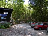 5
5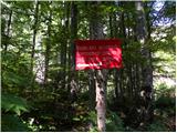 6
6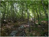 7
7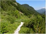 8
8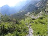 9
9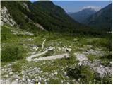 10
10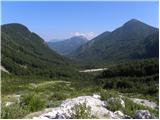 11
11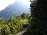 12
12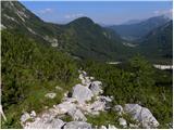 13
13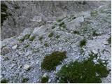 14
14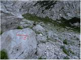 15
15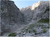 16
16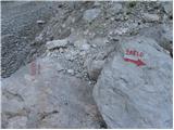 17
17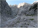 18
18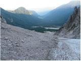 19
19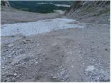 20
20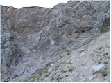 21
21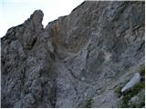 22
22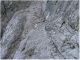 23
23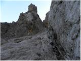 24
24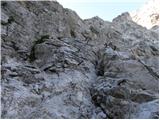 25
25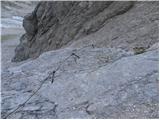 26
26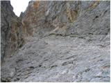 27
27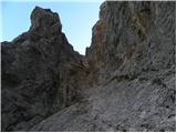 28
28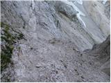 29
29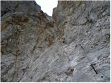 30
30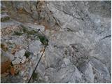 31
31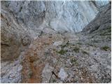 32
32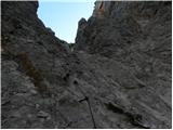 33
33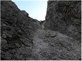 34
34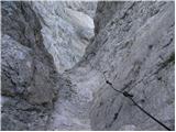 35
35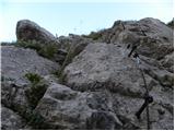 36
36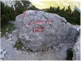 37
37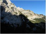 38
38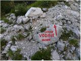 39
39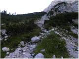 40
40 41
41 42
42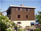 43
43 44
44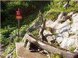 45
45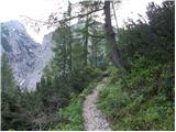 46
46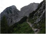 47
47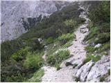 48
48 49
49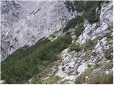 50
50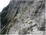 51
51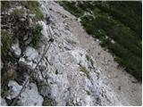 52
52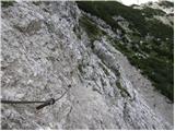 53
53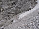 54
54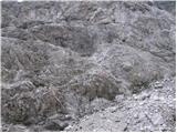 55
55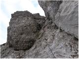 56
56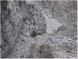 57
57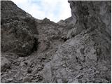 58
58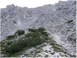 59
59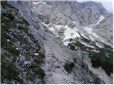 60
60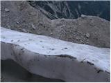 61
61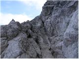 62
62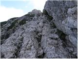 63
63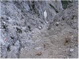 64
64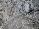 65
65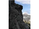 66
66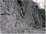 67
67 68
68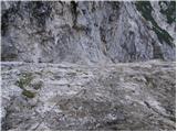 69
69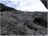 70
70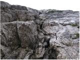 71
71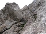 72
72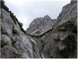 73
73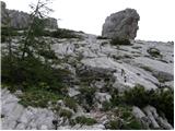 74
74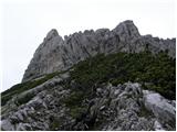 75
75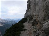 76
76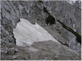 77
77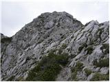 78
78 79
79