Rdeči Kal - Ostri vrh (above Globodol) (via Velika raven)
Starting point: Rdeči Kal (309 m)
| Latitude/Longitude: | 45,86410°N 15,00970°E |
| |
Route name: via Velika raven
Walking time: 1 h 15 min
Difficulty: easy marked way
Elevation gain: 214 m
Elevation difference along the route: 265 m
Map: Dolenjska - Gorjanci, Kočevski Rog 1:50.000
Recommended equipment (summer):
Recommended equipment (winter):
Views: 1.690
 | 1 person like this post |
Access to starting point:
A) From the Ljubljana–Obrežje highway, take the Trebnje West exit, then continue driving towards Dobrnič and Žužemberk. In Dobrnič, at the church, leave the main road leading to Žužemberk and continue straight towards Artmanja vas. At the end of Artmanja vas, go slightly left (slightly right to Korita), then before reaching Vrbovec turn left again, this time towards Mirna Peč. The road ascends more steeply a bit further on, then takes us to the village of Rdeči Kal, where we park at a small parking lot by the intersection, next to the sign marking the start of the settlement.
B) First drive to Trebnje, then continue towards Mirna Peč. Beyond the settlement of Dolenje Ponikve, leave the main road to Mirna Peč and continue right towards Dečja vas and Jordankal. In Jordankal, go right, then drive all the way to Rdeči Kal, where we already notice the mountain signs for Ostri vrh. From the sign, drive about 100 meters further, then park on the left side of the road at a small parking lot near the sign marking the end of the settlement.
C) From the Obrežje–Ljubljana highway, take the Mirna Peč exit, then continue to the said place. In Mirna Peč, reach the main road Novo mesto–Trebnje, which we just cross, and continue towards Dobrnič. After Mirna Peč, the road ascends more steeply for a while, then brings us to a small intersection where the road to the settlements on Globodolsko polje branches left; we continue straight and soon reach Jordankal, where we go straight. Towards Dobrnič, drive to the village of Rdeči Kal, where we already notice the mountain signs for Ostri vrh. From the sign, drive about 100 meters further, then park on the left side of the road at a small parking lot near the sign marking the end of the settlement.
D) From Novo mesto, drive to Mirna Peč, where at the intersection near the church continue left towards Dobrnič. After Mirna Peč, the road ascends more steeply for a while, then brings us to a small intersection where the road to the settlements on Globodolsko polje branches left; we continue straight and soon reach Jordankal, where we go straight. Towards Dobrnič, drive to the village of Rdeči Kal, where we already notice the mountain signs for Ostri vrh. From the sign, drive about 100 meters further, then park on the left side of the road at a small parking lot near the sign marking the end of the settlement.
Route description:
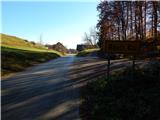
From the starting point, continue eastwards, that is, along the asphalt road leading to the village centre. After about 100 metres, reach a small intersection where we notice a sign (cross); continue right towards Ostri vrh, as directed by the nearby red mountain signpost. The path ahead ascends past a few more houses, then continue left onto a macadam road where we soon notice the blazes. When the road enters the forest, continue right onto a cart track that continues through the forest (straight on the Ostri vrh road via Mali vrh).
Further on, we ascend gently to moderately through the forest, following the blazes at a few junctions. Higher up, the path levels out, then continues for a while with some shorter ascents and descents, before ascending again. When the path reaches the slopes of Ostri vrh, it turns more to the left for a short time, and some views open up briefly. Less trodden but relatively well-marked, the path brings us higher to the point where the path from Dom LD Dobrnič joins from the right.
From here, only a short ascent remains, bringing us to the forested Ostri vrh.
Description and pictures refer to the condition in 2015 (November).

Photos:
 1
1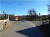 2
2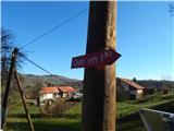 3
3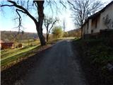 4
4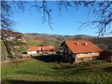 5
5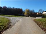 6
6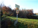 7
7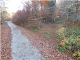 8
8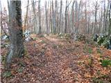 9
9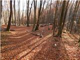 10
10 11
11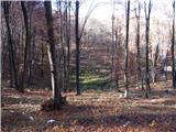 12
12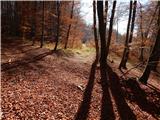 13
13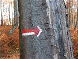 14
14 15
15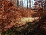 16
16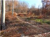 17
17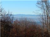 18
18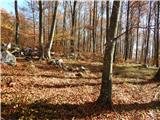 19
19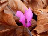 20
20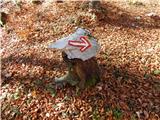 21
21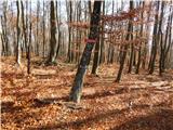 22
22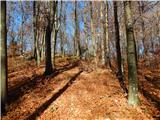 23
23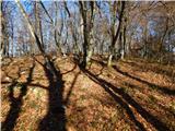 24
24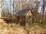 25
25 26
26
Discussion about the trip Rdeči Kal - Ostri vrh (above Globodol) (via Velika raven)
To post a comment you must log in:
If you do not yet have a username, you must first
register.