Reka (Laze) - Church of the Nativity of Mary in Police (through the gully of stream Sjaunk (Sejalnik))
Starting point: Reka (Laze) (230 m)
Starting point Lat/Lon: 46.1166°N 13.9089°E 
Path name: through the gully of stream Sjaunk (Sejalnik)
Time of walking: 1 h 5 min
Difficulty: easy unmarked way
Difficulty of skiing: no data
Altitude difference: 296 m
Altitude difference (by path): 310 m
Map:
Access to starting point:
A) From Idrija or Cerkno we drive towards Tolmin, where in the settlement Reka we need to pay attention to the approaching beginning of the path. At first, we cross the stream Kozarska grapa, and a little ahead after the right turn also an almost unnoticeable stream Poličanka, and we drive a little further to the hamlet Laze (hamlet is located between the road sign 9.0 km and 8.5 km), where at the turn-off of the road to the right to the nearby houses there is the beginning of the described path. At the starting point, there aren't any parking spots, so we have to park a little earlier or later on an appropriate place by the road.
B) We drive to Bača pri Modreju (to here from Most na Soči or Podbrdo), and then we continue driving towards Idrija. In the settlement Reka, between the road sign 8.5 km and 9.0 km we get to the hamlet Laze, where at the turn-off of the road to the left towards the nearby houses there is the beginning of the described path. At the starting point, there aren't any parking spots, so we have to park a little earlier or later on an appropriate place by the road.
Path description:
From the main road, we go on a side road which ascends to the nearby houses, and when the road ends on a cart track, we ascend to the highest house, which we bypass on the right side. Behind the house, there appears a relatively easy to follow footpath which at first ascends diagonally on the left side of the stream (right bank), and at the photogenic boulder passes on the right side of the stream (left bank).
The path ahead becomes quite steep and it is ascending above the steep gully of the stream Sjaunk (Sejalnik), but the path is from the steep slope mainly distant for about a meter, so that there is no significant danger of slipping. Next follows a longer diagonal ascent, where we cross also few steeper parts, where mainly in wet there is also the danger of slipping. Higher, the slope flattens, and on the right, the forest is replaced by pastures. Few minutes ahead, the path turns a little to the right and it brings us to the settlement Police, where among the houses we reach an asphalt road.
We follow the road to the right (left path continues towards Šentviška Gora and Črvov vrh), at the nearby crossroad, where the road which continues towards the valley turns left, we continue slightly right, so that we bypass the nearby hayrack on the right side. The path ahead leads us on a quite flat terrain, where we go past the chapel and a stone "počivalec", and then in a gentle descent, we quickly get to the church of the Nativity of Mary, which was renovated and handed to the parish Cerkno in December 2019.
Description and pictures refer to a condition in February 2020.
Pictures:
 1
1 2
2 3
3 4
4 5
5 6
6 7
7 8
8 9
9 10
10 11
11 12
12 13
13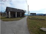 14
14 15
15 16
16 17
17 18
18 19
19