Bele vode - Bivouac Gorizia
Starting point: Bele vode (980 m)
| Latitude/Longitude: | 46,40950°N 13,53600°E |
| |
Walking time: 2 h 30 min
Difficulty: easy marked way
Elevation gain: 970 m
Elevation difference along the route: 980 m
Map: Julijske Alpe - zahodni del 1:50.000
Recommended equipment (summer):
Recommended equipment (winter): ice axe, crampons
Views: 18.550
 | 2 people like this post |
Access to starting point:
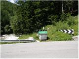
From Kranjska Gora, via the border crossing at Rateče, we drive to Trbiž / Tarvisio. In Trbiž we continue left in the direction of Bovec and follow the road to the intersection near Rabeljsko Lake. Here we continue right in the direction of Nevejski preval / Sella Nevea. We follow this road, which is mostly ascending, to the bridge, where in the left bend the road crosses the stream Bele vode / Rio Bianco. On the left side of the road, we will notice a few smaller parking spots.
From Bovec we drive to the border crossing Predel, from which we descend to the Italian side. Just a little after Rabeljsko Lake we come to the intersection, where we continue left in the direction of Nevejski preval / Sella Nevea. Further, follow the above description.
Route description:
From the signposts at the beginning of the path (before the bridge on the right side of the road) we continue through the forest on the right side of the stream Rio Bianco along which we ascend gently for quite some time. The valley Bele vode (Italian: Rio Bianco) also got its name from the stream. The path then turns to the left and crosses smaller streams a few times. Later, the path turns again a little to the right and there follows a shorter ascent in hairpins to the abandoned hut Brunner, where because of the forest there is no view. At the hut, where there is also a junction, we continue straight on path 625 in the direction of bivouac Gorizia. The path then soon comes out of the forest and ascends along the stream through dwarf pines. Later, the path turns to the left and brings us to a junction. We continue on the left path towards bivouac Gorizia, to the right branches off the path towards the notch Bele vode (Italian: Forca di Rio Bianco). The dwarf pines then soon end, and the path starts to ascend a little more steeply. When the path flattens a little again, a sign on the rock directs us left towards the bivouac, to which we have approximately 50 meters, and to the right runs the direct path towards Krniška škrbina (Italian: Forcella del Vallone).

Along the route: Rifugio Brunner (1432m)
Photos:
 1
1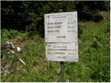 2
2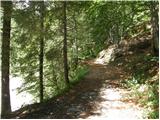 3
3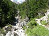 4
4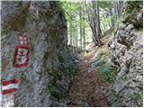 5
5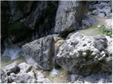 6
6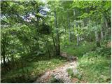 7
7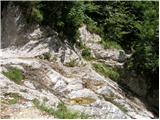 8
8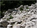 9
9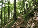 10
10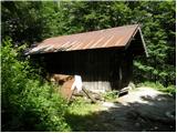 11
11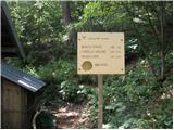 12
12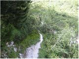 13
13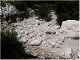 14
14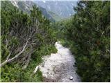 15
15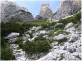 16
16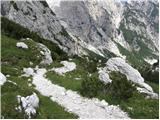 17
17 18
18 19
19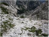 20
20 21
21 22
22
Discussion about the trip Bele vode - Bivouac Gorizia
|
| Lj7. 07. 2012 |
Great tour for a hot summer day, as a large part of the path you hear the murmur of the Bela voda stream and can also refresh yourself in one of the pools. Pleasant surprise at Koča Brunner: the hut is renovated (closed today though, no sign about operation), the meadow cleared of trees, so nice view of Jerebica from in front of the hut. 
|
|
|
|
| IgorZlodej7. 07. 2012 |
It's a forestry hut, closed to visitors, used only by CAI Tarvisio members. But it has been renovated since last year.
|
|
|
|
| Lj8. 07. 2012 |
Igor, thanks for the information. Foresters and hunters really have the nicest locations for their huts. Lp
|
|
|
|
| J.P.9. 11. 2025 09:57:46 |
I saw that you can also overnight at the Brunner hut by arrangement. Great tour also for these autumn days... snow only starts at 1800m. Lp
|
|
|
|
| turbo9. 11. 2025 18:18:05 |
|
|
|
|
| 2061alessio10. 11. 2025 17:39:53 |
hello, yes it's still current ...until tomorrow, because then we'll shut off the water, prepare wood for the stove, clean up etc. and over winter it won't be available, reservations for 2026 will run from spring onwards to autumn via e-mail 
|
|
|
|
| turbo10. 11. 2025 17:43:36 |
Wow, thanks for the info. Info worth a round
|
|
|
|
| J.P.12. 11. 2025 15:48:58 |
Thanks to both for the useful info!
|
|
|
To post a comment you must log in:
If you do not yet have a username, you must first
register.