Starting point: Robanov kot (650 m)
| Latitude/Longitude: | 46,39480°N 14,70300°E |
| |
Walking time: 3 h
Difficulty: easy marked way
Elevation gain: 1113 m
Elevation difference along the route: 1113 m
Map: Kamniške in Savinjske Alpe 1:50.000
Recommended equipment (summer):
Recommended equipment (winter): ice axe, crampons
Views: 66.827
 | 1 person like this post |
Access to starting point:
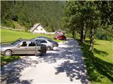
Through the Volovljek pass (Kranjski Rak) or from Mozirje we drive to Luče, then we follow the signs for Solčava and Logarska dolina. When we arrive in the settlement Robanov Kot, the signs for the alpine valley Robanov kot direct us left onto a side road, along which we drive to the parking lot near the Roban farm, where we park. We can also park 500 m lower, where there is another arranged parking lot, but we must not park on the parking lot of the pension Govc-Vršnik, because consequently there is no space for the guests of the pension.
Route description:
If we've parked on the lower parking lot, we continue on the road to the parking lot at the farm Roban, and only a few meters ahead from the last parking lot we get to a crossroad, where we continue sharply right (straight Robanova planina - ramp). The road, which then starts ascending steeper, we follow all the way to the farm Knez (to here we need approximately 1.5 hours).
Only a few meters before the farm there is a crossroad, where we continue on the left road (the path straight leads through the yard), which after a long turn joins the road which leads through the yard. By the road then after a few minutes of walking from the farm, we notice a wooden mountain signpost with the caption Strelovec, which points us to the left and slightly downwards, on a cart track. The cart track then crosses a small streamlet, which in dry days dries up, and then starts ascending mostly through the forest and higher it changes into a steep footpath, which then crosses a few steep slopes. The path higher passes into a dense forest, which ends with a nice vantage point, from which a nice view opens up on peaks and walls above Robanov kot. Next follows traversing of partly vegetated grassy slopes, and then the path goes into the forest, after which we step on panoramic Knezova planina.
Behind the mountain pasture the path goes into the forest and starts to ascend steeply in a traverse. When we again step out of the forest, the footpath suddenly vanishes. Here we go right towards the main ridge, which we reach after a good 5 minutes of steep ascent (on this part there are several smaller footpaths, which bring us to the ridge). On the ridge, we continue right (left Krofička and Klemenča jama) and we continue the ascent on the partly vegetated summit ridge of Strelovec. After 10 minutes of ridge walking we reach the scenic peak Strelovec.
Robanov kot - Knezova planina 2:30, Knezova planina - Strelovec 30 minutes.

Photos:
 1
1 2
2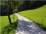 3
3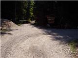 4
4 5
5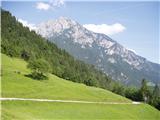 6
6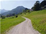 7
7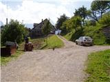 8
8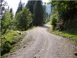 9
9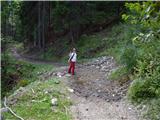 10
10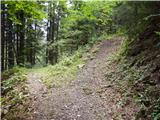 11
11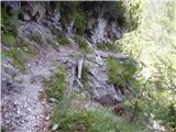 12
12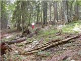 13
13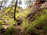 14
14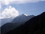 15
15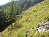 16
16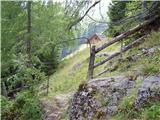 17
17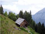 18
18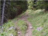 19
19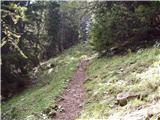 20
20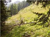 21
21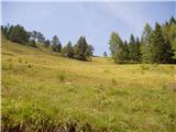 22
22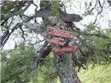 23
23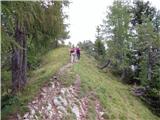 24
24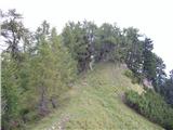 25
25 26
26 27
27
Discussion about the trip Robanov kot - Strelovec
|
| martina5614. 12. 2006 |
WONDERFUL FOR US BEGINNERS....
|
|
|
|
| Gost15. 04. 2007 |
Super! What a view!Sunny Sunday 15.4.07. Description: by car I drove from Robanov kot to Knez farm,from there on foot to Knezova planina, up to here no trace of snow! First snow appears on the path in the forest above this planina (the track is good,but the sun melts it at the speed of light),but only up to the ridge(about 30min. walking on southern snow),where it's bare to the very top! View:WONDERFUL!!! I descended the same path, but it's possible to reach also koča na Klemenči jami, but on the S side there's still a lot of snow! Recommended for a morning hike, as walking takes really approx. 1h 40min up, down faster 1h 15min. LP Klavdija
|
|
|
|
| jprim8. 10. 2008 |
And that's how it was at Strelovec, or rather the view from Strelovec on 5. 10. 2008. In short, absolutely wonderful.
|
|
|
|
| jprim8. 10. 2008 |
I'm struggling with sending photos and hoping it works, if not, more luck next time...
|
|
|
|
| geppo8. 10. 2008 |
It won't work here..
Go to current conditions - Strelovec is already open and upload there!
Regards
|
|
|
|
| jprim8. 10. 2008 |
I'm reading and reading, but I really can't find Strelovec in the current conditions. Or...?
|
|
|
|
| Jany9. 10. 2008 |
If you type "STRELOVEC" and not "STRELOV'C" it will work. Just try!
Regards
|
|
|
|
| hasto27. 07. 2009 |
Does anyone have any experience with ski touring from Strelovec towards Robanov kot?
Today I was at the top (ascent route from Logarska via Klemenče jama and back) and the grassy slopes descending towards Robanov kot looked interesting to ski, but I don't know what the conditions are like lower down in the forested section of the descent to Robanov kot.
|
|
|
|
| Alpinist239. 07. 2010 |
There's an even nicer path from Icmanikova planina.
|
|
|
|
| ditka22. 08. 2012 |
...we were there on Saturday, they weren't collecting parking fees and since we wanted to park at that mentioned last payable parking lot we even drove to the Knez farm...then continued as described....it was beautiful...
|
|
|
|
| garmont21. 11. 2015 |
Even before we reach Knezova planina, a nice path branches off to the right (picture no. 16), which takes us directly to the summit. The described path via Knezova planina can be used for the return to the Robanov kot side.
|
|
|
|
| fpetel19. 10. 2016 |
Nice hike.
Yesterday we managed to get lost on the trail.
Somewhat strangely marked and I didn't see any markers further on, so before the pasture we turned right into the slope along overgrown sheep paths and steep grass to the ridge and left to the summit.
Interesting, but I advise against it in wet conditions and for descent.
|
|
|
|
| ljubitelj gora9. 10. 2016 |
Around picture 16 there is a junction upwards, last year similarly went up steep grass to the ridge and continued along the ridge to Krofička.
|
|
|
|
| garmont13. 12. 2018 |
Instead of left downhill (picture 10), now continue straight on the road to the first right bend. From there straight on the poorer forest road (direction sign). After approx. 100 meters, the abandoned lower and new upper path join. Then follow the upper description...
|
|
|
|
| franjo661. 03. 2019 |
What are the conditions like?
Thanks for the reply
Best regards
|
|
|
|
| seinfeld17. 06. 2019 |
Yesterday we did this trip. We also drove almost to Knezova farm, parked in the forest below it. Walking an hour and a half on a dusty road would be pure masochism.
Before Knezova planina we turned right uphill on an unmarked path to the top, back on the marked one. There are crazy views along the way and at the top.
The whole path is decently marked, but the marks are old and faded in places. You have to be attentive and read the comments under the instructions.
|
|
|
|
| postopač17. 06. 2019 |
We two also up yesterday. On foot from Govec, yes also on the road, which is dusty because of cars and vans, like yours was. So, hikers walk and are not masochists because of that, right?
|
|
|
|
| geppo18. 06. 2019 |
From Solčava there is an old path that joins or ends 100m above the church of Marija Snežna. It is very nicely laid out through the forest. Formerly the Knezi/Haudeji used it to approach Solčava (attending mass and other activities). It is marked and clearly visible. I notice it is not much visited. But there is a problem at the beginning and end of the path. Above the church it has been cut by a forest track, at the end at Haudej, when you come out to the meadow, a torrent has partially destroyed it.
You can park at the parking lot by the church in Solčava (large parking lot). Then go across the pasture, which is fenced (sheep grazing). At the end there are pasture gates. When you open them you are at the start of the path. In the torrent gully above the pasture there is a clearly visible little path. For a while it runs along the stream then turns left and brings you to a muddy forest track. Along the track approx. 500m (direction NE) then you see that hikers steeply climb from the track into the forest (right). In the forest you immediately pick up the visible path and marks. The path is so nicely laid out that it's a pleasure to walk it. Then soon you come back to a track that crosses the path. You climb this track for approx. 10-15 min and at the end of the track back into the forest, where the path is visible. Just before Haudej right before stepping onto their meadow the torrent has partially destroyed the path. You can avoid this by going approx. 50m lower along the forest track, which brings you to the meadow. So you come out approx. a few hundred meters from the Haudej homestead. Once you master this path you will return to it many more times.
Some inserts of this path are in my posts: Current conditions / Strelovec 11.10.2018
A little attention is needed to follow the marks/path traces and there should be no problems!!
I wish you a nice trip in this area
best regards
|
|
|
|
| Planinecizgg22. 02. 2020 |
Hi,
does anyone know what the current conditions on this path are like. Best regards.
|
|
|
|
| Tejama28. 12. 2020 |
I'm also interested in what the conditions are like now. In these days, more snow is also supposed to fall. Thanks for the reply.
|
|
|
|
| zokipoki28. 12. 2020 |
Strelovec is completely snow-covered and a lot more snow can fall in the coming days. Winter Strelovec is not an easy hike.
|
|
|
|
| kiht26. 06. 2021 19:46:21 |
Hello, I'm interested in the condition of the trail? Thanks
|
|
|
|
| zokipoki26. 06. 2021 21:21:50 |
If you're interested in snow, it's clear. Otherwise, the trail in the middle section between Knez and Knezova planina is partially destroyed due to logging, but traceable and passable. Best
|
|
|
|
| garmont25. 03. 2023 15:13:35 |
In the path description it should be stated that the mountain path from Knez onwards no longer leads left downhill (pictures 10 and 11), but continues along the road to the marked junction left.
Higher up, the path no longer goes through the forest, but sticks to the new logging trail and is also newly marked (pictures 12 and 13).
|
|
|
|
| zmiga21. 07. 2024 17:54:10 |
Today I went on this trail to Strelovec. Wonderful trail with beautiful views and well marked. It's true that the trail description is a bit outdated, but the trail is well marked and orientationally undemanding. We left the car at Robanova farm and it took, as stated here, 3h to the top 
|
|
|
|
| anazala3. 10. 2025 20:11:42 |
Wonderful hill. Views super. Ascent too.
|
|
|
To post a comment you must log in:
If you do not yet have a username, you must first
register.